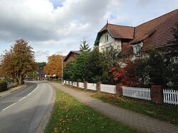
Daerstorf | |
|---|---|
 | |
| Coordinates: 53°26′18″N 09°48′20″E / 53.43833°N 9.80556°E | |
| Country | Germany |
| State | Lower Saxony |
| District | Harburg |
| Municipality | Neu Wulmstorf |
| Elevation | 59 m (194 ft) |
| Time zone | UTC+01:00 (CET) |
| • Summer (DST) | UTC+02:00 (CEST) |
| Postal codes | 21629 |
| Dialling codes | 040 |
| Vehicle registration | WL |
ⓘ (Low German: Doasdörp) is a village in the municipality Neu Wulmstorf in the district Harburg in the north of Lower Saxony, Germany. It is part of the Hamburg Metropolitan Region.
History[edit]
Tumuli show early settlements in Bronze Age[1][2] and a small village around 770.[3] 'Dardestorpe' was first documented 1295 at the abbey of Hildesheim. During the First French Empire Daerstorf had a population of 101 was part of the Bouches-de-l'Elbe.[4] The neighboring village of Neu Wulmstorf was founded in 1835 by the Daerstorf farmhand Peter Lohmann, who was working in Wulmstorf at the time. Just shortly before the end of World War II Daerstorf was captured on April 20, 1945, by the A-Companie of the 1st Rifle Brigade and the 8th King's Royal Irish Hussars of the English troops after heavy fights.[5][6]

The independent municipality Daerstorf became part of Neu Wulmstorf on 1 January 1970.
Notes[edit]
- ^ 1200 Jahre altes Gräberfeld aus der Sachsenzeit bei Elstorf entdeckt Retrieved 28 August 2013.
- ^ "Pferdegrab - Grabbeigabe oder Tieropfer". Archived from the original on 2013-08-28. Retrieved 2013-12-09.
- ^ Neue Funde bei archäologischer Ausgrabung in Neu Wulmstorf-Elstorf
- ^ Lasius, A. F. L.: Der Französische Kaiser-Staat unter der Regierung des Kaisers Napoleon des Grossen im Jahre 1812. (Osnabrück: Kißling 1813), Seite 57f
- ^ Paterson, Ian A. (30 July 2012), Engagements - 1945: Hamburg The Final Push to Hamburg
- ^ Ein Bericht zusammengestellt aus deutschen Quellen und Zeitzeugenberichten (fett gedruckt) und militärischen Aufzeichnungen der Engländer. Archived 2013-10-07 at the Wayback Machine (PDF; 1,7 MB)


