
Size of this preview: 800 × 600 pixels. Other resolutions: 320 × 240 pixels | 640 × 480 pixels | 1,024 × 768 pixels | 1,280 × 960 pixels | 2,560 × 1,920 pixels | 3,648 × 2,736 pixels.
Original file (3,648 × 2,736 pixels, file size: 3.57 MB, MIME type: image/jpeg)
Summary
| Description |
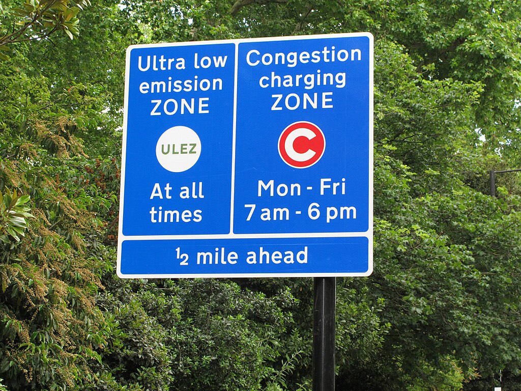
English: Sign warning drivers in London that they are about to enter the Ultra Low Emission Zone and Congestion Charging Zone. In the ultra low emission zone, the same area as the congestion charging zone, vehicles which do not meet specified standards for emission of air polluting nitrogen oxides (NOx) and particulate matter (PM) from engines have to pay a daily charge. The charges apply at all times. This sign is on the A3217 by Eaton Square. |
| Date | |
| Source | https://www.geograph.org.uk/photo/6183970 |
| Author | David Hawgood |
| Attribution (required by the license) | David Hawgood / Sign for London ultra low emission zone / |
| Camera location | | View this and other nearby images on: OpenStreetMap |
|---|
.jpg¶ms=051.495860_N_-000.151800_E_globe:Earth_type:camera_source:geograph-osgb36(TQ28397905)_region:GB-ENG_heading:22.00&language=en)
| Object location | | View this and other nearby images on: OpenStreetMap |
|---|
.jpg¶ms=051.496040_N_-000.151700_E_globe:Earth_class:object_type:object_source:geograph-osgb36(TQ28407907)_region:GB-ENG_heading:22.00&language=en)
Licensing

|
This image was taken from the Geograph project collection. See this photograph's page on the Geograph website for the photographer's contact details. The copyright on this image is owned by David Hawgood and is licensed for reuse under the Creative Commons Attribution-ShareAlike 2.0 license.
|
This file is licensed under the Creative Commons Attribution-Share Alike 2.0 Generic license.
Attribution: David Hawgood
- You are free:
- to share – to copy, distribute and transmit the work
- to remix – to adapt the work
- Under the following conditions:
- attribution – You must give appropriate credit, provide a link to the license, and indicate if changes were made. You may do so in any reasonable manner, but not in any way that suggests the licensor endorses you or your use.
- share alike – If you remix, transform, or build upon the material, you must distribute your contributions under the same or compatible license as the original.
File history
Click on a date/time to view the file as it appeared at that time.
| Date/Time | Thumbnail | Dimensions | User | Comment | |
|---|---|---|---|---|---|
| current | 11:33, 28 July 2019 | | 3,648 × 2,736 (3.57 MB) | Geograph Update Bot | Higher-resolution version from Geograph. |
| 10:51, 25 July 2019 |  | 1,024 × 768 (318 KB) | Bellowhead678 | User created page with UploadWizard |
File usage
The following pages on the English Wikipedia use this file (pages on other projects are not listed):
Global file usage
The following other wikis use this file:
- Usage on ig.wikipedia.org
- Usage on no.wikipedia.org
- Usage on pt.wikipedia.org
- Usage on vi.wikipedia.org
.jpg)