No higher resolution available.
Shire_Hall,_Bodmin_-_geograph.org.uk_-_50323.jpg (640 × 480 pixels, file size: 131 KB, MIME type: image/jpeg)
Summary
| Description |
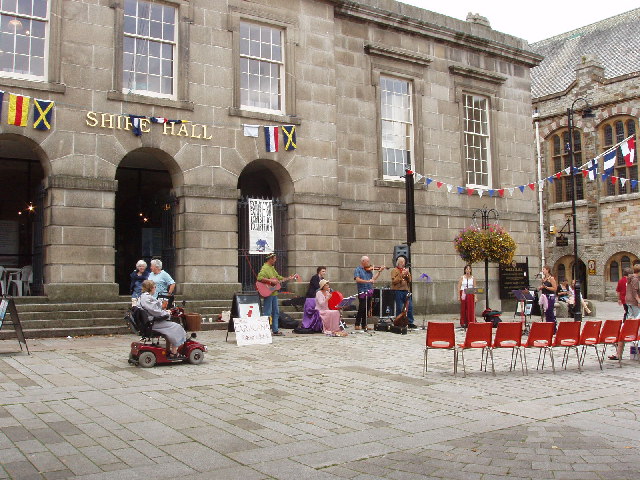
English: Shire Hall, Bodmin. This houses a Tourist Information Centre, a theatre, and the "Courtroom Experience".
"Built between 1837 and 1838 the Shire Hall is an architectural gem with its extraordinary interior cantilevered staircase and the imposing solid granite front facade. Used as the County Court until 1988 the building has now been carefully restored to its original glory by Bodmin Town Council using funds from the Lottery and from the European Fund", says its website www.bodminmoor.co.uk
|
|
| Date | ||
| Source | From geograph.org.uk | |
| Author | David Hawgood | |
| Attribution (required by the license) | David Hawgood / Shire Hall, Bodmin / | |
| Object location | | View this and other nearby images on: OpenStreetMap |
|---|
_&language=en)
Licensing

|
This image was taken from the Geograph project collection. See this photograph's page on the Geograph website for the photographer's contact details. The copyright on this image is owned by David Hawgood and is licensed for reuse under the Creative Commons Attribution-ShareAlike 2.0 license.
|
This file is licensed under the Creative Commons Attribution-Share Alike 2.0 Generic license.
Attribution: David Hawgood
- You are free:
- to share – to copy, distribute and transmit the work
- to remix – to adapt the work
- Under the following conditions:
- attribution – You must give appropriate credit, provide a link to the license, and indicate if changes were made. You may do so in any reasonable manner, but not in any way that suggests the licensor endorses you or your use.
- share alike – If you remix, transform, or build upon the material, you must distribute your contributions under the same or compatible license as the original.
File history
Click on a date/time to view the file as it appeared at that time.
| Date/Time | Thumbnail | Dimensions | User | Comment | |
|---|---|---|---|---|---|
| current | 19:02, 30 January 2010 | | 640 × 480 (131 KB) | GeographBot | == {{int:filedesc}} == {{Information |description={{en|1=Shire Hall, Bodmin. This houses a Tourist Information Centre, a theatre, and the "Courtroom Experience". "Built between 1837 and 1838 the Shire Hall is an architectural gem with its extraordinary |
File usage
The following pages on the English Wikipedia use this file (pages on other projects are not listed):
Global file usage
The following other wikis use this file: