Bambang | |
|---|---|
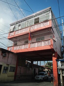
Barangay Hall of Bambang and Barangay Map Satellite view. | |
 | |
 | |
| Coordinates: 14°31′22.22″N 121°4′8.14″E / 14.5228389°N 121.0689278°E | |
| Country | Philippines |
| Region | National Capital Region |
| City | Taguig |
| District | 1st Legislative district of Taguig |
| Government | |
| • Type | Barangay |
| • Punong Barangay | Christopher Ryan C. Esteban |
| Population (2020) | |
| • Total | 13,949[1] |
| Time zone | UTC+8 (PST) |
| Postal Code | 1637 |
| Area code | 02 |
| Website | https://www.facebook.com/profile.php?id=61553949876134&mibextid=JRoKGi |
Bambang is one of the 38 barangays of Taguig, Metro Manila in the Philippines. One of the 9 initial Barrio of Taguig.[2][3]
Etymology[edit]
The name of the Barangay derives from the Tagalog word "Bamban", meaning a river with soft soil. Later on, it was changed to "Bambang", which means the shores of the river of Taguig.[4]
Geography[edit]
Bambang is bounded on the North by Ususan. From the East by Taguig River. Southeast by Wawa. To the South by San Miguel. Then on the West by Katuparan.
References[edit]
- ^ Total Population by Province, City, Municipality and Barangay: as of May 1, 2010 Archived June 25, 2012, at the Wayback Machine - Philippine Statistics Authority
- ^ Bravo, Felipe (1851). Diccionario geografico, estadistico, historico de las islas Filipinas... (in Spanish). Imprenta de José C. de la Peña.
- ^ Diccionario Geografico Estadistico Historico Islas Filipinas, Manuel Buzeta, Felipe Bravo, Rector Del Colegio De Valladolid, Madrid 1850, page 338
- ^ A gift of faith, 400 years. Quadricentennial (1587-1987) St. Anne Parish Tagig, Metro Manila; commemorative book page 60, circa 1987.


