| Roseires Dam | |
|---|---|
 | |
| Location | Ad Damazin, Sudan |
| Coordinates | 11°47′53″N 34°23′15″E / 11.79806°N 34.38750°E |
| Construction began | 1961 |
| Opening date | 1966 |
| Dam and spillways | |
| Height | 78 m (256 ft) |
| Length | 24,410 m (80,090 ft) |
| Reservoir | |
| Total capacity | 7.4 km3 (5,999,278 acre⋅ft) |
| Surface area | 29,000 ha (71,661 acres) |
| Power Station | |
| Installed capacity | 1800 MW[1] |
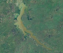
The Roseires Dam (Arabic: خزان الروصيرص) is a dam on the Blue Nile at Ad Damazin, just upstream of the town of Er Roseires, in Sudan. It consists of a concrete buttress dam 1 km wide with a maximum height of 68 m, and an earth dam on either side. The earth dam on the eastern bank is 4 km long, and that on the western bank is 8.5 km long. The reservoir has a surface area of about 290 km2.

The dam was completed in 1966, initially for irrigation purposes. A power generation plant, with a maximum capacity of 280 megawatts, was added in 1971.[2][3]
Extension Project
The original maximum height of the dam was 68 m, which increased to 78 m in 2013 and the dam is now 25 km long. The dam contains five 3 m x 5 m low level sluice gates designed to pass floods and sluice sediment. The dam contains a gated ogre spillway with a discharge capacity of 694 m3/s. In addition, the dam was designed with five low level outlets with a discharge capacity of 5,208 m3/s to pass floods and sluice sediment through the reservoir.[4]
References[edit]
- ^ https://web.archive.org/web/20140301022652/http://www.hydroworld.com/articles/2013/january/sudan-completes-expansion-of-1800-mw-roseiris-hydropower-project.html
- ^ "Sudan Vision Daily - Details". Archived from the original on 2013-12-24. Retrieved 2013-08-16.
- ^ "Heightening of the Roseires Dam Rehabilitation Project - OPEC Fund for International Development". opecfund.org. Retrieved 2023-03-30.
- ^ "Sudan - Roseires". www.hydropower.org. Retrieved 2023-03-30.
External links[edit]
- Sudan Government: Dams Implementation Unit Archived 2011-04-11 at the Wayback Machine
- Sudan, Electric power. Library of Congress
- Africa Dams Briefing 2010 - International Rivers p. 54
- Vintage Project Management - The tamers of rivers 1966
Well, that’s interesting to know that Psilotum nudum are known as whisk ferns. Psilotum nudum is the commoner species of the two. While the P. flaccidum is a rare species and is found in the tropical islands. Both the species are usually epiphytic in habit and grow upon tree ferns. These species may also be terrestrial and grow in humus or in the crevices of the rocks.
View the detailed Guide of Psilotum nudum: Detailed Study Of Psilotum Nudum (Whisk Fern), Classification, Anatomy, Reproduction