
Size of this PNG preview of this SVG file: 512 × 562 pixels. Other resolutions: 219 × 240 pixels | 437 × 480 pixels | 700 × 768 pixels | 933 × 1,024 pixels | 1,866 × 2,048 pixels.
Original file (SVG file, nominally 512 × 562 pixels, file size: 87 KB)
Summary
| Description |
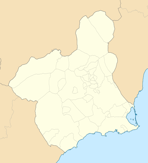
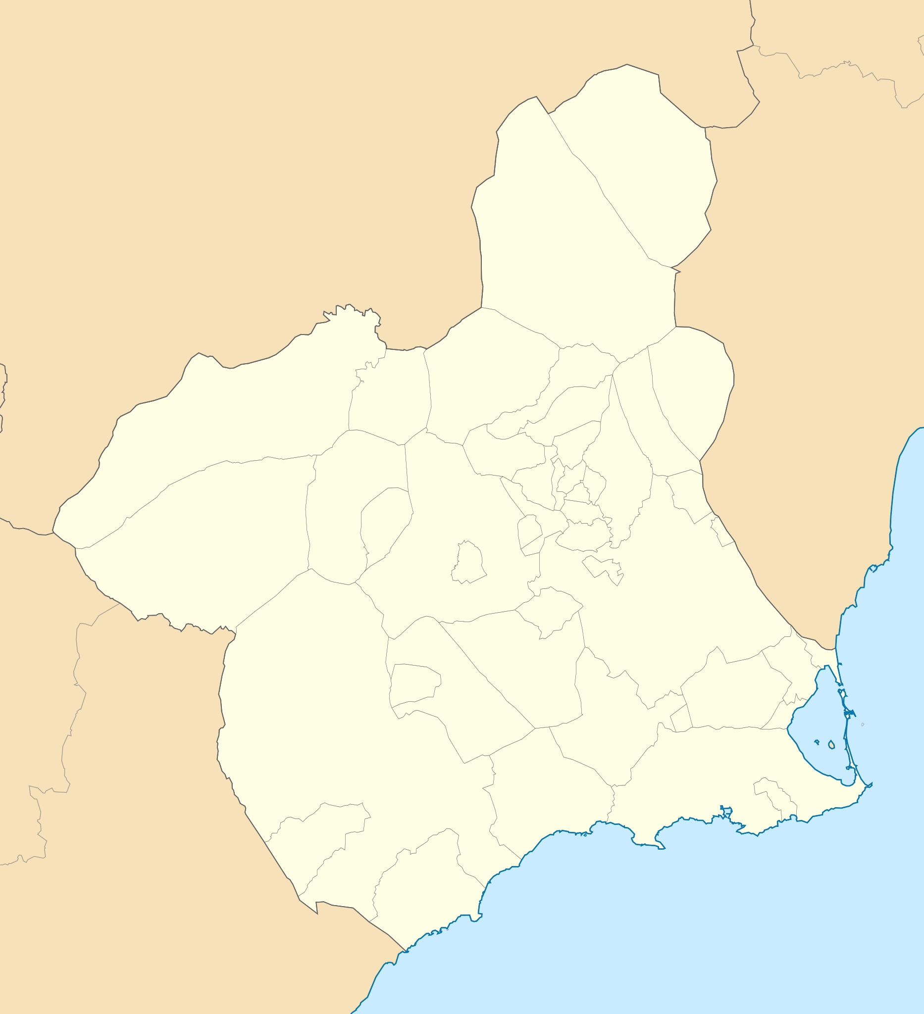
English: Location map of Murcia
Equirectangular projection, N/S stretching 130 %. Geographic limits of the map:
Español: Mapa de localización de Murcia
Proyección equirrectangular, N/S estirada 130 %. Límites geográficos del mapa:
|
|
| Date | ||
| Source | Own work based on: EspañaLoc.svg by HansenBCN and Spain location map.svg by NordNordWest | |
| Author | Miguillen | |
| SVG development | This locator map was created with Inkscape.
|
Licensing
This file is licensed under the Creative Commons Attribution-Share Alike 1.0 Generic license.
- You are free:
- to share – to copy, distribute and transmit the work
- to remix – to adapt the work
- Under the following conditions:
- attribution – You must give appropriate credit, provide a link to the license, and indicate if changes were made. You may do so in any reasonable manner, but not in any way that suggests the licensor endorses you or your use.
- share alike – If you alter, transform, or build upon this work, you must distribute the resulting work under the same license as the original.
File history
Click on a date/time to view the file as it appeared at that time.
| Date/Time | Thumbnail | Dimensions | User | Comment | |
|---|---|---|---|---|---|
| current | 18:35, 22 May 2010 | | 512 × 562 (87 KB) | Miguillen | == {{int:filedesc}} == {{Information |Description= {{en|Location map of Murcia}} Equirectangular projection, N/S stretching 130 %. Geographic limits of the map: * N: 38.854007° N * S: 37.277787° N * W: 2.449817° O * E: 0.582645° O |
File usage
The following pages on the English Wikipedia use this file (pages on other projects are not listed):
- 1992 Summer Olympics torch relay
- 2010 European Ladies' Team Championship
- 2013–14 Tercera División
- 2014–15 Tercera División
- 2015–16 Tercera División
- 2016–17 Tercera División
- 2017–18 Tercera División
- 2018–19 Tercera División
- 2019–20 Tercera División
- 2020–21 Tercera División
- 2021–22 Tercera División RFEF
- 2022–23 Tercera Federación
- 2023–24 Tercera Federación
- 2024–25 Tercera Federación
- Abanilla
- Abarán
- Albudeite
- Alcantarilla
- Aledo, Spain
- Alguazas
- Alhama de Murcia
- Archena
- Beniel
- Blanca, Murcia
- Bullas
- Calasparra
- Campos del Río
- Cartagena, Spain
- Cehegín
- Ceutí
- Cieza, Murcia
- Cueva Antón
- El Algar
- El Plan, Cartagena
- Farmfoods European Senior Masters
- Fortuna, Murcia
- Fuente Álamo de Murcia
- La Manga Club
- La Unión, Murcia
- Las Torres de Cotillas
- Librilla
- Lorquí
- Los Alcázares
- Los Martínez del Puerto
- Mazarrón
- Molina de Segura
- Moratalla, Murcia
- Mula, Spain
- Murcia–San Javier Airport
- OKI Open de España Senior
- Ojós
- Pliego
- Primera División de Baloncesto
- Puerto Lumbreras
- Ricote
- Rincón de San Ginés
- San Antonio Abad, Cartagena
- San Javier, Murcia
- San Pedro del Pinatar
- Santomera
- Torre-Pacheco
- Totana
- Ulea
- Upper Bedoulian Formation
- Villanueva del Río Segura
- Yecla
- Zarzalico
- Águilas
- User:Chienlit/sandbox
- User:Michael!/Project:Location map templates/Spain
- Module:Location map/data/Spain Murcia
- Module:Location map/data/Spain Murcia/doc
Global file usage
The following other wikis use this file:
- Usage on ar.wikipedia.org
- Usage on ast.wikipedia.org
- Usage on azb.wikipedia.org
- Usage on ba.wikipedia.org
- Usage on bg.wikipedia.org
- Usage on ceb.wikipedia.org
- Usage on de.wikipedia.org
- La Condomina
- Estadio Nueva Condomina
- Cabo de Palos
- Wikipedia:Kartenwerkstatt/Positionskarten/Europa
- Estadio Cartagonova
- Vorlage:Positionskarte Spanien Murcia
- Cueva del Agua
- Einband-Weltmeisterschaft 1981
- Palacio de Deportes de Murcia
- Cadre-47/2-Europameisterschaft 1957
- Cadre-47/2-Europameisterschaft 1959
- Cadre-71/2-Europameisterschaft 1960
- Fünfkampf-Europameisterschaft 1970
- Dreiband-Europameisterschaft der Junioren 1999
- Artistique-Weltmeisterschaft 1957
- Usage on eo.wikipedia.org
View more global usage of this file.
Well, that’s interesting to know that Psilotum nudum are known as whisk ferns. Psilotum nudum is the commoner species of the two. While the P. flaccidum is a rare species and is found in the tropical islands. Both the species are usually epiphytic in habit and grow upon tree ferns. These species may also be terrestrial and grow in humus or in the crevices of the rocks.
View the detailed Guide of Psilotum nudum: Detailed Study Of Psilotum Nudum (Whisk Fern), Classification, Anatomy, Reproduction