Size of this preview: 515 × 599 pixels. Other resolutions: 206 × 240 pixels | 412 × 480 pixels | 660 × 768 pixels | 1,027 × 1,195 pixels.
Original file (1,027 × 1,195 pixels, file size: 146 KB, MIME type: image/png)
Summary
| Description |
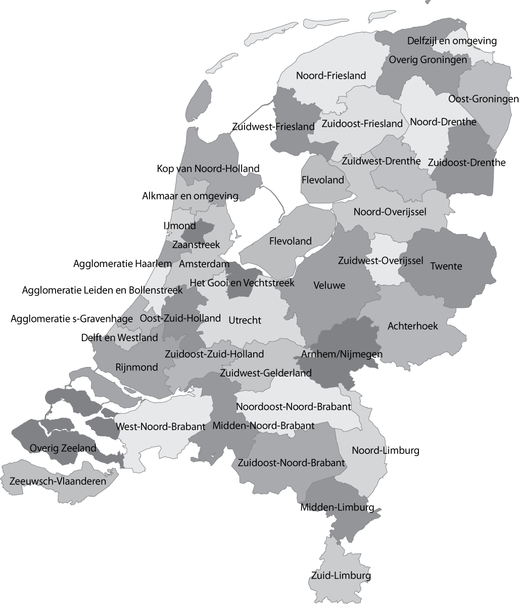
English: Map of the Dutch NUTS3 regions (COROP regions). Made using GIS software. |
| Date | |
| Source | Own work |
| Author | Classical geographer |
| Other versions | Derivative works of this file: Islam in Netherlands.jpg |
Licensing
| This file is made available under the Creative Commons CC0 1.0 Universal Public Domain Dedication. | |
| The person who associated a work with this deed has dedicated the work to the public domain by waiving all of their rights to the work worldwide under copyright law, including all related and neighboring rights, to the extent allowed by law. You can copy, modify, distribute and perform the work, even for commercial purposes, all without asking permission.
|
File history
Click on a date/time to view the file as it appeared at that time.
| Date/Time | Thumbnail | Dimensions | User | Comment | |
|---|---|---|---|---|---|
| current | 12:04, 8 January 2011 | | 1,027 × 1,195 (146 KB) | Classical geographer | Updated Tholen/St. Philipsland (belong to Overig Zeeland, not to Rijnmond). |
| 16:31, 28 July 2010 |  | 1,027 × 1,195 (209 KB) | Classical geographer | Without border. | |
| 16:30, 28 July 2010 |  | 1,102 × 1,300 (211 KB) | Classical geographer | B&W and with more readable labels. | |
| 11:31, 9 July 2009 |  | 1,199 × 1,407 (541 KB) | Classical geographer | Category:Maps of the Netherlands Category:Statistical divisions | |
| 11:30, 9 July 2009 |  | 3,588 × 3,529 (553 KB) | Classical geographer | {{Information |Description={{en|1=Map of the Dutch NUTS3 regions (COROP regions). Made using GIS software.}} |Source=Own work by uploader |Author=Classical geographer |Date=2009-07-09 |Permission= |other_versions= }} [[Categ |
File usage
The following pages on the English Wikipedia use this file (pages on other projects are not listed):
Global file usage
The following other wikis use this file:
- Usage on ar.wikipedia.org
- Usage on ca.wikipedia.org
- Usage on es.wikipedia.org
- Usage on fr.wikipedia.org
- Usage on nl.wikipedia.org
Well, that’s interesting to know that Psilotum nudum are known as whisk ferns. Psilotum nudum is the commoner species of the two. While the P. flaccidum is a rare species and is found in the tropical islands. Both the species are usually epiphytic in habit and grow upon tree ferns. These species may also be terrestrial and grow in humus or in the crevices of the rocks.
View the detailed Guide of Psilotum nudum: Detailed Study Of Psilotum Nudum (Whisk Fern), Classification, Anatomy, Reproduction