El Bagour
الباجور | |
|---|---|
 | |
 Location in Monufia Governorate | |
 El Bagour Location in Egypt | |
| Coordinates: 30°26′00″N 31°03′25″E / 30.433282°N 31.056862°E | |
| Country | |
| Governorate | Monufia |
| Area | |
| • Total | 168.1 km2 (64.9 sq mi) |
| Elevation | 11 m (36 ft) |
| Population (2021)[1] | |
| • Total | 427,017 |
| • Density | 2,500/km2 (6,600/sq mi) |
| Time zone | UTC+2 (EST) |
El Bagour (Arabic: الباجور pronounced [elbɑˈɡuːɾ]) is a small city in northern Egypt. It is located in the Nile Delta in the Monufia Governorate. El Bagour has 48 surrounding villages.
Geography
[edit]El Bagour is located in the eastern part of Monufia Governorate, has borders with Benha to the east - 13 km, Menouf to the west - 15 km, Shibin El Kom to the north - 12 km and Ashmoun to the south - 20 km
Climate
[edit]Köppen-Geiger climate classification system classifies its climate as hot desert (BWh).[2]
| Climate data for El Bagour | |||||||||||||
|---|---|---|---|---|---|---|---|---|---|---|---|---|---|
| Month | Jan | Feb | Mar | Apr | May | Jun | Jul | Aug | Sep | Oct | Nov | Dec | Year |
| Mean daily maximum °C (°F) | 19.2 (66.6) |
21 (70) |
23.7 (74.7) |
27.7 (81.9) |
32 (90) |
34.4 (93.9) |
34.6 (94.3) |
34.5 (94.1) |
32.4 (90.3) |
30.1 (86.2) |
25.3 (77.5) |
20.9 (69.6) |
28.0 (82.4) |
| Daily mean °C (°F) | 12.6 (54.7) |
14 (57) |
16.3 (61.3) |
19.5 (67.1) |
23.7 (74.7) |
26.4 (79.5) |
27.3 (81.1) |
27.2 (81.0) |
25.2 (77.4) |
22.9 (73.2) |
19 (66) |
14.5 (58.1) |
20.7 (69.3) |
| Mean daily minimum °C (°F) | 6.1 (43.0) |
7 (45) |
9 (48) |
11.4 (52.5) |
15.4 (59.7) |
18.4 (65.1) |
20.1 (68.2) |
19.9 (67.8) |
18 (64) |
15.7 (60.3) |
12.8 (55.0) |
8.2 (46.8) |
13.5 (56.3) |
| Average precipitation mm (inches) | 6 (0.2) |
5 (0.2) |
3 (0.1) |
2 (0.1) |
2 (0.1) |
0 (0) |
0 (0) |
0 (0) |
0 (0) |
2 (0.1) |
3 (0.1) |
6 (0.2) |
29 (1.1) |
| Source: Climate-Data.org (altitude: 16m)[2] | |||||||||||||
Population
[edit]According to 2006 census, Population reached 304,420 citizens ( Main city and surrounding villages ). Main city's population is about 50,000 citizens.
Gallery
[edit]-
 El Bagour Stadium
 -
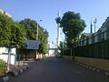 El Bagour Stadium St.


See also
[edit]References
[edit]- ^ a b c "Al-Bājūr (Markaz, Egypt) - Population Statistics, Charts, Map and Location". citypopulation.de. Retrieved 17 March 2023.
- ^ a b "El Bagur - Climate graph, Temperature graph, Climate table". Climate-Data.org. Retrieved 2014-07-30.
Well, that’s interesting to know that Psilotum nudum are known as whisk ferns. Psilotum nudum is the commoner species of the two. While the P. flaccidum is a rare species and is found in the tropical islands. Both the species are usually epiphytic in habit and grow upon tree ferns. These species may also be terrestrial and grow in humus or in the crevices of the rocks.
View the detailed Guide of Psilotum nudum: Detailed Study Of Psilotum Nudum (Whisk Fern), Classification, Anatomy, Reproduction