Nathrop, Colorado | |
|---|---|
 An old school in Nathrop. | |
 Nathrop Location of the Nathrop CDP in the State of Colorado. | |
| Coordinates: 38°44′55″N 106°04′35″W / 38.7487401°N 106.0764200°W[1] | |
| Country | |
| State | |
| County | Chaffee County |
| Government | |
| • Type | unincorporated town |
| Area | |
| • Total | 0.723 sq mi (1.873 km2) |
| • Land | 0.723 sq mi (1.873 km2) |
| • Water | 0.000 sq mi (0.000 km2) |
| Elevation | 7,680 ft (2,341 m) |
| Population | |
| • Total | 288 |
| • Density | 400/sq mi (150/km2) |
| Time zone | UTC-7 (MST) |
| • Summer (DST) | UTC-6 (MDT) |
| ZIP Code[4] | 81236 |
| Area code | 719 |
| GNIS feature[2] | Nathrop CDP |
Nathrop is an unincorporated town, a post office, and a census-designated place (CDP) located in and governed by Chaffee County, Colorado, United States. The population was 288 at the 2020 census.[3] The Nathrop post office has the ZIP code 81236.[4]
History[edit]
Nathrop was named for Charles Nachtrieb, owner of the townsite.[2][5] In 1880, the Denver and Rio Grande Railroad built through Nathrop as part of their Tennessee Pass line. The tracks were placed out of service in 1997, but Union Pacific, present-day owner of the line, may reach an agreement to reopen it.
Geography[edit]
The Nathrop CDP has an area of 463 acres (1.873 km2), all land.[1]
Ruby Mountain[edit]
Ruby Mountain is a rhyolite outcrop located about one mile northeast of Nathrop. Small spessartite garnet crystals are found throughout the outcropping. Small pebbles of black obsidian referred to as "Apache tears" by collectors can also be found in the talus rock at the base of the cliffs.[6]

Demographics[edit]
The United States Census Bureau defined the Nathrop CDP for the United States Census 2020.
| Year | Pop. | ±% |
|---|---|---|
| 2020 | 288 | — |
| Source: United States Census Bureau | ||
Attractions[edit]
- Alpine Tunnel
- Arkansas Headwaters Recreation Area
- Browns Canyon National Monument
- Mount Princeton
- San Isabel National Forest
- St. Elmo
See also[edit]
- Outline of Colorado
- State of Colorado
- Arkansas Headwaters Recreation Area
- Browns Canyon National Monument
References[edit]
- ^ a b c "State of Colorado Census Designated Places - BAS20 - Data as of January 1, 2020". United States Census Bureau. Retrieved December 6, 2020.
- ^ a b c d "U.S. Board on Geographic Names: Domestic Names". United States Geological Survey. Retrieved December 20, 2020.
- ^ a b United States Census Bureau. "Nathrop CDP, Colorado". Retrieved April 9, 2023.
- ^ a b "Look Up a ZIP Code". United States Postal Service. Retrieved December 20, 2020.
- ^ Dawson, John Frank (1954). Place names in Colorado: why 700 communities were so named, 150 of Spanish or Indian origin. Denver, CO: The J. Frank Dawson Publishing Co. p. 36.
- ^ "Salida Colorado Rockhounding and Mineral Collecting in the rocky mountains".
External links[edit]
- Nathrop @ Colorado.com
- Nathrop @ UncoverColorado.com
- History of Nathrop
- Arkansas Headwaters Recreation Area
- Browns Canyon National Monument
- Chaffee County website
- San Isabel National Forest website
Municipalities and communities of Chaffee County, Colorado, United States | ||
|---|---|---|
| City | 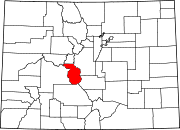 | |
| Towns | ||
| CDPs | ||
| Unincorporated communities | ||