 Ilhéu das Cabras seen from the city of São Tomé | |
| Geography | |
|---|---|
| Location | north of São Tomé near the urban area of São Tomé, São Tomé and Príncipe |
| Coordinates | 0°24′29″N 6°42′54″E / 0.408°N 6.715°E |
| Highest elevation | 90 m (300 ft) |
| Administration | |
| Demographics | |
| Population | 0 |

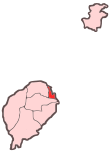
Ilhéu das Cabras is an uninhabited island in the Gulf of Guinea. It is one of the smaller islands of São Tomé and Príncipe. The islet is located about 2 km off the northeast coast of the island of São Tomé, 8 km north of the city centre of São Tomé. The islet consists of two hills, about 90 metres high.[1] There is a lighthouse on the northeastern summit,[1] built in 1890; its focal height 97 metres[2] and its range is 12 nmi (22 km; 14 mi).[3] The islet was mentioned as "Mooro Caebres" in the 1665 map by Johannes Vingboons.[4]
References[edit]
- ^ a b Sailing Directions (Enroute), Pub. 123: Southwest Coast of Africa (PDF). Sailing Directions. United States National Geospatial-Intelligence Agency. 2017. p. 76.
- ^ Rowlett, Russ. "Lighthouses of São Tomé and Príncipe". The Lighthouse Directory. University of North Carolina at Chapel Hill. Retrieved 30 October 2018.
- ^ List of Lights, Pub. 113: The West Coasts of Europe and Africa, the Mediterranean Sea, Black Sea and Azovskoye More (Sea of Azov) (PDF). List of Lights. United States National Geospatial-Intelligence Agency. 2018. p. 442.
- ^ 1665 map of the island of St Thomé by Johannes Vingboons[permanent dead link], now at the Dutch National Archive
External links[edit]
 Media related to Ilhéu das Cabras at Wikimedia Commons

