Hammondsville, Ohio | |
|---|---|
 Hammondsville Post Office on Ohio State Route 213 | |
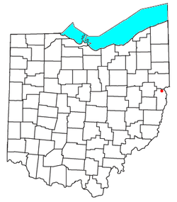
 Location of Hammondsville in the state of Ohio | |
| Coordinates: 40°33′27″N 80°42′25″W / 40.55750°N 80.70694°W | |
| Country | United States |
| State | Ohio |
| County | Jefferson |
| Townships | Saline |
| Elevation | 689 ft (210 m) |
| Time zone | UTC-5 (Eastern (EST)) |
| • Summer (DST) | UTC-4 (EDT) |
| ZIP code | 43930[2] |
| Area code | 740 |
| GNIS feature ID | 1064786[1] |
Hammondsville is an unincorporated community in central Saline Township, Jefferson County, Ohio, United States. It is part of the Weirton–Steubenville metropolitan area. It lies along Ohio State Route 213.
History[edit]
Hammondsville was laid out in 1852 and named for Charles Hammond, the original owner of the town site.[3] A post office has been in operation at Hammondsville since 1852.[4] Hammondsville was originally a mining community and the Hammondsville Mining and Coal Company operated there.[5]
Education[edit]
Hammondsville is part of the Edison Local School District. Campuses serving the community include Stanton Elementary School (Preschool-Grade 8) and Edison High School [1] (Grades 9-12).
Notable people[edit]
- Bevo Francis, basketball player, one of the most prolific scorers in college basketball history
References[edit]
- ^ a b U.S. Geological Survey Geographic Names Information System: Hammondsville, Ohio
- ^ Zip Code Lookup
- ^ Doyle, Joseph Beatty (1910). 20th Century History of Steubenville and Jefferson County, Ohio and Representative Citizens. Richmond-Arnold Publishing Company. pp. 466.
- ^ "Jefferson County". Jim Forte Postal History. Retrieved January 2, 2016.
- ^ Caldwell, John Alexander (1880). History of Belmont and Jefferson Counties, Ohio: And Incidentally Historical Collections Pertaining to Border Warfare and the Early Settlement of the Adjacent Portion of the Ohio Valley. Historical Publishing Company. p. 581.
