
Size of this preview: 722 × 600 pixels. Other resolutions: 289 × 240 pixels | 578 × 480 pixels | 925 × 768 pixels | 1,050 × 872 pixels.
Original file (1,050 × 872 pixels, file size: 242 KB, MIME type: image/jpeg)
Summary
| Description |
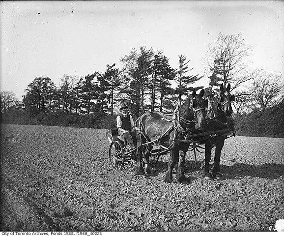
Photographer: Alexander Galbraith 1914 <a href="http://www.toronto.ca/archives/index.htm" rel="nofollow">City of Toronto Archives</a> Fonds 1568, Item 226
|
||
| Date | |||
| Source | Toronto police planting potatoes, north of Chaplin Crescent | ||
| Author | Toronto History from Toronto, Canada |
| Camera location | | View this and other nearby images on: OpenStreetMap |
|---|
.jpg¶ms=043.706564_N_-079.422573_E_globe:Earth_type:camera_source:Flickr_&language=en)
Licensing
This file is licensed under the Creative Commons Attribution 2.0 Generic license.
- You are free:
- to share – to copy, distribute and transmit the work
- to remix – to adapt the work
- Under the following conditions:
- attribution – You must give appropriate credit, provide a link to the license, and indicate if changes were made. You may do so in any reasonable manner, but not in any way that suggests the licensor endorses you or your use.
| This image was originally posted to Flickr by Toronto History at https://flickr.com/photos/48096488@N03/30116252200 (archive). It was reviewed on 12 October 2018 by FlickreviewR 2 and was confirmed to be licensed under the terms of the cc-by-2.0. |
File history
Click on a date/time to view the file as it appeared at that time.
| Date/Time | Thumbnail | Dimensions | User | Comment | |
|---|---|---|---|---|---|
| current | 14:18, 12 October 2018 | | 1,050 × 872 (242 KB) | Geo Swan | Transferred from Flickr via #flickr2commons |
File usage
The following pages on the English Wikipedia use this file (pages on other projects are not listed):
.jpg)