StHelens1818GreenwoodsMap.png (368 × 271 pixels, file size: 246 KB, MIME type: image/png)
Summary[edit]
| Description |
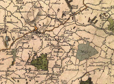
A crop of C. & J. Greenwood's, Map of the County Palatine of Lancaster, from an Actual Survey made in the Year 1818. First edition, 1830. |
|---|---|
| Source |
Taken direct from source |
| Article | |
| Portion used |
St. Helens |
| Low resolution? |
Yes |
| Purpose of use |
To |
| Replaceable? |
None |
| Other information |
The copyright on this map lapsed in 1950, and reproductions are available free of charge from Local Libraries. This image has been derived from a colour scan of a reproduction by myself, Koncorde, from the St. Helens Central Library Archives. This is a derivative work, comprising only a small sample of the complete mapKoncorde (talk) 00:05, 29 June 2010 (UTC) |
| Fair useFair use of copyrighted material in the context of St Helens, Merseyside//en.wikipedia.org/wiki/File:StHelens1818GreenwoodsMap.pngtrue | |
| Description |
A crop of C. & J. Greenwood's, Map of the County Palatine of Lancaster, from an Actual Survey made in the Year 1818. First edition, 1830. |
|---|---|
| Source |
Taken direct from source |
| Article | |
| Portion used |
St. Helens |
| Low resolution? |
Yes |
| Purpose of use |
To |
| Replaceable? |
None |
| Other information |
The copyright on this map lapsed in 1950, and reproductions are available free of charge from Local Libraries. This image has been derived from a colour scan of a reproduction by myself, Koncorde, from the St. Helens Central Library Archives. This is a derivative work, comprising only a small sample of the complete mapKoncorde (talk) 00:05, 29 June 2010 (UTC) |
| Fair useFair use of copyrighted material in the context of History of St Helens, Merseyside//en.wikipedia.org/wiki/File:StHelens1818GreenwoodsMap.pngtrue | |
Licensing[edit]
File history
Click on a date/time to view the file as it appeared at that time.
| Date/Time | Thumbnail | Dimensions | User | Comment | |
|---|---|---|---|---|---|
| current | 04:30, 27 May 2017 | | 368 × 271 (246 KB) | DatBot (talk | contribs) | Reduce size of non-free image (BOT - disable) |
| 00:05, 29 June 2010 | No thumbnail | 610 × 450 (585 KB) | Koncorde (talk | contribs) | {{Non-free use rationale |Article = St. Helens and associated areas. |Description = A crop of C. & J. Greenwood's, Map of the County Palatine of Lancaster, from an Actual Survey made in the Year 1818. First edition, 1830. |Source |
You cannot overwrite this file.