
Size of this preview: 656 × 599 pixels. Other resolutions: 263 × 240 pixels | 526 × 480 pixels | 830 × 758 pixels.
Original file (830 × 758 pixels, file size: 808 KB, MIME type: image/png)
Summary
| Description |
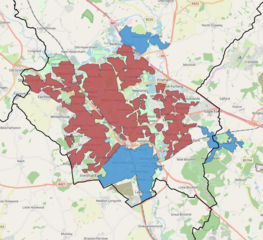
English: Map of the Milton Keynes Built-up area as defined by the Office of National Statistics for the 2011 Census, displaying subdivisions and local authority boundaries |
| Date | |
| Source | Own work |
| Author | Eopsid |
Licensing
I, the copyright holder of this work, hereby publish it under the following license:
This file is licensed under the Creative Commons Attribution-Share Alike 4.0 International license.
- You are free:
- to share – to copy, distribute and transmit the work
- to remix – to adapt the work
- Under the following conditions:
- attribution – You must give appropriate credit, provide a link to the license, and indicate if changes were made. You may do so in any reasonable manner, but not in any way that suggests the licensor endorses you or your use.
- share alike – If you remix, transform, or build upon the material, you must distribute your contributions under the same or compatible license as the original.
File history
Click on a date/time to view the file as it appeared at that time.
| Date/Time | Thumbnail | Dimensions | User | Comment | |
|---|---|---|---|---|---|
| current | 20:54, 22 February 2021 | | 830 × 758 (808 KB) | Eopsid | Uploaded own work with UploadWizard |
File usage
The following pages on the English Wikipedia use this file (pages on other projects are not listed):