
Size of this PNG preview of this SVG file: 800 × 476 pixels. Other resolutions: 320 × 191 pixels | 640 × 381 pixels | 1,024 × 610 pixels | 1,280 × 762 pixels | 2,560 × 1,524 pixels | 5,804 × 3,456 pixels.
Original file (SVG file, nominally 5,804 × 3,456 pixels, file size: 56 KB)
Summary
| Description |
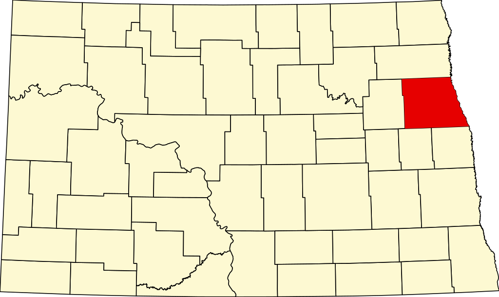
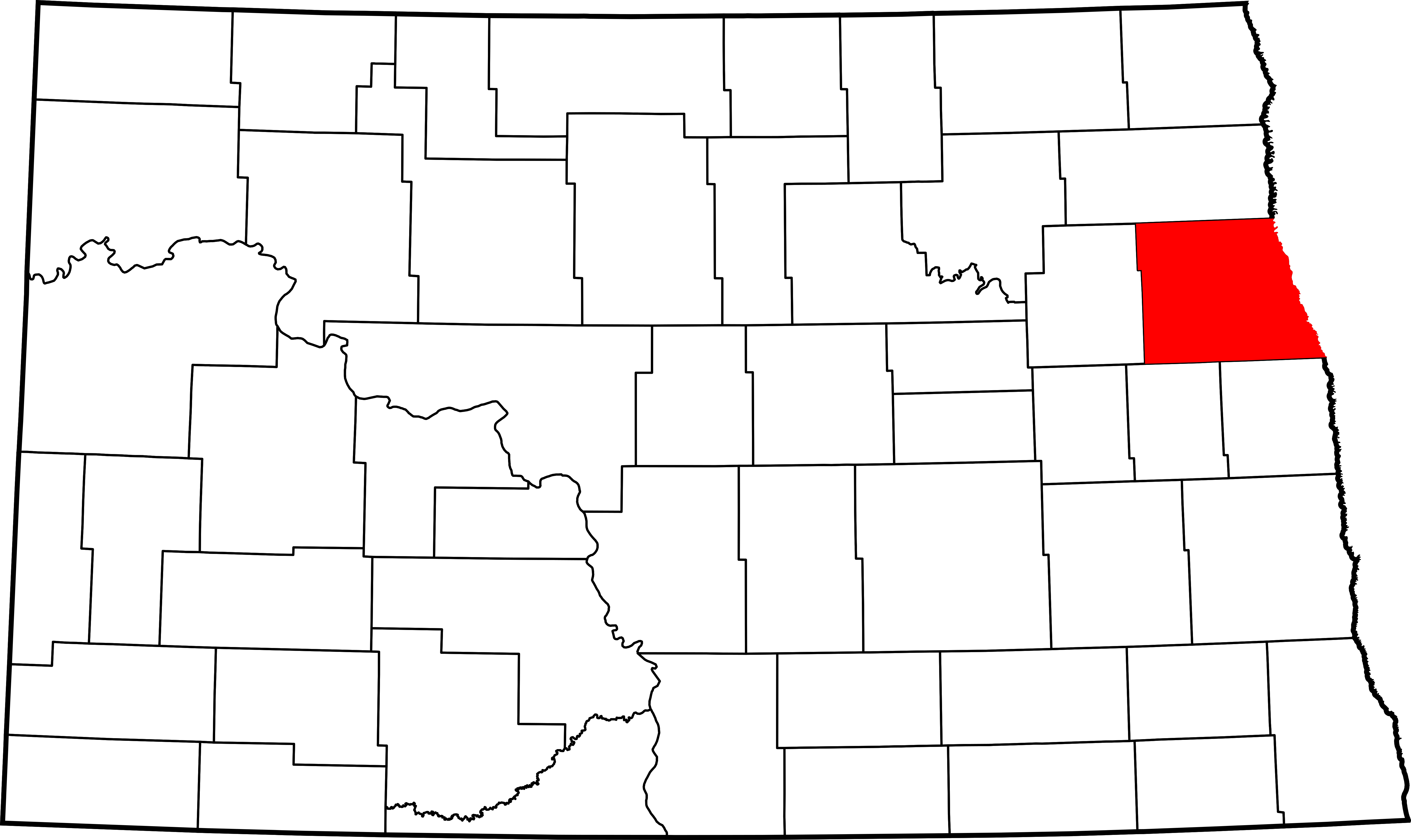
English: This is a locator map showing Grand Forks County in North Dakota. |
| Source | Own work |
| Author | David Benbennick made this map. |
| Camera location | | View this and other nearby images on: OpenStreetMap |
|---|
For more information, see Commons:United States county locator maps.
Licensing
| I, the copyright holder of this work, release this work into the public domain. This applies worldwide. In some countries this may not be legally possible; if so: I grant anyone the right to use this work for any purpose, without any conditions, unless such conditions are required by law. |
File history
Click on a date/time to view the file as it appeared at that time.
| Date/Time | Thumbnail | Dimensions | User | Comment | |
|---|---|---|---|---|---|
| current | 16:04, 12 February 2006 | | 5,804 × 3,456 (56 KB) | David Benbennick | {{subst:User:Dbenbenn/clm|county=Grand Forks County|state=North Dakota|type=county}} |
File usage
More than 100 pages use this file. The following list shows the first 100 pages that use this file only. A full list is available.
- 312 Kittson Avenue
- Agnes Township, Grand Forks County, North Dakota
- Allendale Township, Grand Forks County, North Dakota
- Americus Township, Grand Forks County, North Dakota
- Arvilla, North Dakota
- Arvilla Township, Grand Forks County, North Dakota
- Avalon Theater (Larimore, North Dakota)
- B'nai Israel Synagogue and Montefiore Cemetery
- BPOE Lodge: Golden Block
- Building at 201 S. 3rd St.
- Building at 205 DeMers Ave.
- Building at 317 S. 3rd St.
- Carlott Funseth Round Barn
- Clifford Annex
- Dakota Block (Grand Forks, North Dakota)
- Dinnie Apartments
- Dinnie Block
- Downtown Grand Forks
- Dr. Henry Wheeler House
- Edgar Building
- Electric Construction Co. Building
- Emerado, North Dakota
- Finks and Gokey Block
- First National Bank (Grand Forks, North Dakota)
- Flatiron Building (Grand Forks, North Dakota)
- George B. Clifford House
- Gilby, North Dakota
- Grand Forks, North Dakota
- Grand Forks Air Force Base
- Grand Forks Air Force Base (CDP)
- Grand Forks City Hall
- Grand Forks County, North Dakota
- Grand Forks County Courthouse
- Grand Forks County Fairgrounds WPA Structures
- Grand Forks Herald
- Grand Forks Mercantile Building 1898
- Grand Forks Mercantile Co.
- Grand Forks Near Southside Historic District
- Grand Forks Riverside Neighborhood Historic District
- Grand Forks Woolen Mills
- Grand Forks freight station
- Grand Forks station (Northern Pacific Railway)
- Hariman Sanatorium
- Harriet and Thomas Beare House
- Hook and Ladder No. 1 and Hose Co. No. 2
- House at 1648 Riverside Drive
- Iddings Block
- Inkster, North Dakota
- J. Nelson Kelly House
- Johnstown, North Dakota
- Joseph Bell DeRemer House
- Kempton, North Dakota
- Larimore, North Dakota
- Larimore City Hall
- List of counties in North Dakota
- Lyons Garage (Grand Forks, North Dakota)
- Manvel, North Dakota
- Martin V. Linwell House
- Masonic Center (Grand Forks, North Dakota)
- Mekinock, North Dakota
- Metropolitan Opera House (Grand Forks, North Dakota)
- Midway Bridge (Johnstown, North Dakota)
- National Register of Historic Places listings in Grand Forks County, North Dakota
- New Hampshire Apartments
- Niagara, North Dakota
- North Dakota Mill and Elevator
- Northwood, North Dakota
- Northwood Bridge
- Odd Fellows Block (Grand Forks, North Dakota)
- Ost Valle Bridge
- Oxford House (Grand Forks, North Dakota)
- R.S. Blome Granitoid Pavement in Grand Forks
- Red River Valley Brick Co.
- Reynolds, North Dakota
- Roller Office Supply
- Ronald N. Davies Federal Building and U.S. Courthouse
- Skarsbo Apartments
- Sorlie Memorial Bridge
- South Junior High School (Grand Forks, North Dakota)
- Speed Printing
- St. John's Block Commercial Exchange
- St. Michael's Church (Grand Forks, North Dakota)
- St. Michael's Hospital and Nurses' Residence
- St. Michael's Parochial School
- Strabane Township, Grand Forks County, North Dakota
- Stratford Building
- Telephone Co. Building (Grand Forks, North Dakota)
- The Kegs Drive-In
- Thomas D. Campbell House
- Thompson, North Dakota
- United Lutheran Church (Grand Forks, North Dakota)
- University of North Dakota Historic District
- Viets Hotel
- WPA Stone Structures in Memorial Park and Calvary Cemetery
- Washington School (Grand Forks, North Dakota)
- Wells–Denbrook Architects Office Building
- Wright Block
- User:Nyttend/County templates/ND
- Template:Grand Forks County, North Dakota
- Template:NRHP in Grand Forks County, North Dakota
View more links to this file.
Global file usage
The following other wikis use this file:
- Usage on ar.wikipedia.org
- Usage on bg.wikipedia.org
- Usage on bpy.wikipedia.org
- Usage on ca.wikipedia.org
- Usage on cdo.wikipedia.org
- Usage on ceb.wikipedia.org
- Usage on cy.wikipedia.org
- Usage on de.wikipedia.org
- Usage on es.wikipedia.org
- Usage on et.wikipedia.org
- Usage on eu.wikipedia.org
- Usage on fa.wikipedia.org
- امرادو، داکوتای شمالی
- گیلبی، داکوتای شمالی
- گرند فرک، داکوتای شمالی
- اینکستر، داکوتای شمالی
- لاریمور، داکوتای شمالی
- مانول، داکوتای شمالی
- نایجرا، داکوتای شمالی
- نورثوود، داکوتای شمالی
- رینلدز، داکوتای شمالی
- تامپسون، داکوتای شمالی
- ناحیه ایجنز، شهرستان گرند فورک، داکوتای شمالی
- شهرستان گراند فورکس، داکوتای شمالی
- آرویلا، داکوتای شمالی
- پایگاه نیروی هوایی گرند فورکس (حوزه سرشماری)
- الگو:شهرستان گراند فورکس، داکوتای شمالی
- Usage on frr.wikipedia.org
- Usage on fr.wikipedia.org
View more global usage of this file.