Size of this preview: 800 × 600 pixels. Other resolutions: 320 × 240 pixels | 640 × 480 pixels | 1,024 × 768 pixels | 1,280 × 960 pixels | 2,560 × 1,920 pixels | 4,032 × 3,024 pixels.
Original file (4,032 × 3,024 pixels, file size: 5.9 MB, MIME type: image/jpeg)
Summary
| Description |
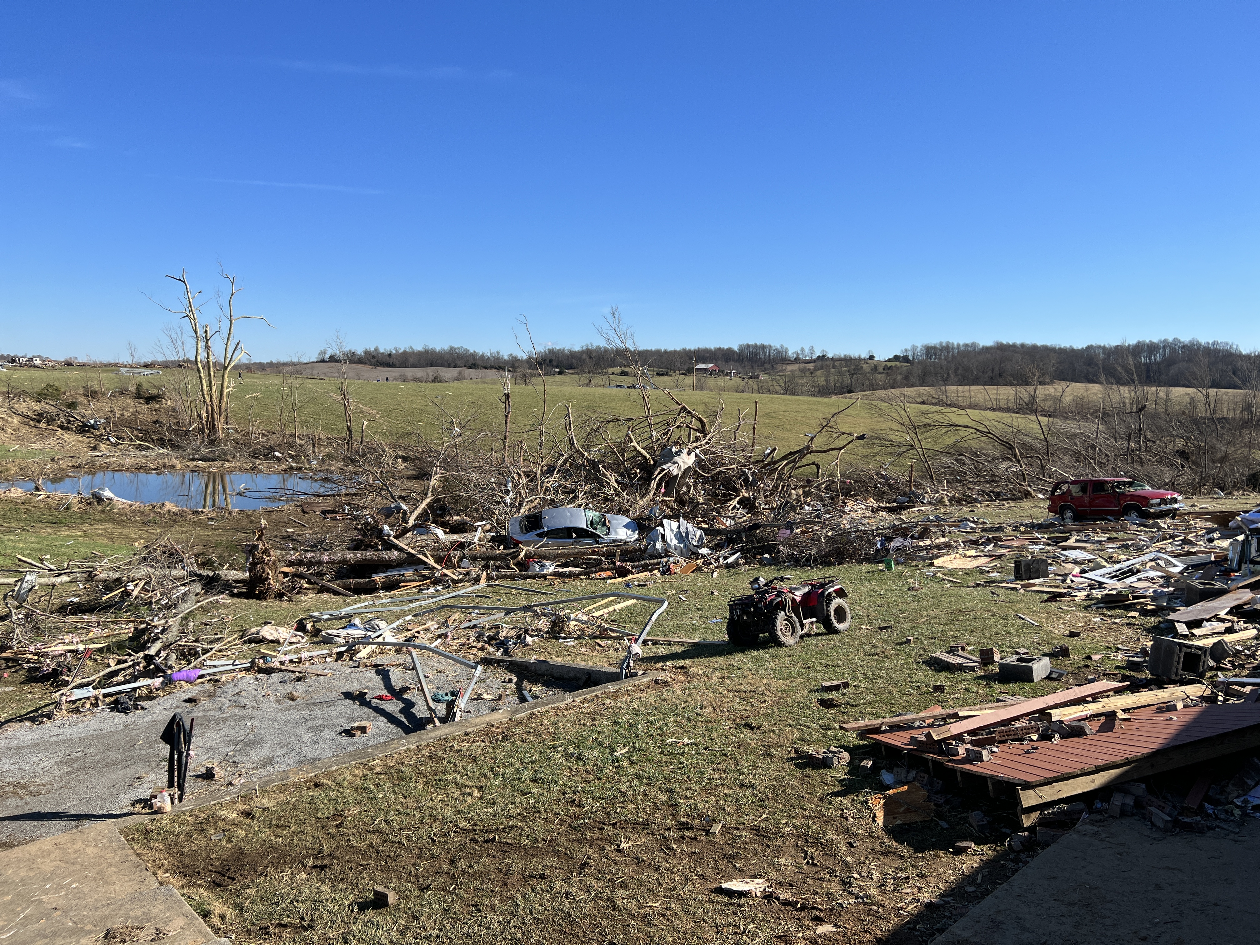
English: The remnants of a completely destroyed home strewn into a pond and nearby trees along with two destroyed vehicles near Saloma, Kentucky.
"One- or Two-Family Residences (FR12) All walls collapsed" |
| Date | |
| Source | https://services.dat.noaa.gov/arcgis/rest/services/nws_damageassessmenttoolkit/DamageViewer/FeatureServer/0/2556661/attachments/1643513 |
| Author | NWS Louisville, KY |
| Camera location | | View this and other nearby images on: OpenStreetMap |
|---|
Licensing
This image is in the public domain because it contains materials that originally came from the U.S. National Oceanic and Atmospheric Administration, taken or made as part of an employee's official duties.
|
File history
Click on a date/time to view the file as it appeared at that time.
| Date/Time | Thumbnail | Dimensions | User | Comment | |
|---|---|---|---|---|---|
| current | 20:07, 13 November 2023 | | 4,032 × 3,024 (5.9 MB) | ChessEric | Uploaded a work by NWS Louisville, KY from https://services.dat.noaa.gov/arcgis/rest/services/nws_damageassessmenttoolkit/DamageViewer/FeatureServer/0/2556661/attachments/1643513 with UploadWizard |
File usage
The following pages on the English Wikipedia use this file (pages on other projects are not listed):