
Size of this preview: 800 × 600 pixels. Other resolutions: 320 × 240 pixels | 640 × 480 pixels | 1,024 × 768 pixels | 1,280 × 960 pixels | 2,048 × 1,536 pixels.
Original file (2,048 × 1,536 pixels, file size: 1.83 MB, MIME type: image/jpeg)
Summary
| Description |
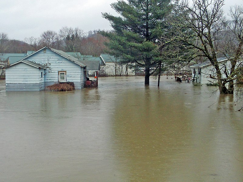
English: A subdivision is flooded after a storm and subsequent flooding due to the Dunloup Creek in West
Virginia on Mar. 13, 2010. Photos courtesy NRCS West Virginia. |
| Date | |
| Source | https://www.flickr.com/photos/usdagov/8615843111/ |
| Author | U.S. Department of Agriculture |
Licensing
This file is licensed under the Creative Commons Attribution 2.0 Generic license.
- You are free:
- to share – to copy, distribute and transmit the work
- to remix – to adapt the work
- Under the following conditions:
- attribution – You must give appropriate credit, provide a link to the license, and indicate if changes were made. You may do so in any reasonable manner, but not in any way that suggests the licensor endorses you or your use.
| This image was originally posted to Flickr by USDAgov at https://flickr.com/photos/41284017@N08/8615843111. It was reviewed on 11 August 2022 by FlickreviewR 2 and was confirmed to be licensed under the terms of the cc-by-2.0. |
File history
Click on a date/time to view the file as it appeared at that time.
| Date/Time | Thumbnail | Dimensions | User | Comment | |
|---|---|---|---|---|---|
| current | 01:21, 11 August 2022 | | 2,048 × 1,536 (1.83 MB) | Blythwood | Uploaded a work by U.S. Department of Agriculture from https://www.flickr.com/photos/usdagov/8615843111/ with UploadWizard |
File usage
The following pages on the English Wikipedia use this file (pages on other projects are not listed):