
Size of this preview: 800 × 600 pixels. Other resolutions: 320 × 240 pixels | 640 × 480 pixels | 1,024 × 768 pixels | 1,280 × 960 pixels | 2,576 × 1,932 pixels.
Original file (2,576 × 1,932 pixels, file size: 1.6 MB, MIME type: image/jpeg)
|
This is an image of a place or building that is listed on the National Register of Historic Places in the United States of America. Its reference number is 90001446. |
Summary
| Description |
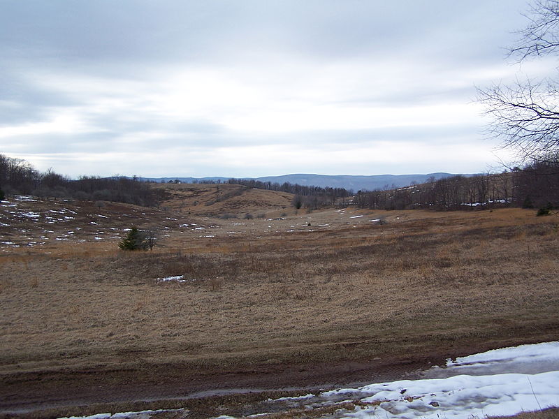
English: Battlefield from the en:Battle of Camp Allegheny (en:American Civil War) in en:Pocahontas County, West Virginia. |
| Date | |
| Source | Own work by author/uploader |
| Author | Brian M. Powell (user Bitmapped on en.wikipedia) |
| Camera location | | View this and other nearby images on: OpenStreetMap |
|---|
Licensing
This image is licensed under the below Creative Commons license assuming that proper attribution (Brian M. Powell) is provided. If you use this image for a non-Wikimedia or non-Wikipedia project, please leave a note at Brian's Wikipedia Talk page.
This file is licensed under the Creative Commons Attribution-Share Alike 3.0 Unported license.
Attribution: Brian M. Powell
- You are free:
- to share – to copy, distribute and transmit the work
- to remix – to adapt the work
- Under the following conditions:
- attribution – You must give appropriate credit, provide a link to the license, and indicate if changes were made. You may do so in any reasonable manner, but not in any way that suggests the licensor endorses you or your use.
- share alike – If you remix, transform, or build upon the material, you must distribute your contributions under the same or compatible license as the original.
File history
Click on a date/time to view the file as it appeared at that time.
| Date/Time | Thumbnail | Dimensions | User | Comment | |
|---|---|---|---|---|---|
| current | 03:37, 27 July 2008 | | 2,576 × 1,932 (1.6 MB) | Bitmapped | {{Information |Description={{en|Battlefield from the en:Battle of Camp Allegheny (en:American Civil War) in en:Pocahontas County, West Virginia.}} |Source=Transferred from [http://en.wikipedia.org en.wikipedia]; transfer was stated to be ma |
File usage
The following pages on the English Wikipedia use this file (pages on other projects are not listed):
Global file usage
The following other wikis use this file:
- Usage on arz.wikipedia.org
- Usage on en.wikivoyage.org
- Usage on fr.wikipedia.org
- Usage on nl.wikipedia.org
- Usage on pl.wikipedia.org
- Usage on www.wikidata.org
- Usage on zh.wikipedia.org