Size of this preview: 800 × 450 pixels. Other resolutions: 320 × 180 pixels | 640 × 360 pixels | 1,024 × 576 pixels | 1,280 × 720 pixels | 2,560 × 1,440 pixels | 5,312 × 2,988 pixels.
Original file (5,312 × 2,988 pixels, file size: 5.27 MB, MIME type: image/jpeg)
Summary
| Description |
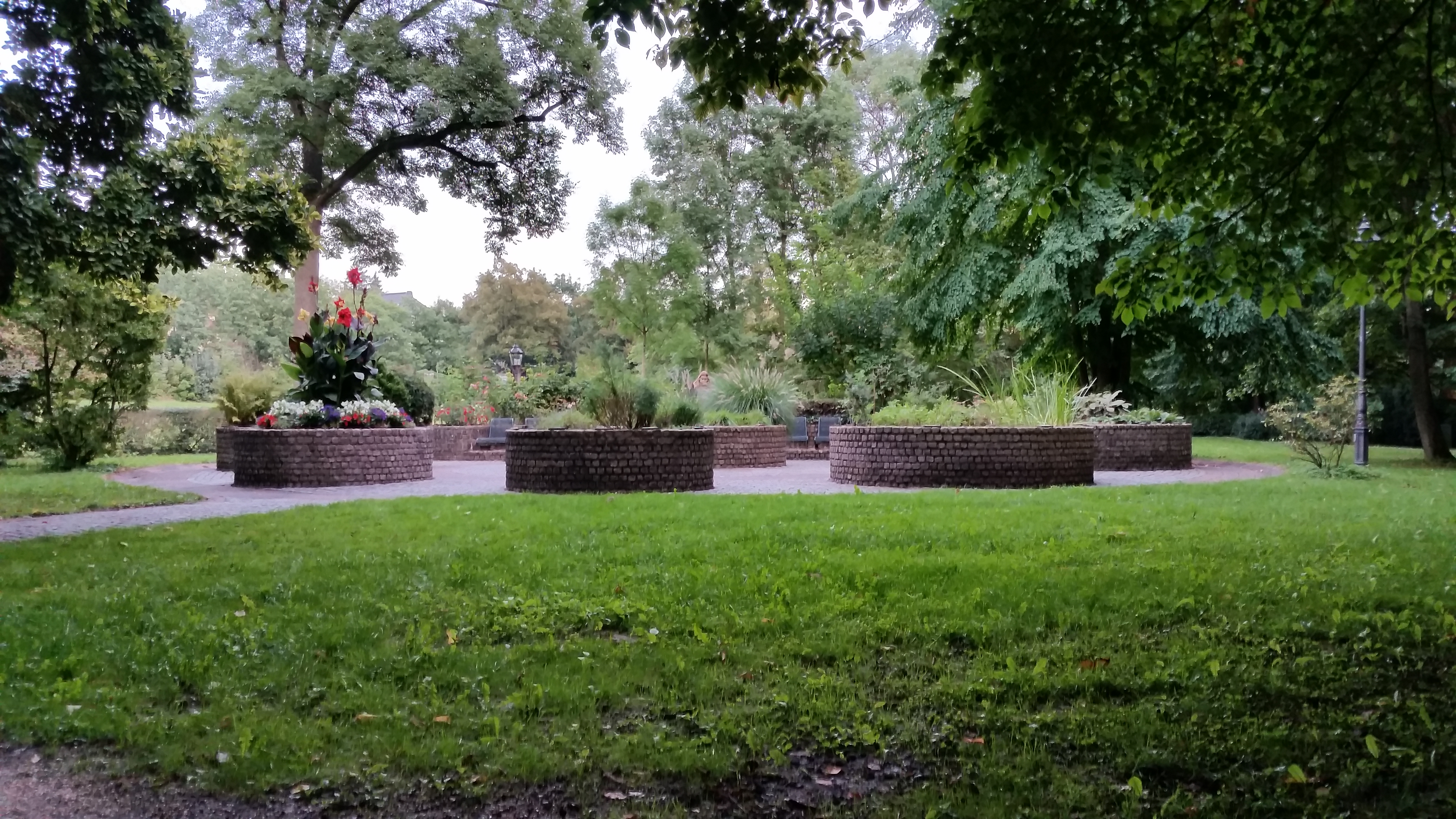
Deutsch: Seit 1983 gibt es den Duft- und Tastgarten im Nordosten vom Kurpark von Bad Homburg - errichtet von der Stadt Bad Homburg und dem Gartenclub Bad Homburg. Acht Hochbetten sind mit Pflanzen zu unterschiedlichen Themen bepflanzt: Küchenkräuter, Heilkräuter, Stauden, Laubgehölze, Rosen, Nadelgehölze und Farne, Sommerblumen, Gräser. Schilder nennen deren Namen und Erläuterungen in "Klarschrift" und in Brailleschrift. Dadurch wird der Blindengarten auch zu einem Lehrgarten. [1]
English: The Odour- and Touch-Garden was built in 1983 by the city of Bad Homburg and the garden club of Bad Homburg. 8 Raised-bed's are planted with plants of differing topics, e.g. culinary herbs, medicinal herb, shrubs, grass, etc. Each plant has its own plaque with its name and explanation - in standard writing and Braille. So the Sensory Garden becomes a teaching and demonstration garden - for every one, including blind person as well. [2] |
| Date | |
| Source | Own work |
| Author | 4spring |
| Camera location | | View this and other nearby images on: OpenStreetMap |
|---|
|
The photographical reproduction of this work is covered under the article § 59 of the German copyright law, which states that "It shall be permissible to reproduce, by painting, drawing, photography or cinematography, works which are permanently located on public ways, streets or places and to distribute and publicly communicate such copies. For works of architecture, this provision shall be applicable only to the external appearance."
As with all other “limits of copyright by legally permitted uses”, no changes to the actual work are permitted under § 62 of the German copyright law (UrhG). See Commons:Copyright rules by territory/Germany#Freedom of panorama for more information.
|
Standort: N 50° 13.662 E 008° 37.777 / 50.2277 8.62962
Licensing
I, the copyright holder of this work, hereby publish it under the following license:
| This file is made available under the Creative Commons CC0 1.0 Universal Public Domain Dedication. | |
| The person who associated a work with this deed has dedicated the work to the public domain by waiving all of their rights to the work worldwide under copyright law, including all related and neighboring rights, to the extent allowed by law. You can copy, modify, distribute and perform the work, even for commercial purposes, all without asking permission.
|
File history
Click on a date/time to view the file as it appeared at that time.
| Date/Time | Thumbnail | Dimensions | User | Comment | |
|---|---|---|---|---|---|
| current | 05:43, 30 December 2017 | | 5,312 × 2,988 (5.27 MB) | 4spring | User created page with UploadWizard |
File usage
The following pages on the English Wikipedia use this file (pages on other projects are not listed):
Global file usage
The following other wikis use this file:
- Usage on ar.wikipedia.org
- Usage on es.wikipedia.org
- Usage on ja.wikipedia.org