No higher resolution available.
165whl.jpg (210 × 284 pixels, file size: 29 KB, MIME type: image/jpeg)
Summary
| Description |
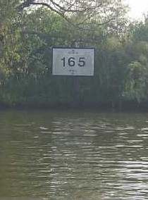
English: This image was copied from wikipedia:en. The original description was: Gulf Intracoastal Waterway mile 165 west of Harvey Lock indicated by Corps of Engineers mileboard, sourced from http://www.mvn.usace.army.mil/ops/sms/datpage.asp?S1# Transwiki approved by: w:en:User:Dmcdevit |
| Source | sourced from http://www.mvn.usace.army.mil/ops/sms/datpage.asp?S1# |
| Author |
Licensing
This image or file is a work of a U.S. Army Corps of Engineers soldier or employee, taken or made as part of that person's official duties. As a work of the U.S. federal government, the image is in the public domain.
|
Original upload log
| date/time | username | resolution | size | edit summary |
|---|---|---|---|---|
| 02:38, 22 April 2006 | w:en:User:Muffuletta | 210×284 | 29 KB | Gulf Intracoastal Waterway {{w|Mile#Status mile|mile}} 165 west of Harvey Lock indicated by Corps of Engineers mileboard, sourced from http://www.mvn.usace.army.mil/ops/sms/datpage.asp?S1# {{PD-USGov-Military-Army-USACE}} |
Image description page history
| link | date/time | username | edit summary |
|---|---|---|---|
| http://en.wikipedia.org/w/index.php?title=Image:165whl.jpg&redirect=no&oldid=49537750 | 09:26, 12 September 2007 | w:en:User:Dmcdevit | |
| http://en.wikipedia.org/w/index.php?title=Image:165whl.jpg&redirect=no&oldid=49537750 | 02:38, 22 April 2006 | w:en:User:Muffuletta | (Gulf Intracoastal Waterway mile 165 west of Harvey Lock indicated by Corps of Engineers mileboard, sourced from http://www.mvn.usace.army.mil/ops/sms/datpage.asp?S1# {{PD-USGov-Military-Army-USACE}}) |
File history
Click on a date/time to view the file as it appeared at that time.
| Date/Time | Thumbnail | Dimensions | User | Comment | |
|---|---|---|---|---|---|
| current | 15:51, 13 September 2007 | | 210 × 284 (29 KB) | BetacommandBot | Transwiki approved by: w:en:User:Dmcdevit This image was copied from wikipedia:en. The original description was: == Summary == Gulf Intracoastal Waterway mile 165 west of Harvey Lock indicated by Corps of Engineers mileboard, sourced from http://www |
File usage
The following pages on the English Wikipedia use this file (pages on other projects are not listed):