Edgartown, Massachusetts | |
|---|---|
 Location in Dukes County in Massachusetts | |
| Coordinates: 41°23′22″N 70°31′3″W / 41.38944°N 70.51750°W | |
| Country | |
| State | Massachusetts |
| County | Dukes |
| Town | Edgartown |
| Area | |
| • Total | 1.20 sq mi (3.11 km2) |
| • Land | 1.20 sq mi (3.10 km2) |
| • Water | 0.01 sq mi (0.01 km2) |
| Elevation | 16 ft (5 m) |
| Population (2020) | |
| • Total | 1,107 |
| • Density | 926.36/sq mi (357.63/km2) |
| Time zone | UTC-5 (Eastern (EST)) |
| • Summer (DST) | UTC-4 (EDT) |
| ZIP Code | 02539 |
| Area code(s) | 508/774 |
| FIPS code | 25-21115 |
| GNIS feature ID | 2631319[2] |
Edgartown is a census-designated place (CDP) comprising the primary settlement in the town of Edgartown, Dukes County, Massachusetts, United States, on the island of Martha's Vineyard. The CDP also includes the neighborhood of Clevelandtown.
Edgartown was first listed as a CDP after the 2010 census[2] with a population of 1,107[3]
Demographics[edit]
| Census | Pop. | Note | %± |
|---|---|---|---|
| 2020 | 1,107 | — | |
| U.S. Decennial Census[4] 2020[5] | |||
2020 census[edit]
| Race / Ethnicity | Pop 2020[5] | % 2020 |
|---|---|---|
| White alone (NH) | 891 | 80.49% |
| Black or African American alone (NH) | 20 | 1.81% |
| Native American or Alaska Native alone (NH) | 3 | 0.27% |
| Asian alone (NH) | 10 | 0.90% |
| Pacific Islander alone (NH) | 1 | 0.09% |
| Some Other Race alone (NH) | 33 | 2.98% |
| Mixed Race/Multi-Racial (NH) | 104 | 9.39% |
| Hispanic or Latino (any race) | 45 | 4.07% |
| Total | 1,107 | 100.00% |
Note: the US Census treats Hispanic/Latino as an ethnic category. This table excludes Latinos from the racial categories and assigns them to a separate category. Hispanics/Latinos can be of any race.
References[edit]
- ^ "2020 U.S. Gazetteer Files". United States Census Bureau. Retrieved May 21, 2022.
- ^ a b c "Edgartown Census Designated Place". Geographic Names Information System. United States Geological Survey, United States Department of the Interior.
- ^ "Edgartown CDP, Massachusetts". United States Census Bureau. Retrieved September 16, 2022.
- ^ "Census of Population and Housing". Census.gov. Retrieved June 4, 2016.
- ^ a b "P2 HISPANIC OR LATINO, AND NOT HISPANIC OR LATINO BY RACE – 2020: DEC Redistricting Data (PL 94-171) – Edgartown CDP, Massachusetts". United States Census Bureau.
Municipalities and communities of Dukes County, Massachusetts, United States | ||
|---|---|---|
| Towns | 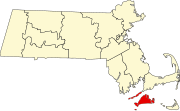 | |
| CDPs | ||
| Other villages | ||
| Indian reservation | ||