Deer Island | |
|---|---|
| Country | Canada |
| Province | New Brunswick |
| County | Charlotte |
| Settled | 1770 |
| Area | |
| • Total | 38.32 km2 (14.80 sq mi) |
| Population (2021) | |
| • Total | 718 |
| • Density | 18.7/km2 (48/sq mi) |
| • Pop 2016-2021 | |
| • Dwellings | 475 |
Deer Island is one of the Fundy Islands in the Bay of Fundy, Canada. It is at the entrance to Passamaquoddy Bay. The island was first settled by colonists around 1770.[1]
Local government was provided by the West Isles Local Service District, which is within the Southwest NB Regional Service Commission.[2]
At 45 km2, it is the largest island in the West Isles Parish CSD, which had a 2021 population of 718.[3] It has three communities: Fairhaven, Leonardville, and Lords Cove.[4] There is a primary school on the island, while older pupils attend Fundy High School on the mainland.
The economy is primarily fishing and aquaculture based although tourism is growing. The Old Sow, the largest tidal whirlpool in the western hemisphere[5] can be viewed from Deer Island Point Park.[6]
The major route is New Brunswick Route 772. The year round L'Etete to Deer Island Ferries run by the government, Deer Island Princess II and Abnaki II, connect Deer Island with L'Etete, New Brunswick on the mainland. During the summer, privately operated ferries, through East Coast Ferries Ltd, operate the Cummings Cove to Welshpool Ferry, Hopper II, to Campobello Island. The Cummings Cove to Eastport Ferry, Fundy Trail II to Maine, has been defunct since 2014. There are two lighthouses on Deer Island. One is in Leonardville and the second is located on Deer island point.
 | |
| Location | Deer Island, Charlotte County, New Brunswick, Canada |
|---|---|
| Coordinates | 44°58′06″N 66°57′18″W / 44.968231°N 66.955103°W |
| Tower | |
| Constructed | 1914 |
| Foundation | concrete base |
| Construction | wooden tower |
| Height | 8 m (26 ft) |
| Shape | square frustun tower with balcony and lantern[7][8] |
| Markings | white tower, red lantern roof |
| Operator | Canadian Coast Guard |
| Light | |
| Focal height | 20 m (66 ft) |
| Range | 10 nmi (19 km; 12 mi) |
| Characteristic | F W |
Gallery[edit]
-
 Ferry crossing between Deer Island (N.B.) and Eastport (ME).
 -
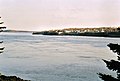 High tide at Deer Island Point.
 -
 Low tide at Deer Island Point with the Old Sow in action.
 -
 Cargo ship sailing by Deer Island Point.
 -
 Deer Island Ferry


References[edit]
- ^ "Deer Island History and Little Known Facts". Retrieved 2 January 2017.
- ^ "Communities in each of the 12 Regional Service Commissions (RSC" (PDF). Government of New Brunswick. Retrieved 26 October 2021.
- ^ Government of Canada, Statistics Canada (February 9, 2022). "Profile table, Census Profile, 2021 Census of Population - West Isles, Parish (P) [Census subdivision], New Brunswick". www12.statcan.gc.ca.
- ^ "LETETE - DEER ISLAND FERRY". Archived from the original on 2 January 2017. Retrieved 2 January 2017.
- ^ "Old Sow Whirlpool". Retrieved 2 January 2017.
- ^ "Public Parks Recreation Areas Hiking Trails". Quoddy Loop. Retrieved 2 January 2017.
- ^ Rowlett, Russ. "Lighthouses of Canada: Southern New Brunswick". The Lighthouse Directory. University of North Carolina at Chapel Hill. Retrieved 2017-02-25.
- ^ List of Lights, Pub. 110: Greenland, The East Coasts of North and South America (Excluding Continental U.S.A. Except the East Coast of Florida) and the West Indies (PDF). List of Lights. United States National Geospatial-Intelligence Agency. 2016.
External links[edit]
- Aids to Navigation Canadian Coast Guard
44°58′32.4″N 66°58′53.6″W / 44.975667°N 66.981556°W
Subdivisions of New Brunswick | |
|---|---|
| Cities | |
| Towns |
|
| Villages | |
| Regional municipality | |
| Rural communities | |
| Rural districts |
|
| Other administrative divisions | |
| International | |
|---|---|
| National | |
| Leonardville Lighthouse | |