68.53.109.112 (talk) No edit summary |
Colonies Chris (talk | contribs) m sp, date & link fixes, using AWB |
||
| Line 22: | Line 22: | ||
<!-- Location --> |
<!-- Location --> |
||
|subdivision_type = [[List of countries|Country]] |
|subdivision_type = [[List of countries|Country]] |
||
|subdivision_name = |
|subdivision_name = United States |
||
|subdivision_type1 = [[Political divisions of the United States|State]] |
|subdivision_type1 = [[Political divisions of the United States|State]] |
||
|subdivision_name1 = [[Kentucky]] |
|subdivision_name1 = [[Kentucky]] |
||
| Line 82: | Line 82: | ||
According to the [[United States Census Bureau]], the city has a total area of 63.1 km<sup>2</sup> (24.4 mi<sup>2</sup>). 62.3 km<sup>2</sup> (24.1 mi<sup>2</sup>) of it is land and 0.8 km<sup>2</sup> (0.3 mi<sup>2</sup>) of it (1.27%) is water. |
According to the [[United States Census Bureau]], the city has a total area of 63.1 km<sup>2</sup> (24.4 mi<sup>2</sup>). 62.3 km<sup>2</sup> (24.1 mi<sup>2</sup>) of it is land and 0.8 km<sup>2</sup> (0.3 mi<sup>2</sup>) of it (1.27%) is water. |
||
On the list (by population) of all metropolitan statistical areas as defined by the |
On the list (by population) of all metropolitan statistical areas as defined by the United States Census Bureau, [[Elizabethtown]] has a population of 25,942. Population estimates are [[current]] as of July 1, 2008. Metropolitan statistical [[area]] names are current as of December 1, 2005. Elizabethtown metropolitan area includes the unincorporated town of Rineyville, where [[Abraham Lincoln]]'s school teacher lived, as well as Glendale, Hodgenville and Eastview. |
||
==History== |
==History== |
||
Samuel Haycraft, Jr., in his ''History of Elizabethtown'', wrote in 1869: "For who can tell what Elizabethtown will be with her delightful location, her enterprising and energetic population, her railroad facilities, her fine water, and her surroundings of intelligent and gentlemanly farmers, the best fruit country in the world, and her future manufactories that must |
Samuel Haycraft, Jr., in his ''History of Elizabethtown'', wrote in 1869: "For who can tell what Elizabethtown will be with her delightful location, her enterprising and energetic population, her railroad facilities, her fine water, and her surroundings of intelligent and gentlemanly farmers, the best fruit country in the world, and her future manufactories that must spring up, and when it becomes a large city it will be well to look back upon her starting point." |
||
Founded in July 1797, Elizabethtown is the Hardin County seat. In 1779, three early settlers, Capt. [[Thomas Helm]], Col. [[Andrew Hynes]], and Col. [[Samuel Haycraft]], built forts with blockhouses to use as [[stockades]] for defense against Native Americans. The forts, being one mile (1.6 km) apart, formed a triangle. At the time, there were no other settlements between the [[Ohio River]] and the [[Green River (Kentucky)|Green River]]. Soon, however, other people came and settled around these forts. |
Founded in July 1797, Elizabethtown is the Hardin County seat. In 1779, three early settlers, Capt. [[Thomas Helm]], Col. [[Andrew Hynes]], and Col. [[Samuel Haycraft]], built forts with blockhouses to use as [[stockades]] for defense against Native Americans. The forts, being one mile (1.6 km) apart, formed a triangle. At the time, there were no other settlements between the [[Ohio River]] and the [[Green River (Kentucky)|Green River]]. Soon, however, other people came and settled around these forts. |
||
| Line 91: | Line 91: | ||
Hardin County was established in 1793 and named for Colonel John Hardin, an Indian fighter who had been killed by Native Americans while on a peace mission with tribes in Ohio. It did not take long for the settlement to become an active community. In just a few years, professional men and tradesmen came to live in the area. In 1793, Colonel Hynes had {{convert|30|acre|m2}} of land surveyed and laid off into lots and streets to establish Elizabethtown. Named in [[honor]] of the wife of Andrew Hynes, Elizabethtown was legally established on July 4, 1797. |
Hardin County was established in 1793 and named for Colonel John Hardin, an Indian fighter who had been killed by Native Americans while on a peace mission with tribes in Ohio. It did not take long for the settlement to become an active community. In just a few years, professional men and tradesmen came to live in the area. In 1793, Colonel Hynes had {{convert|30|acre|m2}} of land surveyed and laid off into lots and streets to establish Elizabethtown. Named in [[honor]] of the wife of Andrew Hynes, Elizabethtown was legally established on July 4, 1797. |
||
Thomas Lincoln was a resident of Hardin County and helped Samuel Haycraft build a millrace at Haycraft's mill on Valley Creek. He married Nancy Hanks in 1806 and they lived in a [[log cabin]] built in Elizabethtown. Their daughter, Sarah, was born there in 1808. Soon after, they moved to the Sinking Spring Farm where Abraham Lincoln was born. Thomas Lincoln took his family to Indiana in 1816. After his wife died in 1818, he came back to Elizabethtown and married Sarah Bush Johnston. Sarah had the privilege of rearing |
Thomas Lincoln was a resident of Hardin County and helped Samuel Haycraft build a millrace at Haycraft's mill on Valley Creek. He married Nancy Hanks in 1806 and they lived in a [[log cabin]] built in Elizabethtown. Their daughter, Sarah, was born there in 1808. Soon after, they moved to the Sinking Spring Farm where Abraham Lincoln was born. Thomas Lincoln took his family to Indiana in 1816. After his wife died in 1818, he came back to Elizabethtown and married Sarah Bush Johnston. Sarah had the privilege of rearing ten year-old Abraham. |
||
On March 5, 1850 the Commonwealth of Kentucky granted a charter to the [[Louisville and Nashville Railroad]] Company authorizing it to raise funds and built a railroad from [[Louisville, Kentucky|Louisville]] to the [[Tennessee]] state line in the direction of [[Nashville, Tennessee|Nashville]]. [[John L. Helm]], the grandson of Capt. Thomas Helm, became the president of the |
On March 5, 1850 the Commonwealth of Kentucky granted a charter to the [[Louisville and Nashville Railroad]] Company authorizing it to raise funds and built a railroad from [[Louisville, Kentucky|Louisville]] to the [[Tennessee]] state line in the direction of [[Nashville, Tennessee|Nashville]]. [[John L. Helm]], the grandson of Capt. Thomas Helm, became the president of the railroad in October 1854 and through his efforts, the main stem of the road was built through Elizabethtown. The road was completed to Elizabethtown in 1858, the first train arriving on June 15, 1858. The opening of the railroad brought growth and prosperity to Elizabethtown. The community became one of the most important stops along the railroad and a strategic point during the Civil War. [[Joshua Jewett]] (September 30, 1815 - July 14, 1861) was a United States Representative from Kentucky who lived in Elizabethtown. |
||
On December 27, 1862, General [[John Hunt Morgan]] and his 3,000-man cavalry attacked Elizabethtown. During the battle more than 100 cannon balls were fired into the town. Although he successfully captured Elizabethtown, his goal was to disrupt the railroad. He proceeded north along the route of the railroad burning trestles and destroying sections of the track. After the battle, one cannon ball was lodged in the side of a building on the Public Square. The building later burned in 1887 and when it was rebuilt the cannon ball was replaced in the side of the building, as close to its original impact as possible, where it remains in the present day. |
On December 27, 1862, General [[John Hunt Morgan]] and his 3,000-man cavalry attacked Elizabethtown. During the battle more than 100 cannon balls were fired into the town. Although he successfully captured Elizabethtown, his goal was to disrupt the railroad. He proceeded north along the route of the railroad burning trestles and destroying sections of the track. After the battle, one cannon ball was lodged in the side of a building on the Public Square. The building later burned in 1887 and when it was rebuilt the cannon ball was replaced in the side of the building, as close to its original impact as possible, where it remains in the present day. |
||
| Line 105: | Line 105: | ||
Despite its being in a "[[dry county]]" ([[Hardin County, Kentucky]]), alcoholic drink sales are allowed in restaurants seating at least 100 diners and deriving at least 70% of their total sales from food. The locals refer to this as being a "damp" or [[moist county|"moist" county]]. |
Despite its being in a "[[dry county]]" ([[Hardin County, Kentucky]]), alcoholic drink sales are allowed in restaurants seating at least 100 diners and deriving at least 70% of their total sales from food. The locals refer to this as being a "damp" or [[moist county|"moist" county]]. |
||
[[Charles B. Middleton]], who originated the character of [[Ming the Merciless]] in the [[Flash Gordon]] movie serials, is a famous native of [[Elizabethtown]]. |
[[Charles B. Middleton]], who originated the character of [[Ming the Merciless]] in the [[Flash Gordon]] movie serials, is a famous native of [[Elizabethtown]]. |
||
| Line 126: | Line 124: | ||
As of the [[census]]{{GR|2}} of 2000, there were 22,542 people, 9,306 households, and 6,123 families residing in the city. By 2008, that number had jumped to 25,942. The [[population density]] was 361.6/km<sup>2</sup> (936.6/mi<sup>2</sup>). There were 10,043 housing units at an average density of 161.1/km² (417.3/mi²). The racial makeup of the city was 86.04% [[White American|White]], 9.70% [[African American]], 0.30% [[Native Americans in the United States|Native American]], 1.89% [[Asian American|Asian]], 0.06% [[Pacific Islander American|Pacific Islander]], 0.56% from [[Race and ethnicity in the United States Census|other races]], and 1.46% from two or more races. [[Hispanic and Latino Americans|Hispanics or Latinos]] of any race were 1.79% of the population. |
As of the [[census]]{{GR|2}} of 2000, there were 22,542 people, 9,306 households, and 6,123 families residing in the city. By 2008, that number had jumped to 25,942. The [[population density]] was 361.6/km<sup>2</sup> (936.6/mi<sup>2</sup>). There were 10,043 housing units at an average density of 161.1/km² (417.3/mi²). The racial makeup of the city was 86.04% [[White American|White]], 9.70% [[African American]], 0.30% [[Native Americans in the United States|Native American]], 1.89% [[Asian American|Asian]], 0.06% [[Pacific Islander American|Pacific Islander]], 0.56% from [[Race and ethnicity in the United States Census|other races]], and 1.46% from two or more races. [[Hispanic and Latino Americans|Hispanics or Latinos]] of any race were 1.79% of the population. |
||
There were 9,306 households out of which 32.5% had children under the age of 18 living with them, 48.3% were |
There were 9,306 households out of which 32.5% had children under the age of 18 living with them, 48.3% were married couples living together, 13.9% had a female householder with no husband present, and 34.2% were non-traditional or mixed families. 30.2% of all households were made up of individuals and 10.8% had someone living alone who was 65 years of age or older. The average household size was 2.33 and the average family size was 2.89. |
||
The age distribution was 24.9% under the age of 18, 9.0% from 18 to 24, 30.8% from 25 to 44, 21.3% from 45 to 64, and 14.0% who were 65 years of age or older. The median age was 36 years. For every 100 females there were 91.5 males. For every 100 females age 18 and over, there were 86.5 males. |
The age distribution was 24.9% under the age of 18, 9.0% from 18 to 24, 30.8% from 25 to 44, 21.3% from 45 to 64, and 14.0% who were 65 years of age or older. The median age was 36 years. For every 100 females there were 91.5 males. For every 100 females age 18 and over, there were 86.5 males. |
||
Revision as of 00:03, 11 January 2010
Elizabethtown, Kentucky | |
|---|---|
 Hardin County courthouse in Elizabethtown, Kentucky | |
 Location of Elizabethtown, Kentucky | |
| Country | United States |
| State | Kentucky |
| County | Hardin |
| Area | |
| • Total | 24.4 sq mi (63.1 km2) |
| • Land | 24.1 sq mi (62.3 km2) |
| • Water | 0.3 sq mi (0.8 km2) |
| Elevation | 725 ft (221 m) |
| Population (2008) | |
| • Total | 25,942 |
| • Density | 936.6/sq mi (361.6/km2) |
| Time zone | UTC-5 (Eastern (EST)) |
| • Summer (DST) | UTC-4 (EDT) |
| ZIP codes | 42701-42702 |
| Area code | 270 |
| FIPS code | 21-24274 |
| GNIS feature ID | 0491640 |
Elizabethtown is the 14th largest city in Kentucky, United States and is Hardin County's county seat. Its population was estimated at 25,942 in 2008. It is the principal city of and is included in the Elizabethtown, Kentucky Metropolitan Statistical Area, which is included in the Louisville–Jefferson County–Elizabethtown–Scottsburg, KY-IN Combined Statistical Area.
Geography
Elizabethtown is located at 37°42′10″N 85°51′58″W / 37.70278°N 85.86611°W (37.702674, −85.866173)Template:GR.
According to the United States Census Bureau, the city has a total area of 63.1 km2 (24.4 mi2). 62.3 km2 (24.1 mi2) of it is land and 0.8 km2 (0.3 mi2) of it (1.27%) is water.
On the list (by population) of all metropolitan statistical areas as defined by the United States Census Bureau, Elizabethtown has a population of 25,942. Population estimates are current as of July 1, 2008. Metropolitan statistical area names are current as of December 1, 2005. Elizabethtown metropolitan area includes the unincorporated town of Rineyville, where Abraham Lincoln's school teacher lived, as well as Glendale, Hodgenville and Eastview.
History
Samuel Haycraft, Jr., in his History of Elizabethtown, wrote in 1869: "For who can tell what Elizabethtown will be with her delightful location, her enterprising and energetic population, her railroad facilities, her fine water, and her surroundings of intelligent and gentlemanly farmers, the best fruit country in the world, and her future manufactories that must spring up, and when it becomes a large city it will be well to look back upon her starting point."
Founded in July 1797, Elizabethtown is the Hardin County seat. In 1779, three early settlers, Capt. Thomas Helm, Col. Andrew Hynes, and Col. Samuel Haycraft, built forts with blockhouses to use as stockades for defense against Native Americans. The forts, being one mile (1.6 km) apart, formed a triangle. At the time, there were no other settlements between the Ohio River and the Green River. Soon, however, other people came and settled around these forts.
Hardin County was established in 1793 and named for Colonel John Hardin, an Indian fighter who had been killed by Native Americans while on a peace mission with tribes in Ohio. It did not take long for the settlement to become an active community. In just a few years, professional men and tradesmen came to live in the area. In 1793, Colonel Hynes had 30 acres (120,000 m2) of land surveyed and laid off into lots and streets to establish Elizabethtown. Named in honor of the wife of Andrew Hynes, Elizabethtown was legally established on July 4, 1797.
Thomas Lincoln was a resident of Hardin County and helped Samuel Haycraft build a millrace at Haycraft's mill on Valley Creek. He married Nancy Hanks in 1806 and they lived in a log cabin built in Elizabethtown. Their daughter, Sarah, was born there in 1808. Soon after, they moved to the Sinking Spring Farm where Abraham Lincoln was born. Thomas Lincoln took his family to Indiana in 1816. After his wife died in 1818, he came back to Elizabethtown and married Sarah Bush Johnston. Sarah had the privilege of rearing ten year-old Abraham.
On March 5, 1850 the Commonwealth of Kentucky granted a charter to the Louisville and Nashville Railroad Company authorizing it to raise funds and built a railroad from Louisville to the Tennessee state line in the direction of Nashville. John L. Helm, the grandson of Capt. Thomas Helm, became the president of the railroad in October 1854 and through his efforts, the main stem of the road was built through Elizabethtown. The road was completed to Elizabethtown in 1858, the first train arriving on June 15, 1858. The opening of the railroad brought growth and prosperity to Elizabethtown. The community became one of the most important stops along the railroad and a strategic point during the Civil War. Joshua Jewett (September 30, 1815 - July 14, 1861) was a United States Representative from Kentucky who lived in Elizabethtown.
On December 27, 1862, General John Hunt Morgan and his 3,000-man cavalry attacked Elizabethtown. During the battle more than 100 cannon balls were fired into the town. Although he successfully captured Elizabethtown, his goal was to disrupt the railroad. He proceeded north along the route of the railroad burning trestles and destroying sections of the track. After the battle, one cannon ball was lodged in the side of a building on the Public Square. The building later burned in 1887 and when it was rebuilt the cannon ball was replaced in the side of the building, as close to its original impact as possible, where it remains in the present day.
From 1871 to 1873, the Seventh Cavalry and a battalion of the Fourth Infantry, led by General George Armstrong Custer, were stationed in Elizabethtown. The battalions were stationed in the community to suppress the Ku Klux Klan and Carpet Baggers and to break up illegal distilleries which began to flourish in the South after the Civil War. General Custer and his wife, Elizabeth, lived in a small cottage behind Aunt Beck Hill's boarding house, now known as the Brown-Pusey House.
Today Elizabethtown is still a large growing community. With a population of over 25,000 persons, the community has a growing industrial and commercial economy. There are also many cultural and recreational opportunities in the area, including the summer concert series at Freeman Lake Park, organized sports, and the Heartland Festival. The City Seal, with the inscription "Elizabethtown, Strong and Growing Since 1779" still rings true today.
Culture
The town is regionally referred to as "E'town." It is notable as one of two larger towns (the other being Bowling Green) along I-65 between Louisville and Nashville. The movie Elizabethtown (2005) was named after the town, even though the majority of the movie was filmed in Versailles and Louisville because Elizabethtown has lost most of its historic buildings in recent years due to development and sprawl.
Despite its being in a "dry county" (Hardin County, Kentucky), alcoholic drink sales are allowed in restaurants seating at least 100 diners and deriving at least 70% of their total sales from food. The locals refer to this as being a "damp" or "moist" county.
Charles B. Middleton, who originated the character of Ming the Merciless in the Flash Gordon movie serials, is a famous native of Elizabethtown.
Transportation
The city is served by the Elizabethtown Regional Airport (EKX) and the Elizabethtown Airport Board is currently exploring options to bring commercial services to the city.
Demographics
| Census | Pop. | Note | %± |
|---|---|---|---|
| 1970 | 11,748 | — | |
| 1980 | 15,380 | 30.9% | |
| 1990 | 18,167 | 18.1% | |
| 2000 | 22,542 | 24.1% | |
| 2008 (est.) | 25,492 | [1] | |
| http://ukcc.uky.edu/~census/21111.txt | |||
As of the censusTemplate:GR of 2000, there were 22,542 people, 9,306 households, and 6,123 families residing in the city. By 2008, that number had jumped to 25,942. The population density was 361.6/km2 (936.6/mi2). There were 10,043 housing units at an average density of 161.1/km² (417.3/mi²). The racial makeup of the city was 86.04% White, 9.70% African American, 0.30% Native American, 1.89% Asian, 0.06% Pacific Islander, 0.56% from other races, and 1.46% from two or more races. Hispanics or Latinos of any race were 1.79% of the population.
There were 9,306 households out of which 32.5% had children under the age of 18 living with them, 48.3% were married couples living together, 13.9% had a female householder with no husband present, and 34.2% were non-traditional or mixed families. 30.2% of all households were made up of individuals and 10.8% had someone living alone who was 65 years of age or older. The average household size was 2.33 and the average family size was 2.89.
The age distribution was 24.9% under the age of 18, 9.0% from 18 to 24, 30.8% from 25 to 44, 21.3% from 45 to 64, and 14.0% who were 65 years of age or older. The median age was 36 years. For every 100 females there were 91.5 males. For every 100 females age 18 and over, there were 86.5 males.
The median income for a household in the city was $35,823, and the median income for a family was $45,399. Males had a median income of $32,406 versus $23,709 for females. The per capita income for the city was $20,442. About 8.5% of families and 10.5% of the population were below the poverty line, including 14.6% of those under age 18 and 9.1% of those age 65 or over.
In 2000, Hardin County, Kentucky and Larue County, Kentucky were defined as the Elizabethtown, KY Metropolitan Statistical Area by the Bureau of the Census. It is part of the Louisville-Jefferson County-Elizabethtown-Scottsburg, KY-IN Combined Statistical Area.
Education

Elizabethtown Independent Schools
- Elizabethtown High School
- T.K. Stone Middle School
- Morningside Elementary School
- Helmwood Heights Elementary School
- Valley View Educational Center
Hardin County Schools
The Hardin County Schools are another district that encompasses some of the city limits.
Here are the schools located within the City limits:
- Bluegrass Middle School
- G.C. Burkhead Elementary School
- Heartland Elementary School
- Lincoln Trail Elementary School
- New Highland Elementary School
Although John Hardin High School has an Elizabethtown mailing address, and some Elizabethtown residents are zoned into that school, it actually lies within the city limits of neighboring Radcliff.[2]
Private schools
- Saint James Roman Catholic Regional School
- Elizabethtown Christian Academy
- Gloria Dei Lutheran School
Postsecondary education
Elizabethtown is home to Elizabethtown Community and Technical College, a member of the Kentucky Community and Technical College System. It also has an extended campus of Western Kentucky University as well as Empire Beauty School formerly the Hair Design School on Westport Road.
Sister city
Elizabethtown has one sister city, as designated by Sister Cities International:
Churches
The first Baptist settlement west of the Alleghany Mountains was in Elizabethtown at Severns Valley Baptist Church, named after the first name of Elizabethtown. Catholics came west from Nelson County and settled at Colesburg at St. Claire Parish before coming to St. James Parish in Elizabethtown. Lucinda Helm helped bring United Methodists into Elizabethtown and they immortalized her in naming the Helm Memorial United Methodist Church, today simply called MUMC.
Other denomination also came including The Church of Jesus Christ of Latter-day Saints, Lutheran, Preysbeterian, Church of Christ, Episcopalian, Pentecostalism, and in modern times, Islam. More than 12 denominations are represented by over 100 churches in Elizabethtown. Today, Hardin County is home to many faiths and denominations working to strengthen the fabric of the Elizabethtown spirit.
Notable natives and residents
- Philip Arnold, confidence trickster
- Antwain Barbour, former college basketball player for the Kentucky Wildcats men's basketball team
- John Y. Brown, 31st Governor of Kentucky
- Cecil Collins, American football player
- John LaRue Helm, former Governor of Kentucky
- Benjamin Hardin Helm, brigadier general, Confederate States of America
- Walter Huddleston, retired politician
- Keen Johnson, former Governor of Kentucky
- Charles B. Middleton, American stage and film actor
- Kenny Perry, PGA Tour golfer (born in Elizabethtown, although he is more identified with Franklin, where he grew up and now lives)
- Todd Perry (football player)
- Kelly Rutherford, American Actress
- Chris Todd, Auburn Tigers quarterback
References
- ^ [1] line 25202
- ^ "City of Radcliff Comprehensive Plan 2003: Element Seven, Community Facilities" (PDF). Public Works Department, City of Radcliff, Kentucky. pp. 7–5. Retrieved 2009-07-28.
External links
Municipalities and communities of Hardin County, Kentucky, United States | ||
|---|---|---|
| Cities | 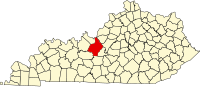 | |
| CDPs | ||
| Other unincorporated communities | ||
| Footnotes | ‡This populated place also has portions in an adjacent county or counties | |