| Avon Bottoms Wildlife Area | |
|---|---|
IUCN category V (protected landscape/seascape) | |
 Avon Bottoms State Natural Area | |
| Location | Rock County, Wisconsin |
| Nearest city | Brodhead, Wisconsin |
| Coordinates | 42°33′04″N 89°21′30″W / 42.551109°N 89.358304°W |
| Area | 3,402 acres (13.77 km2) |
| Established | 1960 |
| Governing body | Wisconsin Department of Natural Resources |
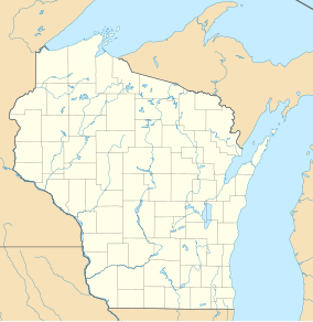
The Avon Bottoms Wildlife Area is a tract of protected land located on the border of Illinois in Rock County, Wisconsin, managed by the Wisconsin Department of Natural Resources (WDNR).[1]
History[edit]
The Avon Bottoms Wildlife area was established in 1960 as part of a federal wildlife restoration project, specifically to improve duck and pheasant populations in the area to attract hunters.[2]
The area was established with the intention to improve and preserve wildlife and habitat diversity along the Sugar River, a popular destination for kayakers, canoers, and tubers.[3][4] The preservation of the area has led to the Wisconsin Wetlands Association to declare the floodplain forest a "wetland gem".[5]
The Natural Resources Conservation Service, an agency of the United States Department of Agriculture restored wetlands and grasslands in the area, with 3,100 such acres working as easements directly adjacent to the wildlife area.
Land cover[edit]
The main feature of the wildlife area is the bottomland hardwood forest, making up over one third of the total area. There are also many notable examples of large swamp white oak trees in the floodplain areas, mainly in the Avon Bottoms natural area sector. The 1986 WDNR master plan for the Wildlife Area states that some of these trees are near record size, and important to the biodiversity and the environment.[6]
| Cover type | Acres | Percentage cover |
|---|---|---|
| Agriculture | 200 | 6% |
| Bottomland hardwood | 1,440 | 42% |
| Developed | 10 | <1% |
| Grassland | 410 | 12% |
| Lowland shrub | 200 | 6% |
| Non-forested wetlands | 380 | 11% |
| Oak | 70 | 2% |
| Prairie | 340 | 10% |
| Upland conifer | 85 | 2% |
| Upland hardwood | 30 | 1% |
| Water | 237 | 7% |
| Total acreage | 3,402 | 100% |
State natural areas[edit]

The Avon Bottoms State Natural Area is a unit of the larger wildlife area, and comprises 1,649 acres (667 ha) of mostly floodplain forest.[8][9]
In 2016, the State Natural Area Swenson Wet Prairie, designated in 1968, coalesced into the existing Avon Bottoms State Natural Area.[10]
References[edit]
- ^ WDNR Avon Bottoms WFA Website- Retrieved February 6, 2023
- ^ WDNR Sugar River Planning Group Final Master Plan and Footville Wildlife Area Feasibility Study p. 71- Retrieved February 24, 2023
- ^ "Sugar River". travelwisconsin.com. Retrieved February 24, 2023.
- ^ National Rivers Project Website- Retrieved February 6, 2023
- ^ Audubon website- Retrieved February 6, 2023
- ^ WDNR Avon Bottoms Wildlife Area Master Plan 1986- Retrieved February 6, 2023
- ^ WDNR Sugar River Planning Group Final Master Plan and Footville Wildlife Area Feasibility Study p. 72- Retrieved August 24, 2022
- ^ WDNR Avon Bottoms SNA Website- Retrieved February 6, 2023
- ^ Lower Sugar River Watershed Association Open Letter- Retrieved February 25, 2023
- ^ WDNR Swenson Wet Prairie SNA Website- Retrieved February 24, 2023
External links[edit]
- U.S. Geological Survey Map at the U.S. Geological Survey Map Website. Retrieved February 25, 2023.

