Size of this preview: 797 × 600 pixels. Other resolutions: 319 × 240 pixels | 638 × 480 pixels | 1,021 × 768 pixels | 1,280 × 963 pixels | 2,292 × 1,725 pixels.
Original file (2,292 × 1,725 pixels, file size: 733 KB, MIME type: image/jpeg)
Summary
|
This is an image of a place or building that is listed on the National Register of Historic Places in the United States of America. Its reference number is 66000130. |
| Description |
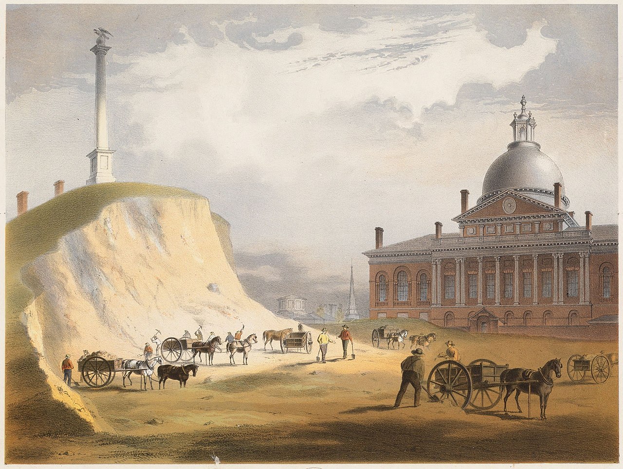
Beacon Hill, from the present site of the reservoir between Hancock & Temple Sts. العربية: حي بيكون هيل في بوسطن عام 1811، مشهد من الشمال مقابل مجلس ولاية ماساتشوستس. |
||||||||||||||||||||
| Date | |||||||||||||||||||||
| Source | [1] | ||||||||||||||||||||
| Author |
|
||||||||||||||||||||

| Object location | | View this and other nearby images on: OpenStreetMap |
|---|
Licensing
This file is licensed under the Creative Commons Attribution-Share Alike 2.5 Generic license.
- You are free:
- to share – to copy, distribute and transmit the work
- to remix – to adapt the work
- Under the following conditions:
- attribution – You must give appropriate credit, provide a link to the license, and indicate if changes were made. You may do so in any reasonable manner, but not in any way that suggests the licensor endorses you or your use.
- share alike – If you remix, transform, or build upon the material, you must distribute your contributions under the same or compatible license as the original.
Original upload log
The original description page was here. All following user names refer to en.wikipedia.
- 2006-02-15 20:44 Flux.books 719×531×8 (83570 bytes) Cutting down Beacon Hill, c. 1800. Edited version of image from http://ocw.mit.edu/OcwWeb/Urban-Studies-and-Planning/11-001JFall2001/LectureNotes/detail/lec2.htm - MIT Open Courseware Terms of Use: http://ocw.mit.edu/OcwWeb/Global/terms-of-use.htm
File history
Click on a date/time to view the file as it appeared at that time.
| Date/Time | Thumbnail | Dimensions | User | Comment | |
|---|---|---|---|---|---|
| current | 00:08, 12 November 2020 | 2,292 × 1,725 (733 KB) | Filetime | Better version | |
| 18:23, 9 January 2017 | 640 × 480 (84 KB) | Franzy89 | Better version | ||
| 11:16, 2 July 2007 | 719 × 531 (82 KB) | Liftarn | {{Information |Description=Cutting down Beacon Hill, c. 1800. Edited version of image from http://ocw.mit.edu/OcwWeb/Urban-Studies-and-Planning/11-001JFall2001/LectureNotes/detail/lec2.htm - MIT Open Courseware Terms of Use: http://ocw.mit.edu/OcwWeb/Gl |
File usage
The following pages on the English Wikipedia use this file (pages on other projects are not listed):
Global file usage
The following other wikis use this file:
- Usage on ar.wikipedia.org
- Usage on de.wikipedia.org
- Usage on fr.wikipedia.org
- Usage on hy.wikipedia.org
- Usage on hyw.wikipedia.org
- Usage on ru.wikipedia.org