
Size of this preview: 800 × 533 pixels. Other resolutions: 320 × 213 pixels | 640 × 426 pixels | 1,024 × 682 pixels | 1,280 × 852 pixels | 2,560 × 1,704 pixels | 3,088 × 2,056 pixels.
Original file (3,088 × 2,056 pixels, file size: 2.53 MB, MIME type: image/jpeg)
Summary
| Description |
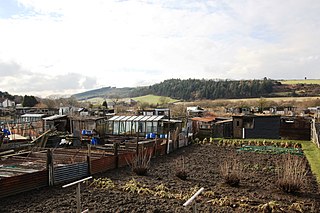
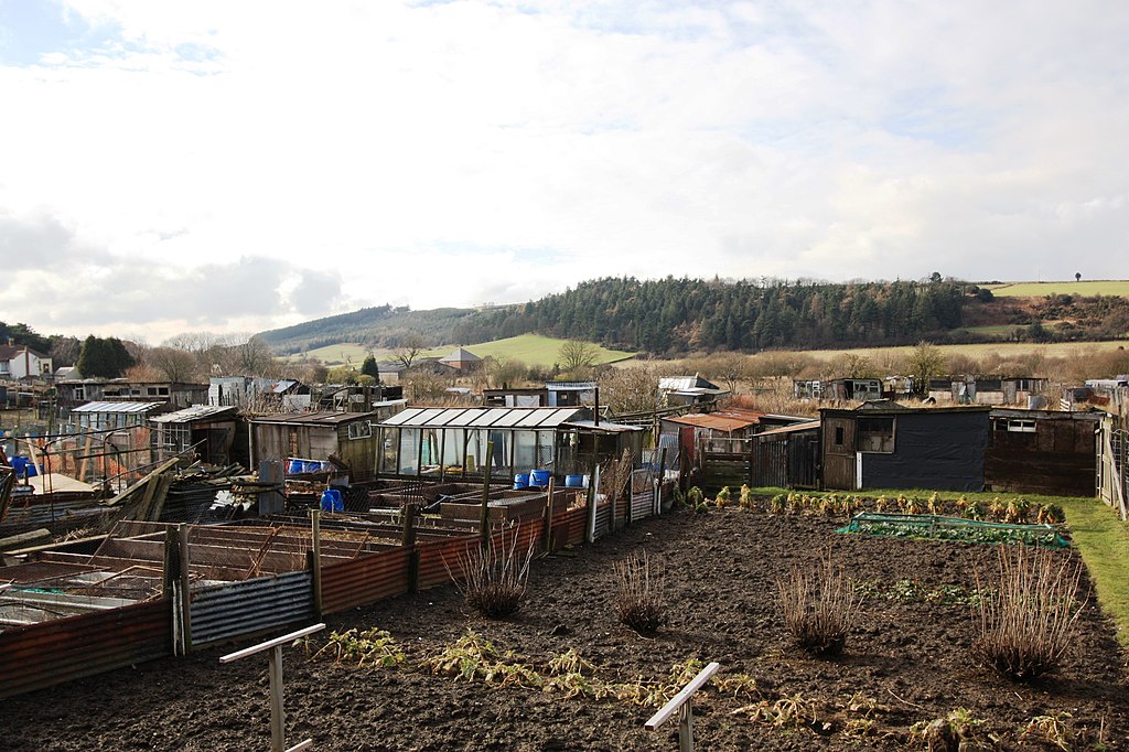
English: Allotment gardens near Boosbeck This photograph shows a view of the allotment gardens near Boosbeck. Combe Bank Farm can just be seen below the green field (left of centre). A part of the route of the Cleveland Street footpath can also be seen. The picture was taken from the Margrove Park road looking in a west-north-westerly direction towards Hutton Wood. |
| Date | |
| Source | From geograph.org.uk |
| Author | Philip Barker |
| Attribution (required by the license) | Philip Barker / Allotment gardens near Boosbeck / |
| Camera location | | View this and other nearby images on: OpenStreetMap |
|---|
_heading:270.00&language=en)
| Object location | | View this and other nearby images on: OpenStreetMap |
|---|
_heading:270.00&language=en)
Licensing

|
This image was taken from the Geograph project collection. See this photograph's page on the Geograph website for the photographer's contact details. The copyright on this image is owned by Philip Barker and is licensed for reuse under the Creative Commons Attribution-ShareAlike 2.0 license.
|
This file is licensed under the Creative Commons Attribution-Share Alike 2.0 Generic license.
Attribution: Philip Barker
- You are free:
- to share – to copy, distribute and transmit the work
- to remix – to adapt the work
- Under the following conditions:
- attribution – You must give appropriate credit, provide a link to the license, and indicate if changes were made. You may do so in any reasonable manner, but not in any way that suggests the licensor endorses you or your use.
- share alike – If you remix, transform, or build upon the material, you must distribute your contributions under the same or compatible license as the original.
File history
Click on a date/time to view the file as it appeared at that time.
| Date/Time | Thumbnail | Dimensions | User | Comment | |
|---|---|---|---|---|---|
| current | 10:58, 5 March 2011 | | 3,088 × 2,056 (2.53 MB) | GeographBot | == {{int:filedesc}} == {{Information |description={{en|1=Allotment gardens near Boosbeck This photograph shows a view of the allotment gardens near Boosbeck. Combe Bank Farm can just be seen below the green field (left of centre). A part of the route of t |
File usage
The following pages on the English Wikipedia use this file (pages on other projects are not listed):