Füzesabony District
Füzesabonyi járás | |
|---|---|
 Coat of arms | |
 Füzesabony District within Hungary and Heves County. | |
| Country | |
| County | Heves |
| District seat | Füzesabony |
| Area | |
| • Total | 578.55 km2 (223.38 sq mi) |
| • Rank | 4th in Heves |
| Population (2011 census) | |
| • Total | 30,416 |
| • Rank | 5th in Heves |
| • Density | 53/km2 (140/sq mi) |
Füzesabony (Hungarian: Füzesabonyi járás) is a district in south-eastern part of Heves County. Füzesabony is also the name of the town where the district seat is found. The district is located in the Northern Hungary Statistical Region.
Geography
[edit]Füzesabony District borders with Eger District to the north, Mezőkövesd District (Borsod-Abaúj-Zemplén County) and Tiszafüred District (Jász-Nagykun-Szolnok County) to the east, Heves District to the southwest, Gyöngyös District to the west. The number of the inhabited places in Füzesabony District is 16.
Municipalities
[edit]The district has 1 town, 1 large village and 14 villages. (ordered by population, as of 1 January 2012)[1]
- Aldebrő (649)
- Besenyőtelek (2,569)
- Dormánd (1,040)
- Egerfarmos (675)
- Füzesabony (7,781) – district seat
- Kál (3,501)
- Kápolna (1,575)
- Kompolt (2,098)
- Mezőszemere (1,232)
- Mezőtárkány (1,575)
- Nagyút (660)
- Poroszló (2,715)
- Sarud (1,126)
- Szihalom (1,938)
- Tófalu (526)
- Újlőrincfalva (250)
The bolded municipality is city, italics municipality is large village.
Demographics
[edit]Religion in Füzesabony District (2011 census)
In 2011, it had a population of 30,416 and the population density was 53/km2.
| Year | County population[2] | Change |
|---|---|---|
| 2011 | 30,416 | n/a |
Ethnicity
[edit]Besides the Hungarian majority, the main minorities are the Roma (approx. 3,000), German (250) and Romanian (100).
Total population (2011 census): 30,416
Ethnic groups (2011 census):[3] Identified themselves: 29,126 persons:
- Hungarians: 25,815 (88.63%)
- Gypsies: 2,775 (9.53%)
- Others and indefinable: 536 (1.84%)
Approx. 1,500 persons in Füzesabony District did not declare their ethnic group at the 2011 census.
Religion
[edit]Religious adherence in the county according to 2011 census:[4]
- Catholic – 15,809 (Roman Catholic – 15,694; Greek Catholic – 113);
- Reformed – 1,539;
- Evangelical – 45;
- other religions – 611;
- Non-religious – 3,711;
- Atheism – 185;
- Undeclared – 8,516.
Gallery
[edit]-
 Füzesabony, Pusztaszikszó Chapel
 -
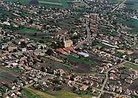 Aerial view of Besenyőtelek
 -
 Lake Tisza EcoCentrum in Poroszló
 -
 St. Peter and Paul Church in Kál


See also
[edit]References
[edit]- ^ A KSH 2012. évi helységnévkönyve
- ^ népesség.com, "Füzesabonyi járás népessége"
- ^ 4.1.6.1 A népesség nemzetiség szerint, 2011, (in Hungarian) [1]
- ^ 4.1.7.1 A népesség vallás, felekezet szerint, 2011, (in Hungarian) [2]
External links
[edit]| Town (1) |
| |
|---|---|---|
| Large village (1) | ||
| Villages (14) | ||
47°43′00″N 20°28′00″E / 47.7167°N 20.4667°E