Loon op Zand | |
|---|---|
 Windmill in Kaatsheuvel | |
 Flag  Coat of arms | |
 Location in North Brabant | |
| Coordinates: 51°40′N 5°2′E / 51.667°N 5.033°E | |
| Country | Netherlands |
| Province | North Brabant |
| Government | |
| • Body | Municipal council |
| • Mayor | Hanne van Aart (VVD) |
| Area | |
| • Total | 50.71 km2 (19.58 sq mi) |
| • Land | 49.94 km2 (19.28 sq mi) |
| • Water | 0.77 km2 (0.30 sq mi) |
| Elevation | 5 m (16 ft) |
| Population (January 2021)[4] | |
| • Total | 23,504 |
| • Density | 471/km2 (1,220/sq mi) |
| Time zone | UTC+1 (CET) |
| • Summer (DST) | UTC+2 (CEST) |
| Postcode | 5170–5176 |
| Area code | 013, 0416 |
| Website | www |

Loon op Zand (Dutch pronunciation: [ˈloːn ɔp ˈsɑnt] ⓘ)[a] is a municipality and a village in the southern Netherlands. It had a population of 23,504 in 2021.
The western part of national park the Loonse en Drunense Duinen is located in the municipality of Loon op Zand.
Population centres[edit]
- De Moer
- Heikant
- Kaatsheuvel
- Loon op Zand
Topography[edit]

Dutch Topographic map of the municipality of Loon op Zand, June 2015.
Kaatsheuvel[edit]
Kaatsheuvel is the location of the amusement park Efteling.
Loon op Zand[edit]

Loon op Zand is the oldest village of the municipality. Somewhere around the year 1000, this village was founded in a very wet and swampy area. There was also a lot of drift-sand whose origin, according to geological experts, dates back to the last ice age. As of this moment, Loon op Zand has the biggest driftsand area in all of western Europe. Historically, the presence of this driftsand has caused the relocation of the village on several times. Hinerland farmers build many sandy embankments or levies to protect their land against the ceaseless drifting sand.
The presence of this driftsand explains the name of Loon op Zand. Before 1391, a village called 'Venloon' was situated just a few hundred metres to the north-east of the current village of Loon op Zand. After the villagers relocated in 1391, they called their new village 'Venloon op 't Zant' (Venloon on the Sand), which over the years changed to 'Loon op Zand'.[5]
For 200 years, Loon op Zand and Kaatsheuvel were the centre of the leather tanning and shoe manufacturing industry of the region. There were a lot of factories; most of these were in people's backyards. There were some big shoe manufacturers, such as Van Lier. This world-famous shoe brand originated in Loon op Zand. Just prior to the new millennium, Van Lier abandoned their factory in Loon op Zand and moved to a bigger factory in Breda.
Notable people[edit]

- Paul Litjens (born 1947 in Loon op Zand) a former field hockey player
- Ton Masseurs (born 1947 in Kaatsheuvel) a Dutch pedal steel guitar player
- Ben Knapen (born 1951 in Kaatsheuvel) a Dutch politician, the CDA parliamentary leader in the Senate
- Mark van Loosdrecht (born 1959 in Loon op Zand) an academic and inventor of Nereda, a wastewater treatment technology
- Ilse Broeders (born 1977 in Loon op Zand) a Dutch bobsledder, competed in the 2002 and 2006 Winter Olympics
- Jacqueline Govaert (born 1982 in Kaatsheuvel) a Dutch singer, songwriter, and pianist[6]
Gallery[edit]
-

-

-
 Kaatsheuvel - Raadhuisstraat
 -
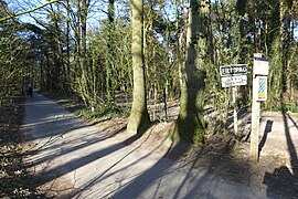 Fietspad


Notes[edit]
References[edit]
- ^ "Burgemeester dhr. W.C. Luijendijk" (in Dutch). Gemeente Loon op Zand. Archived from the original on 30 May 2014. Retrieved 29 May 2014.
- ^ "Kerncijfers wijken en buurten 2020" [Key figures for neighbourhoods 2020]. StatLine (in Dutch). CBS. 24 July 2020. Retrieved 19 September 2020.
- ^ "Postcodetool for 5171EJ". Actueel Hoogtebestand Nederland (in Dutch). Het Waterschapshuis. Archived from the original on 21 September 2013. Retrieved 29 May 2014.
- ^ "Bevolkingsontwikkeling; regio per maand" [Population growth; regions per month]. CBS Statline (in Dutch). CBS. 1 January 2021. Retrieved 2 January 2022.
- ^ https://www.brabantserfgoed.nl/page/11359/venloon-en-het-oprukkende-stuifzand
- ^ IMDb Database retrieved 26 November 2019
External links[edit]
- Official website
 (in Dutch)

| Authority control databases: Geographic |
|---|