
Size of this preview: 776 × 600 pixels. Other resolutions: 311 × 240 pixels | 621 × 480 pixels | 994 × 768 pixels | 1,280 × 989 pixels | 2,122 × 1,640 pixels.
Original file (2,122 × 1,640 pixels, file size: 1.28 MB, MIME type: image/png)
Summary
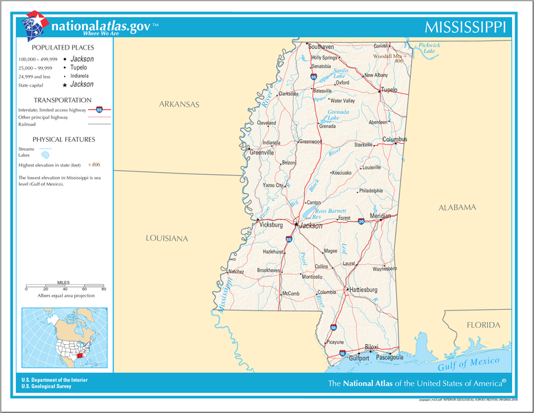
| Description | Map of Mississippi |
| Source | National Atlas |
| Author | U.S. federal government |
Licensing
This map was obtained from an edition of the National Atlas of the United States. Like almost all works of the U.S. federal government, works from the National Atlas are in the public domain in the United States.
Online access: NationalAtlas.gov | 1970 print edition: Library of Congress, Perry-Castañeda Library
|
File history
Click on a date/time to view the file as it appeared at that time.
| Date/Time | Thumbnail | Dimensions | User | Comment | |
|---|---|---|---|---|---|
| current | 21:17, 14 August 2006 | | 2,122 × 1,640 (1.28 MB) | Huebi~commonswiki | {{Information| |Description=Map of Mississippi |Source=[http://www.nationalatlas.gov National Atlas] }} Category:Maps of the United States Category:Maps of Mississippi {{PD-USGov-Atlas}} |
File usage
The following pages on the English Wikipedia use this file (pages on other projects are not listed):
Global file usage
The following other wikis use this file:
- Usage on arz.wikipedia.org
- Usage on bg.wikipedia.org
- Usage on de.wikipedia.org
- Usage on el.wikipedia.org
- Usage on fi.wikipedia.org
- Usage on fr.wikipedia.org
- Usage on hr.wiktionary.org
- Usage on hu.wikipedia.org
- Usage on incubator.wikimedia.org
- Usage on io.wikipedia.org
- Usage on it.wikipedia.org
- Usage on ja.wikipedia.org
- Usage on lt.wikipedia.org
- Usage on mr.wikipedia.org
- Usage on nl.wikipedia.org
- Usage on pl.wikipedia.org
- Usage on sw.wikipedia.org
- Usage on szl.wikipedia.org
- Usage on zea.wikipedia.org