Size of this preview: 800 × 544 pixels. Other resolutions: 320 × 218 pixels | 640 × 435 pixels | 1,024 × 696 pixels | 1,280 × 870 pixels | 2,748 × 1,868 pixels.
Original file (2,748 × 1,868 pixels, file size: 665 KB, MIME type: image/jpeg)
Summary
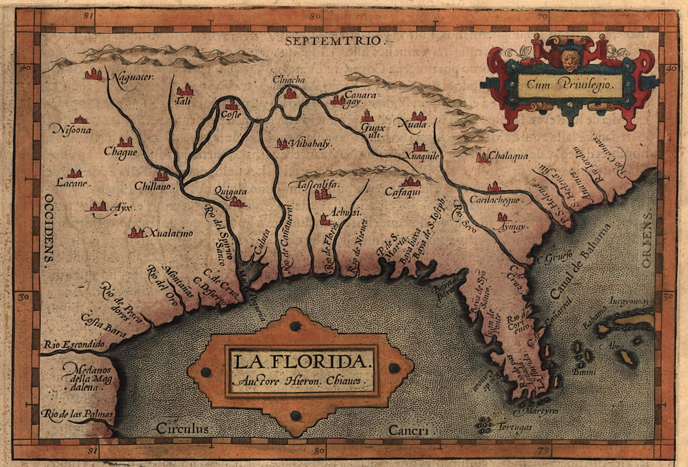
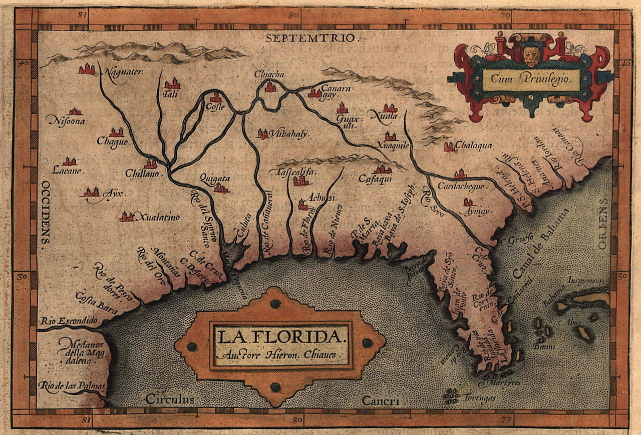
| Description | Map of the Spanish province of "La Florida," which included most of the southeastern United States. The map was drawn by Spanish royal cartographer Geronimo Chiaves, and was probably based on accounts by members of the Hernando De Soto expedition (1539-1543). The map was originally published in Abraham Ortelius' Theatrum Orbis Terrarum in 1584. |
| Date | |
| Source | https://www.loc.gov/exhibits/earlyamericas/online/aftermath/aftermath2.html |
| Author | Geronimo Chiaves, Abraham Ortelius |
Licensing
|
This work is in the public domain in its country of origin and other countries and areas where the copyright term is the author's life plus 100 years or fewer. | |
| This file has been identified as being free of known restrictions under copyright law, including all related and neighboring rights. | |
File history
Click on a date/time to view the file as it appeared at that time.
| Date/Time | Thumbnail | Dimensions | User | Comment | |
|---|---|---|---|---|---|
| current | 20:14, 24 April 2008 | | 2,748 × 1,868 (665 KB) | BrineStans | {{Information |Description=Map of the Spanish province of "La Florida," which included most of the southeastern United States. The map was drawn by Spanish royal cartographer Geronimo Chiaves, and was probably based on accounts by members of the Hernando |
File usage
The following pages on the English Wikipedia use this file (pages on other projects are not listed):
Global file usage
The following other wikis use this file:
- Usage on arz.wikipedia.org
- Usage on ceb.wikipedia.org
- Usage on id.wikipedia.org