| Barkly Tableland Northern Territory | |||||||||||||||
|---|---|---|---|---|---|---|---|---|---|---|---|---|---|---|---|
 Mitchell grass plains representing the Barkly Tableland proper | |||||||||||||||
| Population | 6,330 (2007)[1] | ||||||||||||||
| • Density | 0.0198/km2 (0.0512/sq mi) | ||||||||||||||
| Area | 320,000 km2 (123,552.7 sq mi) | ||||||||||||||
| Territory electorate(s) | Barkly | ||||||||||||||
| Federal division(s) | Lingiari | ||||||||||||||
| |||||||||||||||
The Barkly Tableland is a region in the Central East if the Northern Territory, extending into Western Queensland. The region was named after Sir Henry Barkly. The epithet “Tableland” is inaccurate, since the region is neither elevated relative to adjacent landforms, nor are the boundaries marked by a distinct change in elevation [2][3]
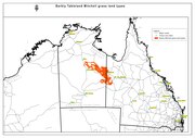
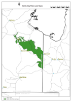
The Barkly Tableland is a poorly defined region. The name Barkly Tableland properly applies only to the areas of largely treeless, cracking-clay soils supporting grasslands dominated by Mitchell Grass (Astrebla spp.) [4][5] A variety of terms such as “Barkly Tablelands Region, or “Barkly Region” have come into common use, referring to various circumscriptions of the region. All include portions of the Barkly Tablelands proper, along with varying adjoining landforms and vegetation types.
Varying Barkly regions encompass:
An area from Dunmarra south to Barrow Creek, and from the Tanami desert to the Queensland border.[6][7]
The Barkly Tableland proper, the associated Gulf Country, the upper Georgina River basin, and portions of the inland desert country.[8]
From the McArthur River in the north, parallel approximately 100 miles inland from the west coast of the Gulf of Carpentaria to the Queensland border in the east.[9]
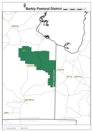
The Barkly Shire local government area[10]
Barkly locality in Queensland.
Various regions defined by Northern Territory and Australian Commonwealth government departments.[11][12][13][14][15]
In addition, there exists a Barkly Tablelands IBRA subregion which conforms approximately with parts of the Barkly Tablelands proper.[16]

History[edit]


William Landsborough was the first non-Indigenous Australian person to explore the tableland, and named it after Sir Henry Barkly, then governor of Victoria.
In 1877 the overlander, Nathaniel Buchanan and Sam Croker crossed the Barkly Tableland and rode on to the Overland Telegraph Line opening new land for settlement. It was not until the introduction of generous leasing arrangements on the Barkly in the late 1870s that the region became more settled.[17]
In 1883, Harry Readford, one of the inspirations for the literary character Captain Starlight, drove a mob of cattle to the Barkly and subsequently established Brunette Downs (then called Corella Creek), with outstations at Anthony Lagoon and Cresswell Creek, for Macdonald, Smith and Co. In 1884, 2,500 cattle were driven to Brunette Downs and in 1885, Readford brought in 1,200 mixed cattle from Burketown.
Geography[edit]


Black soil plains cover much of the Barkly Tableland.[18] Rainfall in this inland area is low (350mm per year) and subject to extreme seasonal fluctuations with rains occurring from November to March during the hot (up to 40 °C) summer. Winters are cool and frost may occur, especially in the southern section of the plain in Queensland.
The Barkly Tableland is a distinct physiographic province of the larger West Australian Shield division. It includes the Mueller Plateau and Sandover-Pituri Platform physiographic sections between the desert uplands in the west and Mount Isa, Queensland in the east. The Tableland drains into the Gulf of Carpentaria via the Flinders River while the southwestern plains drain into Lake Eyre via the Diamantina River or into the Simpson Desert via the Georgina River which has its source on the Tableland. Waterways of the Tableland itself are small as most water drains into the porous limestone, sometimes forming salt lakes. Tarrabool Lake, the largest wooded swamp in tropical Australia, is located in the west of the Tablelands. Other important water sources on the downs are the artesian springs.
Some of the very large cattle stations located on the Tableland include Alexandria Station, Alroy Downs, Anthony Lagoon, Austral Downs, Avon Downs, Banka Banka, Brunette Downs, Creswell Downs, Eva Downs, Helen Springs, Newcastle Waters and Lake Nash Station.
Ecology[edit]
The dominant flora of the Tableland is semi-arid savanna of Mitchell grass. The grasslands are mostly used for cattle grazing and are home to some threatened species of plants and animals.
Flora[edit]
Mitchell grass is hardy with long roots so is well adapted to dry soils and periods of drought. The grasslands support other distinctive plants alongside the grasses but there are no areas of thick woodland, only acacia trees scattered across the plain, and red river gum along watercourses.[19]
Fauna[edit]
The habitat of the Mitchell Grass Downs is mostly a uniform cover of grassland and therefore does not support a great variety of wildlife.[20] The few mammals include the brushtail possum (Trichosurus vulpecula) and the Alexandria false antechinus (Pseudantechinus mimulus), a small carnivorous marsupial found only in a number of small, isolated localities in northern Australia, including Alexandria Station on the Barkly Tableland.
There are healthy populations of grassland birds such as the flock bronzewing. The seasonal wetlands of the downs are important habitats, particularly as breeding grounds for waterbirds. These include the Lake Woods and Lake Buchanan .
There are also many snakes and other reptiles and amphibians adapted to the clay soils that crack in the long dry season and turn to mud after the rains. These include burrowing frogs that emerge to breed in the mud and the long-haired rat which erupts in huge numbers after the monsoon and spreads across the grasslands. Endemic reptiles of the downs include the dwarf dtella gecko (Gehyra minuta), some species of Ctenotus and Lerista skinks, an agamid lizard (Pogona henrylawsoni), and a monitor lizard (Spencer's goanna). The snakes include the Elapidae; speckled brown snake (Pseudonaja guttata), Ingram's brown snake (Pseudonaja ingrami), and Collett's snake, all of which are venomous. Insects include a number of endemic species of ant.
Threats and preservation[edit]
Some of the grassland is protected but most is pasture and although largely unspoilt, it is vulnerable to overgrazing, particularly areas of Queensland bluebush (Chenopodium auricomum). The downs are home to a number of endangered species and localised habitats that are threatened.
Protected areas that contain Mitchell grassland include Connells Lagoon Conservation Reserve[21] in the Northern Territory.
References[edit]
- ^ Australian Bureau of Statistics (2 October 2008). "Australian Demographic Statistics" (PDF). Archived (PDF) from the original on 7 February 2009. Retrieved 24 June 2008.
- ^ F. W. WHITEHOUSE (1940) “Studies in the Late Geological History of Queensland 3. 'THE EVOLUTION OF THE BARKLY TABLELAND”. UNIVERSITY OF QUEENSLAND DEPARTMENT OF GEOLOGY Series 2:1
- ^ C.J. Edgoose & K.T. Winstanley. (2014) “LANDSCAPE EVOLUTION ON THE BARKLY TABLELAND” PROCEEDINGS OF THE AUSTRALIAN RANGELAND SOCIETY BIENNIAL CONFERENCE
- ^ C.J. Edgoose & K.T. Winstanley. (2014) “LANDSCAPE EVOLUTION ON THE BARKLY TABLELAND” PROCEEDINGS OF THE AUSTRALIAN RANGELAND SOCIETY BIENNIAL CONFERENCE
- ^ Jenny Purdie, Chris Materne, Andrew Bubb (2008) “A field guide to the plants of the Barkly Region, Northern Territory”)
- ^ Jenny Purdie, Chris Materne, Andrew Bubb (2008) “A field guide to the plants of the Barkly Region, Northern Territory”)
- ^ Collier, C. 2014. The 2010 Pastoral Industry Survey - Barkly Region. Northern Territory Government, Australia.
- ^ C. S. CHRISTIAN (1954) PART I. “INTRODUCTION TO SURVEY OF THE BARKLY REGION” in “Survey of the Barkly Region, Northern Territory and Queensland, 1947-48 Land Research Series No. 3”. CSIRO)
- ^ Warren M. Elofson SO FAR AND YET SO CLOSE: FRONTIER CATTLE RANCHING IN WESTERN PRAIRIE CANADA AND THE NORTHERN TERRITORY OF AUSTRALIA. University of Calgary Press
- ^ Tollner, David William (18 December 2013). "Local Government Act changes to local government areas and councils" (PDF). Northern Territory Government Gazette. Northern Territory Government. p. 3. Retrieved 26 April 2019.
with effect from 1 January 2014:
- ^ PHN Northern Territory (2020) Barkly Region DATA REPORT. Northern Territory Government
- ^ Department of the Chief Minister and Cabinet (2023) Barkly, retrieved October 2023
- ^ Northern Territory Government. (2023) Barkly Regional fact sheet https://budget.nt.gov.au/__data/assets/pdf_file/0020/1224092/barkly.pdf retrieved October 2023
- ^ Caroline Pettit (2013) Barkly District Land Condition Guide. Northern Territory Government”
- ^ Pastoral Land Board (2022) “ANNUAL REPORT 2022” Northern Territory Pastoral Land Board
- ^ Australian Government Department of Agriculture, Water and the Environment (2012) Interim Biogeographic Regionalisation for Australia, Version 7. Commonwealth of Australia
- ^ "Chisholm, Alec H.". The Australian Encyclopaedia. Sydney: Halstead Press. 1963.
- ^ Surface geology of Australia Archived July 30, 2008, at the Wayback Machine Retrieved on 2 September 2008
- ^ "Mitchell Grass Downs". Terrestrial Ecoregions. World Wildlife Fund.
- ^ "Mitchell Grass Downs". Terrestrial Ecoregions. World Wildlife Fund.
- ^ "Terrestrial Protected Areas by Reserve Type in Northern Territory (2016)". CAPAD 2016. Australian government. Archived from the original on 9 April 2018. Retrieved 26 April 2019.
refer 'DETAIL' tab for the IBRA Region code
External links[edit]
- Barkly Tablelands info
- "Barkly Tableland". Queensland Places. Centre for the Government of Queensland, University of Queensland.
| Topics | ||
|---|---|---|
| Regions | ||
| Major settlements | ||