
This is a list of the National Register of Historic Places listings in Williamsburg County, South Carolina.
This is intended to be a complete list of the properties and districts on the National Register of Historic Places in Williamsburg County, South Carolina, United States. The locations of National Register properties and districts for which the latitude and longitude coordinates are included below, may be seen in a map.[1]
There are 12 properties and districts listed on the National Register in the county. Another 2 properties and districts were once listed but have been removed.
This National Park Service list is complete through NPS recent listings posted April 12, 2024.[2]
Current listings[edit]


Former listings[edit]
| [3] | Name on the Register | Image | Date listed | Date removed | Location | City or town | Description |
|---|---|---|---|---|---|---|---|
| 1 | Black Mingo Baptist Church |  |
August 21, 1980 (#80003713) | March 15, 2000 | Rhems vicinity | Destroyed by arsonists on August 1, 1993.[7][8] | |
| 2 | Brockinton-Scott House | January 22, 1980 (#80003712) | December 12, 1989 | 221 West Railroad Avenue | Kingstree | Demolished[9] |
See also[edit]
- List of National Historic Landmarks in South Carolina
- National Register of Historic Places listings in South Carolina
References[edit]
- ^ The latitude and longitude information provided in this table was derived originally from the National Register Information System, which has been found to be fairly accurate for about 99% of listings. Some locations in this table may have been corrected to current GPS standards.
- ^ National Park Service, United States Department of the Interior, "National Register of Historic Places: Weekly List Actions", retrieved April 12, 2024.
- ^ a b Numbers represent an alphabetical ordering by significant words. Various colorings, defined here, differentiate National Historic Landmarks and historic districts from other NRHP buildings, structures, sites or objects.
- ^ "National Register Information System". National Register of Historic Places. National Park Service. March 13, 2009.
- ^ The eight-digit number below each date is the number assigned to each location in the National Register Information System database, which can be viewed by clicking the number.
- ^ Suzanne Pickens Wiley, John Wells, and Edmund Kirby-Smith. "National Register of Historic Places Inventory—Nomination Form: John Calvin Wilson House". South Carolina Department of Archives and History. Retrieved 2013-01-26.
- ^ "Built to glory of God, church lies in ruin". The State. August 3, 1993. p. B1. Retrieved August 24, 2022 – via Newspapers.com.
- ^ "SCDAH".
- ^ "SCDAH".
| Topics |  | |
|---|---|---|
| Lists by county |
| |
| Lists by city | ||
| Other lists | ||
Municipalities and communities of Williamsburg County, South Carolina, United States | ||
|---|---|---|
| Towns | 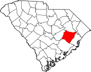 | |
| Unincorporated communities | ||
| Footnotes | ‡This populated place also has portions in an adjacent county or counties | |