No higher resolution available.
The_Herb_Garden_-_geograph.org.uk_-_1629279.jpg (640 × 480 pixels, file size: 132 KB, MIME type: image/jpeg)
Summary
| Description |
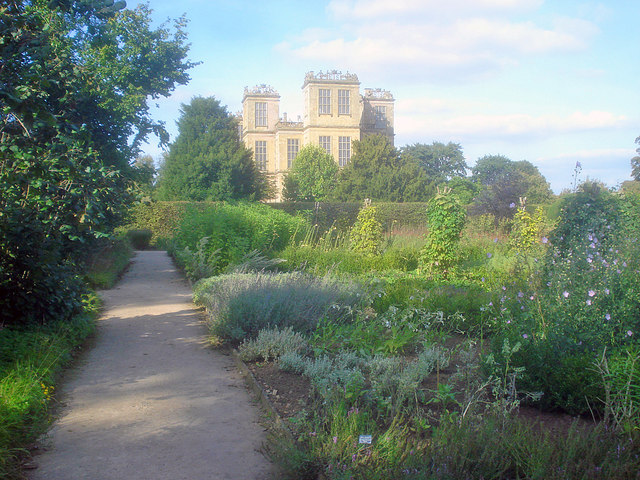
English: The Herb Garden Originally planted in the 1870s by Lady Louisa Egerton, this garden was recreated in the late 1960s by the National Trust, largely following the original design. At the back of this section is the Hornbeam Alley, which divides the garden into rooms. The herb garden is one of the largest in the country, containing over 150 different herbs. |
| Date | |
| Source | From geograph.org.uk |
| Author | Trevor Rickard |
| Attribution (required by the license) | Trevor Rickard / The Herb Garden / |
| Camera location | | View this and other nearby images on: OpenStreetMap |
|---|
_heading:22.00&language=en)
| Object location | | View this and other nearby images on: OpenStreetMap |
|---|
_heading:22.00&language=en)
Licensing

|
This image was taken from the Geograph project collection. See this photograph's page on the Geograph website for the photographer's contact details. The copyright on this image is owned by Trevor Rickard and is licensed for reuse under the Creative Commons Attribution-ShareAlike 2.0 license.
|
This file is licensed under the Creative Commons Attribution-Share Alike 2.0 Generic license.
Attribution: Trevor Rickard
- You are free:
- to share – to copy, distribute and transmit the work
- to remix – to adapt the work
- Under the following conditions:
- attribution – You must give appropriate credit, provide a link to the license, and indicate if changes were made. You may do so in any reasonable manner, but not in any way that suggests the licensor endorses you or your use.
- share alike – If you remix, transform, or build upon the material, you must distribute your contributions under the same or compatible license as the original.
File history
Click on a date/time to view the file as it appeared at that time.
| Date/Time | Thumbnail | Dimensions | User | Comment | |
|---|---|---|---|---|---|
| current | 14:31, 4 March 2011 | | 640 × 480 (132 KB) | GeographBot | == {{int:filedesc}} == {{Information |description={{en|1=The Herb Garden Originally planted in the 1870s by Lady Louisa Egerton, this garden was recreated in the late 1960s by the National Trust, largely following the original design. At the back of this |
File usage
The following pages on the English Wikipedia use this file (pages on other projects are not listed):
Global file usage
The following other wikis use this file:
- Usage on hy.wikipedia.org
- Usage on pnb.wikipedia.org
- Usage on pt.wikipedia.org
- Usage on uk.wikipedia.org
- Usage on vi.wikipedia.org