Size of this preview: 568 × 600 pixels. Other resolutions: 227 × 240 pixels | 455 × 480 pixels | 897 × 947 pixels.
Original file (897 × 947 pixels, file size: 1.2 MB, MIME type: image/png)
| Description |
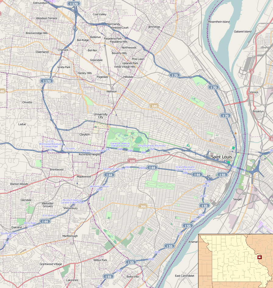
English: Map of St. Louis for pin
Geographic limits of the map:
This file is licensed under the Creative Commons Attribution-Share Alike 2.0 Generic license.
|
| Date | |
| Source | OpenStreetMap. Insert is File:Missouri Locator Map.PNG |
| Author | Dr. Blofeld. Insert by Ruhrfish |
File history
Click on a date/time to view the file as it appeared at that time.
| Date/Time | Thumbnail | Dimensions | User | Comment | |
|---|---|---|---|---|---|
| current | 00:11, 26 March 2011 | | 897 × 947 (1.2 MB) | Blofeld Dr. | {{Information |Description ={{en|1=t}} |Source =t |Author =t |Date =t |Permission = |other_versions = }} |
File usage
More than 100 pages use this file. The following list shows the first 100 pages that use this file only. A full list is available.
- 1904 Summer Olympics
- 1907 Dorris Motor Car Company Building
- A & P Food Stores Building
- Anheuser-Busch Brewery
- Antioch Baptist Church (St. Louis, Missouri)
- Assumption Greek Orthodox Church
- Bell Telephone Building (St. Louis, Missouri)
- Bissell Street Water Tower
- Brown Shoe Company's Homes-Take Factory
- Buckingham Hotel
- Campbell House Museum
- Casino Queen
- Centenary Methodist Episcopal Church, South
- Chase Park Plaza Hotel
- Christ Church Cathedral (St. Louis, Missouri)
- Chuck Berry House
- City Hall (University City, Missouri)
- Clemens House-Columbia Brewery District
- Congregation Temple Israel (Creve Coeur, Missouri)
- Cotton Belt Freight Depot
- Council Plaza
- DeMun, St. Louis
- Ely Walker Lofts
- Emmanuel DeHodiamont House
- Eugene Field House (St. Louis)
- First Church of Christ, Scientist (St. Louis, Missouri)
- Forest Park Hotel
- Forest Park Southeast Historic District
- Fox Theatre (St. Louis)
- Frisco Building
- Gateway Arch
- Gateway Arch National Park
- Greenwood Cemetery (Hillsdale, Missouri)
- Greenwood Historic District
- Hamilton Place Historic District
- Harrison School (St. Louis, Missouri)
- Harris–Stowe State University
- Holy Corners Historic District
- Homer G. Phillips Hospital
- Hotel Jefferson (St. Louis, Missouri)
- Immaculate Conception Church and Rectory (St. Louis)
- J. C. Penney Co. Warehouse Building (St. Louis, Missouri)
- Joseph Erlanger House
- Kate Chopin House (St. Louis, Missouri)
- Laclede's Landing, St. Louis
- Lafayette Square Historic District (St. Louis)
- Lennox Hotel
- Lucas Avenue Industrial Historic District
- Marquette Building (St. Louis)
- Marriott St. Louis Grand Hotel
- Maryland Hotel
- Mayfair Hotel (St. Louis, Missouri)
- Midtown Historic District (St. Louis)
- Missouri Athletic Club Building
- Missouri Botanical Garden
- Negro Masonic Hall
- New Mount Sinai Cemetery
- Norwood Hills Country Club
- Old Courthouse (St. Louis)
- One Hundred Above the Park
- Orpheum Theater (St. Louis)
- Orthwein Mansion
- Parkview, St. Louis
- Pendennis Club Apartment Building
- Pevely Dairy Company Plant
- Portland and Westmoreland Places
- Quinn Chapel AME Church (St. Louis, Missouri)
- Railway Exchange Building (St. Louis)
- Robert E. Lee Hotel (St. Louis, Missouri)
- Roberts, Johnson and Rand-International Shoe Company Complex
- Samuel Cupples House
- Second Presbyterian Church (St. Louis, Missouri)
- Shelley House (St. Louis, Missouri)
- Shrine of St. Joseph, St. Louis
- St. Francis Xavier College Church
- St. Francis de Sales Oratory (St. Louis)
- St. John Nepomuk Parish Historic District
- St. Liborius Church and Buildings
- St. Mary of Victories Church
- St. Vincent's Hospital (Normandy, Missouri)
- Standard Adding Machine Company
- Stix Baer & Fuller
- Sugarloaf Mound
- Sutter-Meyer House
- The Hotel Majestic St. Louis
- The Syndicate (building)
- Tower Grove Park
- Ulysses S. Grant National Historic Site
- Unitarian Church of the Messiah
- United States Customhouse and Post Office (St. Louis, Missouri)
- Wainwright Tomb
- Washington Avenue Historic District (St. Louis, Missouri)
- Washington Terrace (St. Louis)
- Washington University Hilltop Campus Historic District
- Waterman Place-Kingsbury Place-Washington Terrace Historic District
- Willys–Overland Building
- World Chess Hall of Fame
- Wrought Iron Range Company Building
- YWCA, Phillis Wheatley Branch
- Zebediah F. and Mary H. Wetzell House
View more links to this file.
Global file usage
The following other wikis use this file:
- Usage on ar.wikipedia.org
- Usage on ceb.wikipedia.org
- Usage on fa.wikipedia.org
- Usage on fr.wikipedia.org
- Musée d'Art de Saint-Louis
- Busch Stadium
- Grand Center (Saint-Louis)
- St. Louis Arena
- Jardin botanique du Missouri
- Kiel Auditorium
- Francis Field
- Cimetière Bellefontaine
- Thomas Eagleton Courthouse
- One Metropolitan Square
- One City Center (Saint-Louis)
- Pont Eads
- Modèle:Géolocalisation/Saint-Louis
- Old Courthouse
- Downtown (Saint-Louis)
- Martin Luther King Bridge
- Renaissance St. Louis Grand Hotel
- Carondelet (Saint-Louis)
- Apothéose de Saint-Louis
- Dutchtown (Saint-Louis)
- Central West End (Saint-Louis)
- Tower Grove South (Saint-Louis)
- Bevo Mill (Saint-Louis)
- Lindenwood Park (Saint-Louis)
- Boulevard Heights (Saint-Louis)
- North Hampton (Saint-Louis)
- Princeton Heights
- Hermann Stadium
- CityPark
- Usage on ja.wikipedia.org
- Usage on kn.wikipedia.org
- Usage on lv.wikipedia.org
- Usage on ml.wikipedia.org
- Usage on pl.wikipedia.org
View more global usage of this file.