Buena Vista, Colorado | |
|---|---|
 Town Hall | |
| Motto: "8,000 Feet Above Average" | |
 Location of the Town of Buena Vista in Chaffee County, Colorado. | |
 Buena Vista Location of the Town of Buena Vista in the United States. | |
| Coordinates: 38°49′46″N 106°08′22″W / 38.829332°N 106.139515°W[2] | |
| Country | |
| State | |
| County | Chaffee County[1] |
| Incorporated | November 8, 1879[3] |
| Government | |
| • Type | Statutory Town[1] |
| Area | |
| • Total | 3.453 sq mi (8.942 km2) |
| • Land | 3.453 sq mi (8.942 km2) |
| • Water | 0.000 sq mi (0.000 km2) |
| Elevation | 7,965 ft (2,428 m) |
| Population | |
| • Total | 2,855 |
| • Density | 827/sq mi (319/km2) |
| Time zone | UTC−07:00 (MST) |
| • Summer (DST) | UTC−06:00 (MDT) |
| ZIP code | 81211[5] |
| Area code | 719 |
| FIPS code | 08-10105 |
| GNIS feature ID | 0189268 |
| Website | www |
Buena Vista (/ˈbjuːnə ˈvɪstə/)[6] is a Statutory Town located in Chaffee County, Colorado, United States.[1] The town population was 2,855 at the 2020 United States Census.[4]
History[edit]
The Arkansas River Valley and the area of what would become Buena Vista was first settled in 1864 by settlers drawn to the area by the plentiful water which made the land suitable for agriculture.[7] By 1880, the county seat had moved from Granite to Buena Vista, but by 1928 Salida had a larger population so the county seat was moved once again. By 1894, Buena Vista had electricity, telephone service, street lights, parks, cemeteries, and schools.[7] Travelers, speculators, and miners traveling up the Arkansas Valley towards Leadville made Buena Vista a popular stagecoach stop, and railroad depot following the 1890s. While certainly experiencing economic ups and downs, the valley's agricultural economy has made the area more resistant to the 'boom, bust' cycle of mining towns.
Buena Vista is located in central Colorado roughly midway between Salida and Leadville in the Upper Arkansas River Valley at an elevation of 7,965 feet (2,428 m). The area between Buena Vista and Salida is often referred to as the Denver & Rio Grande, South Park & Pacific, and Colorado Midland railroads. Many of the existing buildings of Buena Vista date back to this era, and were built in the 1880s and 1890s.
The name "Buena Vista", Spanish for "Good View", can often be heard pronounced locally as /ˈbjuːnə ˈvɪstə/. This Americanized pronunciation was specified by Alsina Dearheimer, who chose this name for the town, which was officially selected over other names (Cottonwood, Mahonville) on the occasion of the town's incorporation. Alternate pronunciations include the Spanish [ˈbwena ˈβista] and simply /ˈbjuːni/. Many residents simply refer to the town as "BV."[8]
Geography[edit]
Buena Vista is located in the Upper Arkansas River Valley at 38°49′46″N 106°08′22″W / 38.829332°N 106.139515°W (38.829332 -106.139515).
At the 2020 United States Census, the town had a total area of 2,210 acres (8.942 km2), all of it land.[4]
Climate[edit]
Buena Vista has a Semi-arid climate (Köppen climate classification BSk), with cold, dry winters and warm, somewhat wetter summers. Altitude and dryness cause the diurnal temperature variation to be high year-round.
| Climate data for Buena Vista, Colorado (1991–2020 normals, extremes 1905–present) | |||||||||||||
|---|---|---|---|---|---|---|---|---|---|---|---|---|---|
| Month | Jan | Feb | Mar | Apr | May | Jun | Jul | Aug | Sep | Oct | Nov | Dec | Year |
| Record high °F (°C) | 71 (22) |
68 (20) |
73 (23) |
89 (32) |
92 (33) |
105 (41) |
102 (39) |
94 (34) |
96 (36) |
86 (30) |
80 (27) |
69 (21) |
105 (41) |
| Mean maximum °F (°C) | 54.4 (12.4) |
55.5 (13.1) |
64.5 (18.1) |
70.9 (21.6) |
79.7 (26.5) |
88.5 (31.4) |
91.2 (32.9) |
87.5 (30.8) |
83.6 (28.7) |
76.1 (24.5) |
63.8 (17.7) |
54.9 (12.7) |
91.6 (33.1) |
| Mean daily maximum °F (°C) | 40.6 (4.8) |
42.6 (5.9) |
50.4 (10.2) |
56.5 (13.6) |
66.5 (19.2) |
78.4 (25.8) |
83.2 (28.4) |
80.2 (26.8) |
74.0 (23.3) |
62.3 (16.8) |
49.7 (9.8) |
40.1 (4.5) |
60.4 (15.8) |
| Daily mean °F (°C) | 25.8 (−3.4) |
28.1 (−2.2) |
35.8 (2.1) |
41.6 (5.3) |
51.1 (10.6) |
60.9 (16.1) |
66.2 (19.0) |
63.7 (17.6) |
56.8 (13.8) |
45.6 (7.6) |
34.6 (1.4) |
25.7 (−3.5) |
44.7 (7.1) |
| Mean daily minimum °F (°C) | 11.1 (−11.6) |
13.6 (−10.2) |
21.2 (−6.0) |
26.6 (−3.0) |
35.7 (2.1) |
43.4 (6.3) |
49.2 (9.6) |
47.2 (8.4) |
39.6 (4.2) |
28.9 (−1.7) |
19.5 (−6.9) |
11.3 (−11.5) |
28.9 (−1.7) |
| Mean minimum °F (°C) | −7.0 (−21.7) |
−5.4 (−20.8) |
5.4 (−14.8) |
12.6 (−10.8) |
22.3 (−5.4) |
33.4 (0.8) |
41.7 (5.4) |
39.6 (4.2) |
28.0 (−2.2) |
13.5 (−10.3) |
0.6 (−17.4) |
−7.4 (−21.9) |
−13.1 (−25.1) |
| Record low °F (°C) | −37 (−38) |
−31 (−35) |
−24 (−31) |
−9 (−23) |
6 (−14) |
20 (−7) |
25 (−4) |
25 (−4) |
15 (−9) |
−6 (−21) |
−23 (−31) |
−31 (−35) |
−37 (−38) |
| Average precipitation inches (mm) | 0.33 (8.4) |
0.44 (11) |
0.62 (16) |
1.02 (26) |
1.17 (30) |
0.70 (18) |
1.51 (38) |
1.57 (40) |
0.90 (23) |
0.80 (20) |
0.44 (11) |
0.43 (11) |
9.93 (252) |
| Average snowfall inches (cm) | 6.2 (16) |
7.4 (19) |
8.2 (21) |
8.1 (21) |
3.2 (8.1) |
0.0 (0.0) |
0.0 (0.0) |
0.0 (0.0) |
0.4 (1.0) |
3.1 (7.9) |
5.1 (13) |
7.6 (19) |
49.3 (125) |
| Average precipitation days (≥ 0.01 in) | 3.8 | 5.4 | 5.7 | 6.6 | 7.3 | 6.7 | 12.6 | 12.3 | 8.0 | 6.0 | 4.5 | 4.8 | 83.7 |
| Average snowy days (≥ 0.1 in) | 3.8 | 5.3 | 4.4 | 4.0 | 1.6 | 0.0 | 0.0 | 0.0 | 0.1 | 1.8 | 3.7 | 5.2 | 29.9 |
| Source: NOAA[9][10] | |||||||||||||
Demographics[edit]
| Census | Pop. | Note | %± |
|---|---|---|---|
| 1880 | 2,141 | — | |
| 1900 | 1,006 | — | |
| 1910 | 1,041 | 3.5% | |
| 1920 | 903 | −13.3% | |
| 1930 | 751 | −16.8% | |
| 1940 | 779 | 3.7% | |
| 1950 | 783 | 0.5% | |
| 1960 | 1,806 | 130.7% | |
| 1970 | 1,962 | 8.6% | |
| 1980 | 2,075 | 5.8% | |
| 1990 | 1,752 | −15.6% | |
| 2000 | 2,195 | 25.3% | |
| 2010 | 2,617 | 19.2% | |
| 2020 | 2,855 | 9.1% | |
| U.S. Decennial Census | |||
As of the census[11] of 2000, there were 2,195 people, 978 households, and 622 families residing in the town. The population density was 638.6 inhabitants per square mile (246.6/km2). There were 1,124 housing units at an average density of 327.0 per square mile (126.3/km2). The racial makeup of the town was 96.81% Caucasian, 0.09% African American, 0.64% Native American, 0.27% Asian, 0.73% from other races, and 1.46% from two or more races. Hispanic or Latino of any race were 4.74% of the population.
There were 978 households, out of which 27.1% had children under the age of 18 living with them, 54.2% were married couples living together, 7.7% had a female householder with no husband present, and 36.3% were non-families. 31.0% of all households were made up of individuals, and 12.8% had someone living alone who was 65 years of age or older. The average household size was 2.24 and the average family size was 2.83.
In the town, the population was spread out, with 23.6% under the age of 18, 5.1% from 18 to 24, 26.7% from 25 to 44, 27.8% from 45 to 64, and 16.7% who were 65 years of age or older. The median age was 42 years. For every 100 females, there were 92.4 males. For every 100 females age 18 and over, there were 85.8 males.
The median income for a household in the town was $34,800, and the median income for a family was $40,455. Males had a median income of $32,841 versus $25,486 for females. The per capita income for the town was $16,920. About 9.4% of families and 11.7% of the population were below the poverty line, including 19.1% of those under age 18 and 5.7% of those age 65 or over.
Transportation[edit]
U.S. Route 24 is an east–west highway running from Clarkston, Michigan, to its intersection with Interstate 70 near Minturn, Colorado. Its western terminus is located just 64 miles (103 km) north of Buena Vista.
The short segment between US 50 at Poncha Springs and US 24 at Buena Vista was originally U.S. Route 650, designated in 1926. US 285 was commissioned in 1936 along its present extent from Sanderson, Texas, to Denver, mostly replacing state-numbered highways.
Chaffee County Road 306 leaves Buena Vista and travels west to the summit of Cottonwood Pass (elevation 12,126 feet (3,696 meters). This road is closed during the snowy months, typically late October to April or May, but when open allows travelers a more direct route to Gunnison and Crested Butte than US 50 crossing Monarch Pass to the south of town.
Buena Vista is part of Colorado's Bustang network. It is on the Gunnison-Denver Outrider line.[12]
Notable people[edit]
- Christine Arguello (born 1955), federal judge
- Trace Bundy, acoustic guitar player
- Austin Carlile, vocalist, Of Mice and Men
- Mason Finley, American shot putter and discus thrower
- Matt Hemingway, American track and field athlete
- Curtis Imrie, pack burro racer
- Nate Solder, tackle, New York Giants
See also[edit]
- Colorado
- List of counties in Colorado
- List of municipalities in Colorado
- List of places in Colorado
- Arkansas River
- Cottonwood Pass
- Mount Princeton
References[edit]
- ^ a b c d "Active Colorado Municipalities". Colorado Department of Local Affairs. Retrieved October 15, 2021.
- ^ "2014 U.S. Gazetteer Files: Places". United States Census Bureau. July 1, 2014. Retrieved January 5, 2015.
- ^ "Colorado Municipal Incorporations". State of Colorado, Department of Personnel & Administration, Colorado State Archives. December 1, 2004. Retrieved September 2, 2007.
- ^ a b c d "Decennial Census P.L. 94-171 Redistricting Data". United States Census Bureau, United States Department of Commerce. August 12, 2021. Retrieved September 2, 2021.
- ^ "ZIP Code Lookup". United States Postal Service. Archived from the original (JavaScript/HTML) on September 3, 2007. Retrieved September 4, 2007.
- ^ "Buena Vista History". Buena Vista Welcome Center & Chamber of Commerce. Retrieved July 25, 2019.
- ^ Stossmeister, Andrew (September 30, 2023). "BV Beats North Fork". Heart of the Rockies Radio. Retrieved October 17, 2023.
- ^ "NOWData – NOAA Online Weather Data". National Oceanic and Atmospheric Administration. Retrieved December 8, 2023.
- ^ "Summary of Monthly Normals 1991–2020". National Oceanic and Atmospheric Administration. Retrieved December 8, 2023.
- ^ "U.S. Census website". United States Census Bureau. Retrieved January 31, 2008.
- ^ "Bustang Schedule". RideBustang. CDOT.
External links[edit]
- Town of Buena Vista official website
- CDOT map of the Town of Buena Vista
- Buena Vista Chamber of Commerce
- Chaffee County Times (local newspaper)
Municipalities and communities of Chaffee County, Colorado, United States | ||
|---|---|---|
| City | 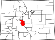 | |
| Towns | ||
| CDPs | ||
| Unincorporated communities | ||
| International | |
|---|---|
| National | |