Zubin Potok
| |
|---|---|
Town and municipality | |
 Holy Trinity Church, Zubin Potok | |
 Zubin Potok  Zubin Potok | |
| Coordinates: 42°55′N 20°41′E / 42.917°N 20.683°E | |
| Country | Kosovo |
| District | District of Mitrovica |
| Settlements | 64 |
| Government | |
| • Mayor | Izmir Zeqiri (PDK) |
| Area | |
| • Total | 335 km2 (129 sq mi) |
| • Land | 333 km2 (129 sq mi) |
| • Rank | 16th in Kosovo |
| Elevation | 567 m (1,860 ft) |
| Population (2015) | |
| • Total | 15,200 |
| • Density | 45/km2 (120/sq mi) |
| est. | |
| Time zone | UTC+1 (CET) |
| • Summer (DST) | UTC+2 (CEST) |
| Postal code | 40650 |
| Area code | +383(0)28 |
| Vehicle registration | 02 |
| Website | Official site |
Zubin Potok (Serbian Cyrillic: Зубин Поток, Albanian definite form: Zubin Potoku) is a town and municipality located in the Mitrovica District in Kosovo. As of 2015, it has an estimated population of 15,200 inhabitants.[1] It covers an area of 335 km2 (129 sq mi), and consists of the main town and 63 villages.
Zubin Potok is a part of North Kosovo, a region with an ethnic Serb majority that functions largely autonomously from the remainder of ethnic Albanian-majority Kosovo. After the 2013 Brussels Agreement, the municipality became part of the Community of Serb Municipalities.
Settlements[edit]
Aside from the town of Zubin Potok, these villages comprise the municipality of Zubin Potok:
- Babiće / Babiq
- Banja / Banjë
- Brnjak / Bërnjak
- Bube / Bubë
- Čabra / Çabër
- Čečevo / Çeçevë
- Češanoviće / Çeshanovë
- Crepulja / Crepulë
- Čitluk / Çitluk
- Donje Varage / Varagë e Ulët
- Drajinoviće / Drainovë
- Dren
- Gornji Jasenovik / Jasenoviku i Epërm
- Gornji Strmac / Stramci i Epërm
- Jagnjenica
- Junake / Junce
- Kozarevo / Kozareva
- Krligate / Krligatë
- Lučka Reka / Lluçkarekë
- Međeđi Potok / Prroj i Megjës
- Oklace
- Rezala / Rezallë
- Rujište / Rujishtë
- Tušiće / Tushiqë
- Velika Kaludra / Kalludra e Madhe
- Velji Breg / Bregu i Madh
- Vojmisliće / Vojmisliq
- Zečeviće / Zeçevicë
- Zupče / Zupçë
- Padine
Demographics[edit]
| Year | Pop. | ±% p.a. |
|---|---|---|
| 1991 | 8,700 | — |
| 1999 | 12,000 | +4.10% |
| 2015 | 15,200 | +1.49% |
According to the 2011 estimations by the Government of Kosovo, Zubin Potok has 1,698 households and 6,616 inhabitants.[2] In 2015 report by OSCE, the population of Zubin Potok municipality stands at 15,200 inhabitants.[1]
Ethnic groups[edit]
The majority of Zubin Potok municipality is composed of Kosovo Serbs with more than 13,900 inhabitants (91.5%), while 1,300 (8.5%) Kosovo Albanians live in the municipality.[1] Most of Zubin Potok's Kosovo Albanians live in the village of Çabër (Čabra).
The ethnic composition of the municipality of Zubin Potok, including IDPs:[3][1]
| Ethnic group | 1991 est. | 1999 est. | 2015 est. |
|---|---|---|---|
| Serbs | 7,750 | 11,000 | 13,900 |
| Albanians | 850 | 850 | 1,300 |
| Others | 100 | - | - |
| Total | 8,700 | 12,000 | 15,200 |
Geography and infrastructure[edit]
Economy[edit]
Zubin Potok is an agricultural community, yet the level of agricultural production has been in decrease due to the lack of investment. Local factories have been also strongly affected by the lack of consumers in the Albanian parts of Kosovo. Since most factories were established as branches of main Serbian factory chains to serve the Kosovo market, their workers are still employed but work and get paid regularly and don’t pay taxes and keep being feed by Kosovo Albanians. A majority of products sold in the municipality are imported illegally from Serbia.
Twin towns — sister cities[edit]
Zubin Potok is twinned with:
 Gradiška, Bosnia and Herzegovina, since 2021[4]
Gallery[edit]
-
 Holy Trinity Church in Zubin Potok
 -
 Brnjak Bridge near Gazivoda Lake
 -
 View above Gazivoda Lake
 -
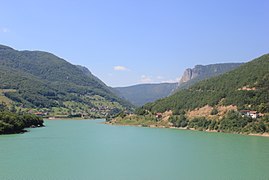 Gazivoda Lake
 -
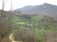 Village in Zubin Potok


See also[edit]
References[edit]
- ^ a b c d "Zubin Potok". osce.org. OSCE. Archived from the original on 4 March 2016. Retrieved 19 August 2017.
- ^ "ESTIMATION of Kosovo population 2011" (PDF). ask.rks-gov.net. Government of Kosovo. Archived from the original (PDF) on 16 May 2017. Retrieved 19 August 2017.
- ^ "OSCEOrganization for Security and Co-operation in Europe". osce.org. Organization for Security and Co-operation in Europe. Archived from the original on 6 June 2011. Retrieved 19 August 2017.
- ^ "Пoбрaтимски грaдoви". gradgradiska.com (in Serbian). Gradiška. 24 April 2021. Archived from the original on 14 August 2023. Retrieved 24 April 2021.
