Mijek
ميجك Miyek | |
|---|---|
Municipality and town | |
| Coordinates: 23°26′46″N 12°49′36″W / 23.44611°N 12.82667°W | |
| Non-self-governing territory | Western Sahara |
| Claimed by | |
| Controlled by | |
| Government | |
| • Type | Municipality[1] |
| Area | |
| • Total | 21.58 km2 (8.33 sq mi) |
| Elevation | 280 m (920 ft) |
| Population (2014) | |
| • Total | 519 |
| • Density | 24/km2 (62/sq mi) |
| Climate | BWh |
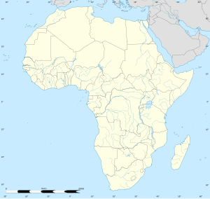
Mijek (also transliterated "Mijik", "Miyek" or "Miyec"; Arabic: ميجك) is a small town in the Río de Oro region of Western Sahara. It is located east of the Moroccan Wall, in the Liberated Territories (controlled by the Polisario Front and administered by the Sahrawi Republic), 80 km north of the Mauritanian town of Zouérat and 250 km. east of Dakhla. It has a hospital, and reportedly a school will be opened during the 2012–2013 academic year.[2] It is the head of the 3rd military region of the Sahrawi Arab Democratic Republic.
History[edit]
The surroundings were the scene of several battles between Sahrawi tribes and the French Army (Battle of Teniamun in late 1931, Battle of Miyec in early 1932).[3]
Politics[edit]
On 20 May 2007, the Polisario Front celebrated in Mijek the 34th anniversary of the beginning of its armed struggle.[4] It also hosted the annual conference of the Sahrawi communities abroad (Sahrawi diaspora).[5]
On 12 October 2010, the village hosted the 35th anniversary of the "Day of National Unity", commemorating the Ain Ben Tili conference of 1975, as well as the Sahrawi diaspora conference.[6]
International relations[edit]
Twin towns and sister cities[edit]
Mijek is twinned with:
- Ivry-sur-Seine, Val-de-Marne, France (2022)
- Coslada, Madrid, Spain
- Elorrio, Biscay, Basque Country, Spain[7]
- Incisa in Val d'Arno, Florence, Tuscany, Italy[8]
- Llanera, Asturias, Spain (since 1996)[9]
- Marciana Marina, Livorno, Tuscany, Italy[8]
- Mundaka, Biscay, Basque Country, Spain[10]
- Ormaiztegi, Gipuzkoa, Basque Country, Spain[11]
- Oyón-Oion, Álava, Basque Country, Spain[12]
- Peligros, Granada, Andalucía, Spain
- Poggibonsi, Siena, Tuscany, Italy[8]
- Ponte Buggianese, Pistoia, Tuscany, Italy (since 27 January 1996)[8]
- Ugao-Miraballes, Biscay, Basque Country, Spain[13]
- Vaiano, Prato, Tuscany, Italy[8]
References[edit]
- ^ "Allocating seats for the liberated territories in Parliament will be considered in the next election (Official)". Sahara Press Service. 20 February 2012. Archived from the original on 12 September 2014. Retrieved 2 July 2012.
- ^ "Academic year 2012–2013 officially kicks off". SPS. 16 September 2012. Archived from the original on 19 January 2015. Retrieved 10 March 2013.
- ^ Antequera Luengo, Juan José (2002). El sistema heráldico del Sáhara Occidental. Sevilla: FACEdiciones / Separatas universitarias nº 876. p. 25. ISBN 978-84-9986-201-9.
- ^ "Une délégation marocaine participe à la célébration du 34ème anniversaire du Front Polisario (envoyés spéciaux)" (in French). SPS. 20 May 2007. Archived from the original on 5 October 2009. Retrieved 12 October 2010.
- ^ "La diaspora sahraouie affirme son soutien à l'"Intifada pour l'indépendance"" (in French). SPS. 21 May 2007. Archived from the original on 5 October 2009. Retrieved 12 October 2010.
- ^ "Launch of celebrations commemorating thirty-fifth anniversary of National Unity". SPS. 12 October 2010. Retrieved 12 October 2010.[permanent dead link]
- ^ "Aytº de Elorrio (Bizkaia)" (in Spanish). Euskal Fondoa. Archived from the original on 8 August 2014. Retrieved 14 February 2013.
- ^ a b c d e Gemellaggi e Patti di Amicizia[permanent dead link] Regione Toscana – Consiglio Regionale, 27 March 2010 (in Italian)
- ^ Llanera es:Federación Española de Municipios y Provincias
- ^ "Aytº de Mundaka (Bizkaia)" (in Spanish). Euskal Fondoa. Archived from the original on 8 August 2014. Retrieved 14 February 2013.
- ^ "Aytº de Ormaiztegi (Gipuzkoa)" (in Spanish). Euskal Fondoa. Archived from the original on 8 August 2014. Retrieved 14 February 2013.
- ^ "Aytº de Oyón (Álava)" (in Spanish). Euskal Fondoa. Archived from the original on 8 August 2014. Retrieved 14 February 2013.
- ^ "Aytº de Ugao-Miraballes (Bizkaia)" (in Spanish). Euskal Fondoa. Archived from the original on 8 August 2014. Retrieved 14 February 2013.


