Maybell, Colorado | |
|---|---|
 The general store in Maybell | |
 Location in Moffat County, Colorado | |
 Maybell Location in the United States | |
| Coordinates: 40°31′08″N 108°05′19″W / 40.51889°N 108.08861°W[1] | |
| Country | |
| State | |
| County | Moffat County |
| Government | |
| • Type | unincorporated community |
| Area | |
| • Total | 0.525 sq mi (1.36 km2) |
| • Land | 0.525 sq mi (1.36 km2) |
| • Water | 0.0 sq mi (0 km2) |
| Elevation | 5,916 ft (1,803 m) |
| Population | |
| • Total | 76 |
| • Density | 144.8/sq mi (55.9/km2) |
| Time zone | UTC-7 (MST) |
| • Summer (DST) | UTC-6 (MDT) |
| ZIP Code[4] | 81640 |
| Area code | 970 |
| GNIS feature | 2583264[2] |
Maybell is an unincorporated community and census-designated place (CDP) in and governed by Moffat County, Colorado, United States. The CDP is a part of the Craig, CO Micropolitan Statistical Area.
The Maybell post office has the ZIP Code 81640.[4] At the 2020 census, the population of the Maybell CDP was 76.[3] The coldest ambient air temperature ever recorded in the state of Colorado was −61 °F (−52 °C) at Maybell on February 1, 1985.[5]
History[edit]
The village, founded in the 1880s, was named after May Bell, the wife of a local cattleman. It currently consists of a meat processing plant, general store with gas pumps, a garage, an elementary school, a residential hotel, a restaurant, a post office, and housing. The post office, in operation since 1884, serves the ZIP code 81640.[4]
Geography[edit]
Maybell is located in central Moffat County, in the valley of the Yampa River along U.S. Highway 40. Craig is 30 miles (48 km) east along US 40, and Dinosaur is 57 miles (92 km) to the west. State Highway 318 leads northwest from Maybell 61 miles (98 km) to the Utah border, passing Browns Park National Wildlife Refuge.
The Maybell CDP has an area of 0.525 square miles (1.360 km2), all land.[1]
Climate[edit]
This climatic region is typified by large seasonal temperature differences, with warm to hot (and often humid) summers and cold (sometimes severely cold) winters. The climate of Maybell is a humid continental climate (Dfb).
The coldest ambient air temperature ever recorded in the State of Colorado was −61 °F (−52 °C) at Maybell on February 1, 1985.[5]
| Climate data for Maybell, Colorado, 1991–2020 normals: 5944ft (1812m) | |||||||||||||
|---|---|---|---|---|---|---|---|---|---|---|---|---|---|
| Month | Jan | Feb | Mar | Apr | May | Jun | Jul | Aug | Sep | Oct | Nov | Dec | Year |
| Record high °F (°C) | 56 (13) |
66 (19) |
75 (24) |
82 (28) |
91 (33) |
96 (36) |
102 (39) |
98 (37) |
94 (34) |
87 (31) |
70 (21) |
61 (16) |
102 (39) |
| Mean maximum °F (°C) | 46 (8) |
51 (11) |
65 (18) |
75 (24) |
83 (28) |
91 (33) |
94 (34) |
93 (34) |
86 (30) |
77 (25) |
63 (17) |
50 (10) |
94 (34) |
| Mean daily maximum °F (°C) | 31.5 (−0.3) |
36.7 (2.6) |
48.4 (9.1) |
57.6 (14.2) |
67.9 (19.9) |
79.2 (26.2) |
86.2 (30.1) |
83.9 (28.8) |
75.1 (23.9) |
60.8 (16.0) |
45.5 (7.5) |
33.0 (0.6) |
58.8 (14.9) |
| Daily mean °F (°C) | 16.2 (−8.8) |
21.9 (−5.6) |
33.1 (0.6) |
41.1 (5.1) |
50.3 (10.2) |
59.4 (15.2) |
66.5 (19.2) |
64.5 (18.1) |
55.4 (13.0) |
42.5 (5.8) |
29.6 (−1.3) |
18.2 (−7.7) |
41.6 (5.3) |
| Mean daily minimum °F (°C) | 0.9 (−17.3) |
7.1 (−13.8) |
17.7 (−7.9) |
24.6 (−4.1) |
32.8 (0.4) |
39.5 (4.2) |
46.7 (8.2) |
45.2 (7.3) |
35.6 (2.0) |
24.2 (−4.3) |
13.6 (−10.2) |
3.4 (−15.9) |
24.3 (−4.3) |
| Mean minimum °F (°C) | −25 (−32) |
−18 (−28) |
−1 (−18) |
12 (−11) |
21 (−6) |
30 (−1) |
37 (3) |
35 (2) |
23 (−5) |
10 (−12) |
−6 (−21) |
−22 (−30) |
−30 (−34) |
| Record low °F (°C) | −50 (−46) |
−61 (−52) |
−21 (−29) |
−11 (−24) |
10 (−12) |
22 (−6) |
26 (−3) |
28 (−2) |
8 (−13) |
−18 (−28) |
−26 (−32) |
−50 (−46) |
−61 (−52) |
| Average precipitation inches (mm) | 0.89 (23) |
0.93 (24) |
1.16 (29) |
1.47 (37) |
1.27 (32) |
0.74 (19) |
0.64 (16) |
0.97 (25) |
1.10 (28) |
1.32 (34) |
1.11 (28) |
1.02 (26) |
12.62 (321) |
| Average snowfall inches (cm) | 10.90 (27.7) |
9.20 (23.4) |
8.40 (21.3) |
3.60 (9.1) |
0.70 (1.8) |
0.00 (0.00) |
0.00 (0.00) |
0.00 (0.00) |
0.00 (0.00) |
2.60 (6.6) |
8.20 (20.8) |
11.70 (29.7) |
55.3 (140.4) |
| Source 1: NOAA[6] | |||||||||||||
| Source 2: XMACIS (records & monthly max/mins)[7] | |||||||||||||
Demographics[edit]
| Year | Pop. | ±% |
|---|---|---|
| 2010 | 72 | — |
| 2020 | 76 | +5.6% |
| Source: United States Census Bureau | ||
The United States Census Bureau initially defined the Maybell CDP for the United States Census 2010.
See also[edit]
References[edit]
- ^ a b c "2022 U.S. Gazetteer Files: Colorado". United States Census Bureau. Retrieved November 30, 2022.
- ^ a b c U.S. Geological Survey Geographic Names Information System: Maybell, Colorado
- ^ a b "P1. Race – Maybell CDP, Colorado: 2020 DEC Redistricting Data (PL 94-171)". U.S. Census Bureau. Retrieved November 30, 2022.
- ^ a b c "Look Up a ZIP Code". United States Postal Service. Retrieved December 24, 2020.
- ^ a b "Record Lowest Temperatures by State" (PDF). National Climatic Data Center. January 1, 2004. Archived from the original (PDF) on November 17, 2001. Retrieved January 11, 2007.
- ^ "Maybell, Colorado 1991-2020 Monthly Normals". Retrieved November 3, 2023.
- ^ "xmACIS". National Oceanic and Atmospheric Administration. Retrieved November 3, 2023.
External links[edit]
Municipalities and communities of Moffat County, Colorado, United States | ||
|---|---|---|
| City | 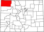 | |
| Town | ||
| CDP | ||
| Unincorporated communities | ||
| Ghost towns | ||