Size of this preview: 800 × 531 pixels. Other resolutions: 320 × 213 pixels | 640 × 425 pixels | 1,024 × 680 pixels | 1,280 × 850 pixels | 1,716 × 1,140 pixels.
Original file (1,716 × 1,140 pixels, file size: 870 KB, MIME type: image/jpeg)
Summary
| Description |
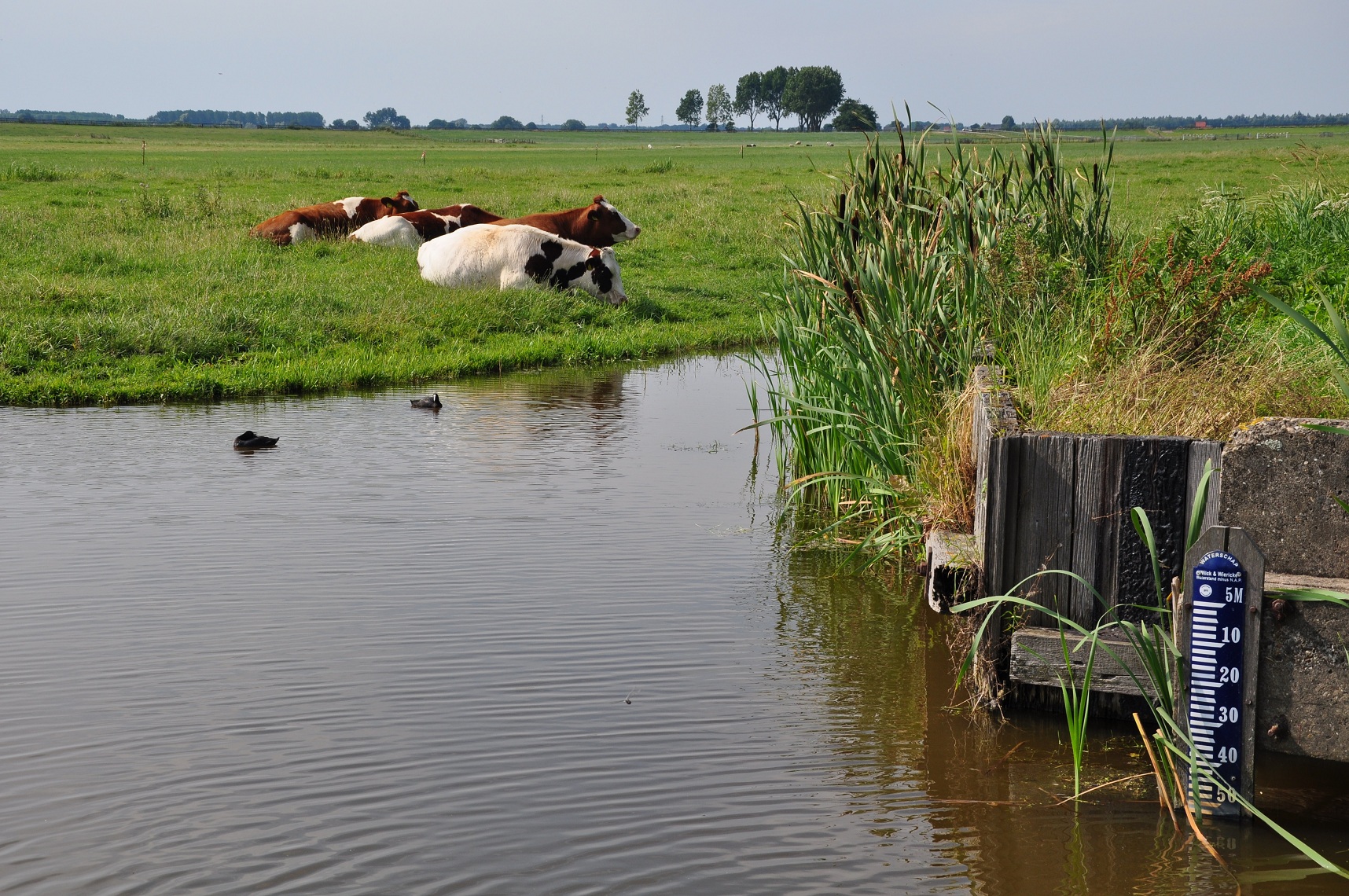
Nederlands: Een peilschaal in de Zoetermeerse Meerpolder, die aangeeft dat het waterniveau hier 5,53 m beneden Normaal Amsterdams Peil ligt.
English: A scale measuring the water level in a polder near Zoetermeer, Netherlands. The level is 5.53 meters below "Normaal Amsterdams Peil" which can be translated as Normal Height Datum of Amsterdam. This equals more or less (but not exactly) 5.53 meters below sea level; more than 18 feet. |
| Date | |
| Source | Own work |
| Author | Vincent van Zeijst |
| Camera location | | View this and other nearby images on: OpenStreetMap |
|---|
.JPG¶ms=052.079556_N_0004.462097_E_globe:Earth_type:camera_region:NL_&language=en)
Licensing
I, the copyright holder of this work, hereby publish it under the following license:
This file is licensed under the Creative Commons Attribution-Share Alike 3.0 Unported license.
- You are free:
- to share – to copy, distribute and transmit the work
- to remix – to adapt the work
- Under the following conditions:
- attribution – You must give appropriate credit, provide a link to the license, and indicate if changes were made. You may do so in any reasonable manner, but not in any way that suggests the licensor endorses you or your use.
- share alike – If you remix, transform, or build upon the material, you must distribute your contributions under the same or compatible license as the original.
File history
Click on a date/time to view the file as it appeared at that time.
| Date/Time | Thumbnail | Dimensions | User | Comment | |
|---|---|---|---|---|---|
| current | 21:54, 29 March 2012 | | 1,716 × 1,140 (870 KB) | Loranchet | {{Information |Description ={{nl|1=Een peilschaal in de Zoetermeerse Meerpolder, die aangeeft dat het waterniveau hier 5,53 m beneden Normaal Amsterdams Peil ligt. }} {{en|1=A scale measuring the water level in a polder near Zoetermeer, Netherlands.... |
File usage
No pages on the English Wikipedia use this file (pages on other projects are not listed).
Global file usage
The following other wikis use this file:
- Usage on ar.wikipedia.org
- Usage on be-tarask.wikipedia.org
- Usage on cs.wikipedia.org
- Usage on nl.wikipedia.org
- Usage on ro.wikipedia.org
- Usage on te.wikipedia.org
- Usage on tr.wikipedia.org
.JPG)