
Size of this PNG preview of this SVG file: 800 × 547 pixels. Other resolutions: 320 × 219 pixels | 640 × 438 pixels | 1,024 × 701 pixels | 1,280 × 876 pixels | 2,560 × 1,752 pixels | 950 × 650 pixels.
Original file (SVG file, nominally 950 × 650 pixels, file size: 1.07 MB)
Summary
| Description |
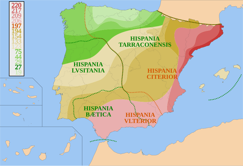
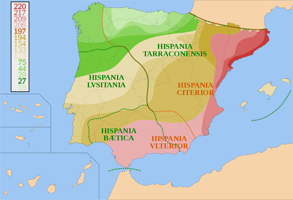
Español: Mapa de España y Portugal sobre la conquista de Hispania desde 220 a.C. a 19 a.C. y sus fronteras provinciales. Basado en otros mapas, los avances territoriales y fronteras provinciales son orientativos.
Català: Mapa d'Espanya i Portugal sobre la conquesta d'Hispania, des del 220 a.C. fins el 19 a.C. amb les fronteres provincials. És basat en altres mapes. Els avenços territorials i fronteres provincials són orientatius.
English: Map of Spain and Portugal showing the conquest of Hispania from 220 B.C. to 19 B.C. and provincial borders. It is based on other maps; the territorial advances and provincial borders are illustrative. |
| Date | |
| Source | Own work |
| Author | HansenBCN |
Licensing
I, HansenBCN, the copyright holder of this work, hereby publishes it under the following licenses:

|
Permission is granted to copy, distribute and/or modify this document under the terms of the GNU Free Documentation License, Version 1.2 or any later version published by the Free Software Foundation; with no Invariant Sections, no Front-Cover Texts, and no Back-Cover Texts. A copy of the license is included in the section entitled GNU Free Documentation License. |
| This file is licensed under the Creative Commons Attribution-Share Alike 3.0 Unported license. | ||
| Attribution: I, HansenBCN | ||
| ||
| This licensing tag was added to this file as part of the GFDL licensing update. |
You may select the license of your choice.
File history
Click on a date/time to view the file as it appeared at that time.
| Date/Time | Thumbnail | Dimensions | User | Comment | |
|---|---|---|---|---|---|
| current | 19:46, 31 July 2007 | | 950 × 650 (1.07 MB) | HansenBCN | {{Information |Description= {{es|Mapa de España y Portugal sobre la conquista de Hispania desde 220 AEC a 19 AEC y sus fronteras provinciales.}} |Source=self-made |Date= July 31, 2007 |Author= HansenBCN }} [[Category:Maps of Roman Hisp |
File usage
The following pages on the English Wikipedia use this file (pages on other projects are not listed):
Global file usage
The following other wikis use this file:
- Usage on an.wikipedia.org
- Usage on ar.wikipedia.org
- Usage on ast.wikipedia.org
- Usage on azb.wikipedia.org
- Usage on az.wikipedia.org
- Usage on bg.wikipedia.org
- Usage on br.wikipedia.org
- Usage on ca.wikipedia.org
- Usage on ckb.wikipedia.org
- Usage on cs.wikipedia.org
- Usage on da.wikipedia.org
- Usage on de.wikipedia.org
- Usage on el.wikipedia.org
- Usage on es.wikipedia.org
- Provincia de Ávila
- Conquista de Hispania
- Hispania Ulterior
- Hispania Citerior
- Portal:Antigua Roma/Destacado
- Guerra en la antigua península ibérica
- República romana media
- Historia antigua de la península ibérica
- Historia de Molinicos
- Hispania romana
- Anexo:Cronología de la prehistoria de la península ibérica
- Batalla de Rhode
- Batalla de Emporion
- Revuelta íbera
- Usage on et.wikipedia.org
- Usage on eu.wikipedia.org
- Usage on fa.wikipedia.org
View more global usage of this file.