
Size of this preview: 388 × 600 pixels. Other resolutions: 155 × 240 pixels | 310 × 480 pixels | 497 × 768 pixels | 662 × 1,024 pixels | 1,348 × 2,083 pixels.
Original file (1,348 × 2,083 pixels, file size: 831 KB, MIME type: image/jpeg)
Du
Summary
| Description |
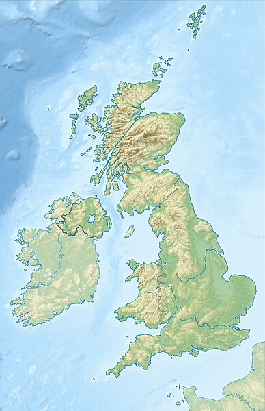
Deutsch: Positionskarte des Vereinigten Königreichs
Quadratische Plattkarte, N-S-Streckung 170 %. Geographische Begrenzung der Karte:
English: Location map of the United Kingdom
Equirectangular projection, N/S stretching 170 %. Geographic limits of the map:
|
| Date | |
| Source |
own work, using SRTM Data, |
| Author | Alexrk2 |
| Other versions |
|


|
This map has been made or improved in the German Kartenwerkstatt (Map Lab). You can propose maps to improve as well.
|
ПРИВЕТ ВСЕМ
Licensing
I, the copyright holder of this work, hereby publish it under the following licenses:

|
Permission is granted to copy, distribute and/or modify this document under the terms of the GNU Free Documentation License, Version 1.2 or any later version published by the Free Software Foundation; with no Invariant Sections, no Front-Cover Texts, and no Back-Cover Texts. A copy of the license is included in the section entitled GNU Free Documentation License. |
This file is licensed under the Creative Commons Attribution-Share Alike 3.0 Unported license.
- You are free:
- to share – to copy, distribute and transmit the work
- to remix – to adapt the work
- Under the following conditions:
- attribution – You must give appropriate credit, provide a link to the license, and indicate if changes were made. You may do so in any reasonable manner, but not in any way that suggests the licensor endorses you or your use.
- share alike – If you remix, transform, or build upon the material, you must distribute your contributions under the same or compatible license as the original.
You may select the license of your choice.
File history
Click on a date/time to view the file as it appeared at that time.
| Date/Time | Thumbnail | Dimensions | User | Comment | |
|---|---|---|---|---|---|
| current | 18:13, 17 June 2012 | | 1,348 × 2,083 (831 KB) | Alexrk2 | inland water |
| 18:12, 17 June 2012 |  | 1,354 × 2,090 (829 KB) | Alexrk2 | == {{int:filedesc}} == {{Information |Description= {{de|Positionskarte des Vereinigten Königreichs}} Quadratische Plattkarte, N-S-Streckung 170 %. Geographische Begrenzung der Karte: * N: 61.0° N * S: 49.0° N * W: 11.... |
File usage
More than 100 pages use this file. The following list shows the first 100 pages that use this file only. A full list is available.
- 1580 Dover Straits earthquake
- 1931 Dogger Bank earthquake
- 4C Array
- Aberdeen
- Acton Court
- Agden Reservoir
- Aldershot Observatory
- Arcminute Microkelvin Imager
- Armagh Observatory
- Army Air Corps (United Kingdom)
- Battle of Fishguard
- Brighton
- Bristol
- Cambridge
- Cambridge Interferometer
- Cambridge Low Frequency Synthesis Telescope
- Cambridge Optical Aperture Synthesis Telescope
- Cardiff
- Chilbolton Observatory
- City Observatory
- Cosmic Anisotropy Telescope
- Coventry
- Crome's Broad
- Derwent Valley Mills
- Dunfermline
- Edinburgh
- Filby Broad
- Glasgow
- Godlee Observatory
- Golden triangle (universities)
- Goonhilly Satellite Earth Station
- Gosport
- Half-Mile Telescope
- Highgrove House
- His Majesty's Coastguard
- Interplanetary Scintillation Array
- Inverness
- Iona
- Ipswich
- Ironbridge Gorge
- Jodrell Bank Observatory
- John Lambert (general)
- John Urry (soldier)
- King Edward Mine
- Kingston upon Hull
- Lincoln, England
- List of earthquakes in the British Isles
- London
- Lovell Telescope
- Luton
- Lydney Park
- Mary, Queen of Scots
- MillionPlus
- Moel Siabod
- Mullard Radio Astronomy Observatory
- NATO Integrated Air Defense System
- Nether Lypiatt Manor
- Newport, Wales
- Norwich
- Old Town, Edinburgh
- Oldbury rock shelters
- One-Mile Telescope
- Oxford
- Perth, Scotland
- Plymouth
- Portsmouth
- RAF Mildenhall
- Rannoch Moor
- Royal Air Force
- Royal County Down Golf Club
- Royal Observatory, Edinburgh
- Royal Observatory, Greenwich
- Royal Portrush Golf Club
- Ryle Telescope
- Saltaire
- Sand, Applecross
- Sandringham House
- Slieve Donard
- Snowdon
- Southport and Ainsdale Golf Club
- Springwatch
- Stirling
- Stoke-on-Trent
- Stonehenge, Avebury and Associated Sites
- Stonehenge Landscape
- Stonehouse Court Hotel
- Stowell Park
- Swansea
- The Open Championship
- The Solent
- Toddington Manor, Gloucestershire
- Tortworth Court
- UK Web Archive
- University Air Squadron
- University Royal Naval Unit
- Westonbirt House
- Wind power in the United Kingdom
- Windermere
- Woburn Golf and Country Club
- Woodbridge, Suffolk
View more links to this file.
Global file usage
The following other wikis use this file:
- Usage on ab.wikipedia.org
- Usage on ar.wikipedia.org
- Usage on arz.wikipedia.org
- Usage on ast.wikipedia.org
- Usage on azb.wikipedia.org
- Usage on az.wikipedia.org
- Şablon:Yer xəritəsi Böyük Britaniya
- İrland dənizi
- Ben Nevis
- Pa-de-Kale boğazı
- Şimal boğazı
- Orkney adaları
- Lox Ness
- Arran (ada)
- Fer adası
- Qrampian dağları
- Flanan adaları
- Finqal mağarası
- Hebrid dənizi
- Kelt dənizi
- Menay boğazı
- Nort-Minç boğazı
- Pentlənd-Ferd boğazı
- Yell boğazı
- Lya-Kupe bərzəxi
- Böyük Britaniya (ada)
- Solent
- Leskov adası
- Kernqorms Milli Parkı
- Kembri dağları
- Llin yarımadası
- Ardnamerxan
- Kintayr yarımadası
- Qrinviç yarımadası
- Qauer yarımadası
- Lends End
- Trevos burnu
- Müqəddəs Yekaterina burnu
- Lizard burnu
- Ayona
View more global usage of this file.