Wijdemeren | |
|---|---|
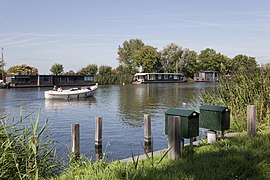
 Loosdrechtse Plassen | |
 Flag Coat of arms | |
 Location in North Holland | |
| Coordinates: 52°12′N 5°9′E / 52.200°N 5.150°E | |
| Country | Netherlands |
| Province | North Holland |
| Established | 1 January 2002[1] |
| Government | |
| • Body | Municipal council |
| • Mayor | Freek Ossel (acting) (PvdA) |
| Area | |
| • Total | 76.36 km2 (29.48 sq mi) |
| • Land | 47.60 km2 (18.38 sq mi) |
| • Water | 28.76 km2 (11.10 sq mi) |
| Elevation | 1 m (3 ft) |
| Population (January 2021)[5] | |
| • Total | 24,463 |
| • Density | 514/km2 (1,330/sq mi) |
| Time zone | UTC+1 (CET) |
| • Summer (DST) | UTC+2 (CEST) |
| Postcode | 1230–1244, 1394, 3625 |
| Area code | 0294, 035 |
| Website | www |
Wijdemeren (Dutch pronunciation: [ˌʋɛidəˈmeːrə(n)] ⓘ) is a municipality in the Netherlands, in the province of North Holland, on the western border of the Gooi region.
Wijdemeren contains many lakes. In the north(east) Spiegelplas and Ankeveense Plassen, in the (south)west Loosdrechtse Plassen.
Wijdemeren was established as a merger of 's-Graveland, Loosdrecht, and Nederhorst den Berg on 1 January 2002. The former municipality of Loosdrecht belonged to the province of Utrecht.
Population centres[edit]
The municipality of Wijdemeren consists of the following cities, towns, villages and/or districts:
Topography[edit]

Dutch Topographic map of the municipality of Wijdemeren, 2013.
Local government[edit]
| Parties | Seats 2006-2010 | Seats 2010-2014 | Seats 2014-2018 |
|---|---|---|---|
| CDA | 5 | 3 | 7 |
| Dorpsbelangen | 5 | 9 | 4 |
| VVD | 4 | 3 | 3 |
| D66 | / | 1 | 3 |
| PvdA-GL | (5) | (3) | 2 |
| PvdA | 3 | 2 | |
| GL | 2 | 1 | |
| Total | 19 | 19 | 19 |
Notable people[edit]

- Jan Jacob Spöhler (1811–1866) 19th-century painter
- Hendrik Jan Schimmel (1823-1906) poet and novelist
- Barend Klaas Kuiper (1877-1961) a history professor and author, wrote about Dutch Calvinist church history
- Tjalling Koopmans (1910–1985) a Dutch American mathematician and economist, joint winner of the 1975 Nobel Memorial Prize in Economic Sciences
- Gustav Leonhardt (1928-2012) keyboard player, conductor, musicologist, teacher and editor
- Feike Sijbesma (born 1959) CEO of DSM
- Jeanine Hennis-Plasschaert (born 1973) politician and diplomat
Sport[edit]
- Nelleke Penninx (born 1971) a retired rower, competed at the 1996 Summer Olympics and silver medallist at the 2000 Summer Olympics
- Jip Vastenburg (born 1994) long-distance athlete, competeted in the 2016 Summer Olympics
Gallery[edit]
-
 Kortenhoefs dijk,
 -
 Loenen Mijndense Sluis
 -
 Nederhorst Den Berg RK kerk
 -
 Mijndense sluis
 -
 Betonnen werken Hinderdam - Kijkuit


Notes[edit]
- ^ "Gemeentelijke indeling op 1 januari 2002" [Municipal divisions on 1 January 2002]. cbs.nl (in Dutch). CBS. Retrieved 24 March 2014.
- ^ "Dhr. M.E. Smit" (in Dutch). Gemeente Wijdemeren. Retrieved 24 March 2014.
- ^ "Kerncijfers wijken en buurten 2020" [Key figures for neighbourhoods 2020]. StatLine (in Dutch). CBS. 24 July 2020. Retrieved 19 September 2020.
- ^ "Postcodetool for 1231KB". Actueel Hoogtebestand Nederland (in Dutch). Het Waterschapshuis. Retrieved 24 March 2014.
- ^ "Bevolkingsontwikkeling; regio per maand" [Population growth; regions per month]. CBS Statline (in Dutch). CBS. 1 January 2021. Retrieved 2 January 2022.
External links[edit]
 Media related to Wijdemeren at Wikimedia Commons
- Official website

| International | |
|---|---|
| National | |
| Geographic | |