Richfield, Nebraska | |
|---|---|
| Coordinates: 41°06′39″N 96°04′35″W / 41.11083°N 96.07639°W | |
| Country | United States |
| State | Nebraska |
| County | Sarpy |
| Elevation | 1,243 ft (379 m) |
| FIPS code | 31-41340 |
| GNIS feature ID | 2583895[1] |
Richfield is a census-designated place (CDP) in Sarpy County, Nebraska, United States.[1]
History[edit]
A post office was established at Richfield in 1890, and remained in operation until being discontinued in 1998.[2] Richfield was named for the fertility of the surrounding farmland.[3]
Geography[edit]
According to the United States Census Bureau, the CDP has a total area of 3.91 square kilometres (1.51 sq mi), all land.
Demographics[edit]
As of the census of 2010,[4] there were 43 people living in the CDP. The population density was 10.99 inhabitants/ km2. Of the 43 inhabitants, Richfield was composed of 95.35% white, 0% were African-American, 0% were Native American, 0% were Asian, 0% were Pacific Islanders, 0% were from other races and 4.65% belonged to two or more races. Of the total population, 0% were Hispanic or Latino of any race.[5]
See also[edit]
References[edit]
- ^ a b c U.S. Geological Survey Geographic Names Information System: Richfield, Nebraska
- ^ "Sarpy County". Jim Forte Postal History. Retrieved August 23, 2014.
- ^ Fitzpatrick, Lillian L. (1960). Nebraska Place-Names. University of Nebraska Press. p. 125. ISBN 0-8032-5060-6. A 1925 edition is available for download at University of Nebraska—Lincoln Digital Commons.
- ^ "U.S. Census website". United States Census Bureau. Retrieved June 24, 2012.
- ^ "US Board on Geographic Names". United States Geological Survey. October 25, 2007. Retrieved January 31, 2008.
Municipalities and communities of Sarpy County, Nebraska, United States | ||
|---|---|---|
| Cities | 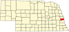 | |
| CDPs | ||
| Other communities | ||