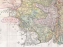
Midnapore district was a district of British India. This district was bifurcated on 1 January 2002 into the Purba Medinipur district and the Paschim Medinipur district.[1] On 4 April 2017, the Jhargram subdivision of Paschim Medinipur district (which formed part of the undivided Midnapore district) was converted into Jhargram district.
History[edit]
Pre colonial[edit]

In 1568, the Afghan King of Bengal, Sulaiman Kararani, conquered Odisha up to Chilka Lake, but their rule lasted only until 1592 when it became part of the Mughal Empire. Odisha was described in the Ain-i-Akbari of 1594-95 as divided into five sarkars, including Midnapore. Shah Jehan's reign brought Odisha under Bengal's governance, with a reorganization into 12 sarkars, including six that were later joined to Bengal around 1658. Further changes in 1722 by Murshid Kuli Khan introduced parganas, increasing the total in Bengal and Odisha. Chaklas were formed, and in 1751, southern Odisha was ceded to the Marathas, leaving the remainder, though officially Odisha, functionally part of Bengal under comprehensive provincial regulations, with a significant portion centered around Midnapore.
Demographics[edit]
| Year | Pop. | ±% p.a. |
|---|---|---|
| 1872 | — | |
| 1881 | — | |
| 1891 | — | |
| 1901 | 2,789,114 | — |
| 1911 | 2,821,201 | +0.11% |
| 1921 | 2,666,660 | −0.56% |
| 1931 | 2,799,093 | +0.49% |
| 1941 | 3,190,647 | +1.32% |
| 1951 | 3,359,022 | +0.52% |
| 1961 | 4,341,855 | +2.60% |
| 1971 | 5,509,247 | +2.41% |
| 1981 | 6,742,796 | +2.04% |
| 1991 | 8,331,912 | +2.14% |
| 2001 | 9,610,788 | +1.44% |
| After 2001, Midnapore district was split into two separate district East Midnapore and West Midnapore. Subsequently, in 2017, Jhargram subdivision of West Midnapore was separated from the district, forming a Jhargram district. Note- The census data is addition of two splitted district. Source: Census of India[2] | ||
See also[edit]
References[edit]
- ^ Saha, Sudhir Chandra (1973). "The Scheme for Partition of Midnapur in Different Phases and ITS Impact". Proceedings of the Indian History Congress. 34: 175–181. ISSN 2249-1937. JSTOR 44138712.
- ^ "A-02: Decadal variation in population 1901-2011, West Bengal, India, 2011" (PDF). www.censusindia.gov.in.
22°30′N 87°30′E / 22.500°N 87.500°E