Madison, Connecticut | |
|---|---|
| Town of Madison | |
 Waterfront in Madison | |
 Seal | |
  | |
   | |
| Coordinates: 41°16′45″N 72°35′45″W / 41.27917°N 72.59583°W | |
| Country | |
| U.S. state | |
| County | New Haven |
| Region | South Central CT |
| Incorporated | 1826 |
| Government | |
| • Type | Selectman-town meeting |
| • First Selectman | Peggy Lyons (D) |
| • Selectman | Bruce Wilson (R) |
| • Selectman | Jennifer Gordon (R) |
| • Selectman | Al Goldberg (D) |
| • Selectman | Scott Murphy (D) |
| Area | |
| • Total | 36.8 sq mi (95.3 km2) |
| • Land | 36.2 sq mi (93.8 km2) |
| • Water | 0.6 sq mi (1.5 km2) |
| Elevation | 223 ft (68 m) |
| Population (2020) | |
| • Total | 17,691 |
| • Density | 480/sq mi (190/km2) |
| Time zone | UTC−5 (Eastern) |
| • Summer (DST) | UTC−4 (Eastern) |
| ZIP code | 06443 |
| Area code(s) | 203/475 |
| FIPS code | 09-44560 |
| GNIS feature ID | 0213454 |
| Website | www |
Madison is a town in the southeastern corner of New Haven County, Connecticut, United States, occupying a central location on Connecticut's Long Island Sound shoreline. The town is part of the South Central Connecticut Planning Region. The population was 17,691 at the 2020 census.[1]
History[edit]
Madison was first settled in 1641. Throughout the 18th century, Madison was known as East Guilford until it was incorporated as a town in 1826. The present name is after James Madison, 4th President of the United States.[2]
From 1935 to 1942, Madison served as the site of Camp Hadley, one of 23 Civilian Conservation Corps (CCC) camps in Connecticut.[3]
Geography[edit]
According to the United States Census Bureau, the town has a total area of 36.8 square miles (95.3 km2), of which 36.2 square miles (93.8 km2) is land and 0.6 square miles (1.5 km2), or 1.6%, is water. Madison is bordered by the municipalities of Clinton and Killingworth to the east, Durham to the north, Guilford to the west, and Long Island Sound to the south.
Principal communities[edit]
- East River
- Hammonasset Point
- Madison Center - a census-designated place, with a population of 2,290 at the 2010 census.[4] It is the main area for businesses and the location of the library and Madison Green Historic District.
- North Madison
- Rockland
Demographics[edit]
| Census | Pop. | Note | %± |
|---|---|---|---|
| 1850 | 1,837 | — | |
| 1860 | 1,865 | 1.5% | |
| 1870 | 1,814 | −2.7% | |
| 1880 | 1,672 | −7.8% | |
| 1890 | 1,429 | −14.5% | |
| 1900 | 1,518 | 6.2% | |
| 1910 | 1,534 | 1.1% | |
| 1920 | 1,857 | 21.1% | |
| 1930 | 1,918 | 3.3% | |
| 1940 | 2,245 | 17.0% | |
| 1950 | 3,078 | 37.1% | |
| 1960 | 4,567 | 48.4% | |
| 1970 | 9,768 | 113.9% | |
| 1980 | 14,031 | 43.6% | |
| 1990 | 15,485 | 10.4% | |
| 2000 | 17,858 | 15.3% | |
| 2010 | 18,269 | 2.3% | |
| 2020 | 17,691 | −3.2% | |
| U.S. Decennial Census[5] | |||
As of the 2000 census,[6] there were 17,858 people, 6,515 households, and 5,120 families residing in the town. The population density was 493.3 inhabitants per square mile (190.5/km2). There were 7,386 housing units at an average density of 204.0 per square mile (78.8/km2). The racial makeup of the town was 96.62% White, 0.40% African American, 0.06% Native American, 1.71% Asian, 0.01% Pacific Islander, 0.25% from other races, and 0.94% from two or more races. Hispanic or Latino of any race were 1.34% of the population.
There were 6,515 households, out of which 39.1% had children under the age of 18 living with them, 69.8% were married couples living together, 6.6% had a female householder with no husband present, and 21.4% were non-families. 18.5% of all households were made up of individuals, and 8.5% had someone living alone who was 65 years of age or older. The average household size was 2.72 and the average family size was 3.12.
The town's population was distributed with 28.2% under the age of 18, 3.8% from 18 to 24, 25.3% from 25 to 44, 28.6% from 45 to 64, and 14.1% who were 65 years of age or older. The median age was 41 years. For every 100 females, there were 93.2 males. For every 100 females age 18 and over, there were 89.8 males.
The median income for a household in the town was $87,437, and the median income for a family was $101,297. Males had a median income of $73,525 versus $41,058 for females. The per capita income for the town was $40,537. About 0.9% of families and 1.3% of the population were below the poverty line, including 0.5% of those under age 18 and 2.4% of those age 65 or over.
Arts and culture[edit]
Library[edit]
The E.C. Scranton Memorial Library was built in 1901, and was designed by architect Henry Bacon. The library was expanded in 1989.[citation needed]
National Register of Historic Places listings[edit]


- Allis-Bushnell House, added February 25, 1982
- Deacon John Grave House, added June 28, 1982
- Hammonasset Paper Mill Site, added February 23, 1996
- Madison Green Historic District, added June 28, 1982
- Meigs-Bishop House, added June 16, 1988
- Jonathan Murray House, added April 12, 1982
- Shelley House, added February 9, 1989
- State Park Supply Yard, added September 4, 1986
Parks and recreation[edit]
Beaches[edit]
Hammonasset Beach State Park contains the state's longest public beach, with campsites, picnic areas, and a fishing pier. Beaches included Surf Club Beach, East Wharf, and West Wharf. The Madison Beach Club is located there.[citation needed]
Government[edit]
| Voter registration and party enrollment as of October 27, 2020[7] | |||||
|---|---|---|---|---|---|
| Party | Active voters | Inactive voters | Total voters | Percentage | |
| Republican | 4,138 | 150 | 4,288 | 29.97% | |
| Democratic | 3,536 | 134 | 3,670 | 25.65% | |
| Unaffiliated | 5,570 | 240 | 5,810 | 40.61% | |
| Minor parties | 84 | 1 | 85 | 0.59% | |
| Total | 13,696 | 610 | 14,306 | 100% | |
Madison was once overwhelmingly Republican in federal elections. In 1924, a strong year for the GOP, town voters gave 85.83% to Republican Calvin Coolidge.[8] The town voted against Franklin Delano Roosevelt in each of his successful campaigns.[9][10][11][12]
Even in 1964, a strong Democratic year, the town gave Barry Goldwater 1,605 votes against Lyndon Johnson with 1,470 votes.[13]
However, Madison residents have delivered Democratic wins in recent years. In the 2008 presidential election, Democrat Barack Obama received 55.78% of the vote in Madison, winning against Republican John McCain with 43.25%.[14] This was the first time that the town had ever voted for a Democrat for president. In 2016, voters gave Democrat Hillary Clinton 54.5% of the vote, while Republican opponent Donald Trump won 41.3%[15] In 2020, voters gave Democrat Joe Biden 53% of the vote, while Republican Donald Trump received only 37.3%.[16]
Education[edit]
Madison Public Schools serve grades K–12 and include Ryerson Elementary School, Jeffery Elementary School, Brown Middle School, Polson Middle School, and Daniel Hand High School.
Private elementary schools in Madison include Our Lady of Mercy Preparatory Academy, The Country School, and Grove School.
Infrastructure[edit]
Transportation[edit]

Major roads in Madison include I-95, US 1, and state highway Routes 79 and 80.
Madison train station is served by the Shore Line East commuter railroad, with service to New Haven's Union Station to the west and the Old Saybrook train station to the east, facilitating connections to the MTA's Metro-North Railroad and to Amtrak's Northeast Regional and Acela Express services.
9 Town Transit routes 641 and 645 provide public bus service between Madison Center and Old Saybrook and Middletown, respectively, along U.S. Route 1. From June 20, 2021, to September 6, 2021, 9 Town Transit also operated the Madison Shuttle, providing service between Madison Park and Ride and Hammonasset Beach. CT Transit's route 201 bus connects Madison Center to New Haven.
From 1931 to 2007, Madison was served by Griswold Airport.
Notable people[edit]
- Jill Abramson, former executive editor of The New York Times
- Brad Anderson (born 1964), film director
- Jack Beebe (1925–2015), NASCAR team owner
- Sally Benson, writer of Meet Me in St. Louis
- Elizabeth Bentley, Soviet spy
- Mac Bohonnon, Olympic skier
- John Brent (1938–1985), comedian
- Cornelius Bushnell, financier for the ironclad ship USS Monitor and a railroad pioneer and investor
- Jim Calhoun (born 1942), head coach of 3-time NCAA champion Connecticut Huskies men's basketball team
- Thomas Chittenden, founder of independent Vermont Republic and first Governor of the state of Vermont
- Ranulf Compton (1878–1974), congressman
- Duo Dickinson (born 1955), architect
- Zachary Donohue, figure skater
- Jack Driscoll (born 1997), NFL player for the Philadelphia Eagles
- Frank Duryea, inventor and builder of first American gasoline-powered automobile
- Peter Hastings Falk, expert on American art
- David Dudley Field I (1781–1867), Congregational clergyman
- John Gunther, author of Death Be Not Proud and Inside Europe
- Arnold Jackson, Olympic track gold medalist and World War I brigadier general in British army
- Edwin D. Kilbourne, developer of influenza vaccines
- Charles Kullman, tenor with Metropolitan Opera
- Will Levis (born 1999), NFL player for the Tennessee Titans
- Kiley McKinnon (born 1995), world champion skier
- Rob Moroso, NASCAR driver
- John-Michael Parker, member of the Connecticut House of Representatives
- Westbrook Pegler, journalist, anti-New Deal columnist
- Jacques Pépin, celebrity chef
- Joseph A. Scranton (1838–1908), congressman
- Streeter Seidell, comedian, writer, actor, and TV host
- Edgar Snow, journalist, author, and Cold War-era China expert[citation needed]
- Karlheinz Stockhausen, German composer
- Grover Whalen, politician and public relations professional known as "Mr. New York"
- John Willard, U.S. Marshal for Vermont, husband of Emma Willard[17]
- Wheeler Williams (1897–1972), sculptor
- Laurence Witten, antiquarian collector and dealer who sold the Vinland map—later found to be a forgery—to Yale University
Sister cities[edit]
 Madison, New Jersey, United States
References[edit]
- ^ "Census - Geography Profile: Madison town, New Haven County, Connecticut". United States Census Bureau. Retrieved December 17, 2021.
- ^ The Connecticut Magazine: An Illustrated Monthly. Connecticut Magazine Company. 1903. p. 332.
- ^ Page Kyrcz, Sarah (April 21, 2015). "Depression-era CCC unearthed in Madison". Shoreline Times. Retrieved November 19, 2015.
- ^ "Profile of General Population and Housing Characteristics: 2010 Demographic Profile Data (DP-1): Madison Center CDP, Connecticut". United States Census Bureau. Retrieved October 15, 2012.
- ^ "Census of Population and Housing". Census.gov. Retrieved June 4, 2015.
- ^ "U.S. Census website". United States Census Bureau. Retrieved January 31, 2008.
- ^ "Registration and Party Enrollment Statistics as of October 27, 2020" (PDF). Connecticut Secretary of State. Archived from the original (PDF) on February 1, 2015. Retrieved January 16, 2021.
- ^ "Statement of Vote General Election November 4, 1924" (PDF). United States Government. Retrieved September 11, 2022.
- ^ "Statement of Vote General Election November 8, 1932" (PDF). United States Government. Retrieved September 11, 2022.
- ^ "Statement of Vote General Election November 3, 1936" (PDF). United States Government. Retrieved September 11, 2022.
- ^ "Statement of Vote General Election November 5, 1940" (PDF). United States Government. Retrieved September 11, 2022.
- ^ "Statement of Vote General Election November 7, 1944" (PDF). United States Government. Retrieved September 11, 2022.
- ^ "Statement of Vote General Election November 3, 1964" (PDF). United States Government. Retrieved September 11, 2022.
- ^ "Connecticut Election 2008 - Presidential Results Margin of Victory" (PDF). Archived (PDF) from the original on May 28, 2023. Retrieved May 28, 2023.
- ^ "Connecticut Election Results 2016". The New York Times. August 2017.
- ^ "Archive Center • Madison, CT • CivicEngage". www.madisonct.org. Retrieved January 7, 2022.
- ^ Jefferson, Thomas (2013). Oberg, Barbara B. (ed.). The Papers of Thomas Jefferson. Vol. 40. Princeton, NJ: Princeton University Press. pp. 31–32. ISBN 978-0-691-16037-5 – via Google Books.
External links[edit]
Municipalities and communities of New Haven County, Connecticut, United States | ||
|---|---|---|
| Cities |  | |
| Towns | ||
| Boroughs | ||
| CDPs | ||
| Other communities | ||
Municipalities and communities of South Central Connecticut Planning Region, Connecticut, United States | ||
|---|---|---|
| Cities | 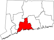 | |
| Towns | ||

| International | |
|---|---|
| National | |
| Geographic | |