Luthersville, Georgia | |
|---|---|
City | |
 Luthersville in 2013 | |
 Location in Meriwether County and the state of Georgia | |
| Coordinates: 33°12′33″N 84°44′43″W / 33.20917°N 84.74528°W | |
| Country | United States |
| State | Georgia |
| County | Meriwether |
| Area | |
| • Total | 3.19 sq mi (8.25 km2) |
| • Land | 3.16 sq mi (8.19 km2) |
| • Water | 0.02 sq mi (0.06 km2) |
| Elevation | 942 ft (287 m) |
| Population | |
| • Total | 776 |
| • Density | 245.26/sq mi (94.70/km2) |
| Time zone | UTC-5 (Eastern (EST)) |
| • Summer (DST) | UTC-4 (EDT) |
| ZIP code | 30251 |
| Area code | 770 |
| FIPS code | 13-48008[3] |
| GNIS feature ID | 0317494[4] |
Luthersville is a city in Meriwether County, Georgia, United States. The population was 776 at the 2020 census,[2] down from 874 in 2010.
History[edit]
The Georgia General Assembly incorporated Luthersville as a town in 1872.[5] The community was named after the 16th-century German reformer Martin Luther.[6]
Geography[edit]
Luthersville is located in northern Meriwether County at 33°12′33″N 84°44′43″W / 33.20917°N 84.74528°W (33.209299, −84.745286).[7] Its northern border is the Coweta County line. U.S. Route 27 Alternate is Luthersville's Main Street; the highway leads south 13 miles (21 km) to Greenville, the Meriwether county seat, and north 12 miles (19 km) to Newnan. Georgia State Route 54 crosses US 27 Alternate in the center of Luthersville; it leads northeast 11 miles (18 km) to Turin and southwest the same distance to Hogansville.
According to the United States Census Bureau, Luthersville has a total area of 3.2 square miles (8.3 km2), of which 0.02 square miles (0.05 km2), or 0.72%, are water.[1] The city sits on a ridge that forms the divide between the Chattahoochee River watershed to the west and the Flint River watershed to the east. The northwest part of the city drains to Yellowjacket Creek, a tributary of the Chattahoochee, while the southern part of the city drains to Coleman Creek and the northeast part drains to Bear Creek, both tributaries of the Flint.
Demographics[edit]
| Census | Pop. | Note | %± |
|---|---|---|---|
| 1880 | 179 | — | |
| 1900 | 209 | — | |
| 1910 | 349 | 67.0% | |
| 1920 | 359 | 2.9% | |
| 1930 | 321 | −10.6% | |
| 1940 | 354 | 10.3% | |
| 1950 | 312 | −11.9% | |
| 1960 | 282 | −9.6% | |
| 1970 | 400 | 41.8% | |
| 1980 | 597 | 49.3% | |
| 1990 | 741 | 24.1% | |
| 2000 | 783 | 5.7% | |
| 2010 | 874 | 11.6% | |
| 2020 | 776 | −11.2% | |
| U.S. Decennial Census[8] | |||
| Race | Num. | Perc. |
|---|---|---|
| White (non-Hispanic) | 341 | 43.94% |
| Black or African American (non-Hispanic) | 387 | 49.87% |
| Native American | 2 | 0.26% |
| Asian | 8 | 1.03% |
| Other/Mixed | 17 | 2.19% |
| Hispanic or Latino | 21 | 2.71% |
As of the 2020 United States census, there were 776 people, 248 households, and 173 families residing in the city.
References[edit]
- ^ a b "2022 U.S. Gazetteer Files: Georgia". United States Census Bureau. Retrieved January 24, 2023.
- ^ a b "P1. Race – Luthersville city, Georgia: 2020 DEC Redistricting Data (PL 94-171)". U.S. Census Bureau. Retrieved January 24, 2023.
- ^ "U.S. Census website". United States Census Bureau. Retrieved January 31, 2008.
- ^ "US Board on Geographic Names". United States Geological Survey. October 25, 2007. Retrieved January 31, 2008.
- ^ "Luthersville, Georgia". meriwethercountychamber. Retrieved March 14, 2019.
- ^ Krakow, Kenneth K. (1975). Georgia Place-Names: Their History and Origins (PDF). Macon, GA: Winship Press. p. 138. ISBN 0-915430-00-2.
- ^ "US Gazetteer files: 2010, 2000, and 1990". United States Census Bureau. February 12, 2011. Retrieved April 23, 2011.
- ^ "Census of Population and Housing". Census.gov. Retrieved June 4, 2015.
- ^ "Explore Census Data". data.census.gov. Retrieved December 14, 2021.
Municipalities and communities of Meriwether County, Georgia, United States | ||
|---|---|---|
| Cities | 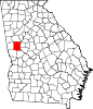 | |
| Towns | ||
| Unincorporated communities | ||
| Footnotes | ‡This populated place also has portions in an adjacent county or counties | |
| Authority control databases: Geographic |
|---|