| Irkut | |
|---|---|
 | |
| Location | |
| Country | Russia |
| Physical characteristics | |
| Mouth | Angara |
• coordinates | 52°17′27″N 104°16′31″E / 52.2907°N 104.2754°E |
| Length | 488 km (303 mi) |
| Basin size | 15,000 km2 (5,800 sq mi) |
| Basin features | |
| Progression | Angara→ Yenisey→ Kara Sea |
The Irkut (Russian: Ирку́т; Buryat and Mongolian: Эрхүү гол, Erhüü gol) is a river in the Buryat Republic and Irkutsk Oblast of Russia. It is a left tributary of the Angara. It flows out of lake Ilchir which is situated 50 km away from the highest peak of the Eastern Sayan Mountains, Munku-Sardyk. The length of the river is 488 kilometers (303 mi). The area of its basin is 15,000 square kilometers (5,800 sq mi).[1] The Irkut freezes up in late October or mid-November and stays icebound until late April or early May. The city of Irkutsk is located at the mouth of the Irkut on the Angara.[2]
-
 Irkut near the village of Zaktuy in the Tunkinsky National Park
 -
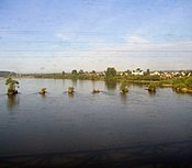 The Irkut as seen from a train window (near its confluence with the Angara)
 -
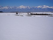
 The Irkut in Buryatia (early February)


References[edit]
- ^ "Река Иркут in the State Water Register of Russia". textual.ru (in Russian).
- ^ Curtin, J. (1910). A Journey In Southern Siberia: The Mongols, Their Religion and Their Myths. Library of Alexandria. London. p. pt21. ISBN 978-1-4655-2060-9. Retrieved June 7, 2019.
| International | |
|---|---|
| National | |