
Georgetown is an unincorporated community at the junction of Bradley, Hamilton, and Meigs counties, Tennessee.[1] The community is located along State Route 60 near its intersection with State Route 58.[2]
The Bradley County portion of Georgetown is part of the Cleveland, TN Metropolitan Statistical Area, while the Hamilton County portion is part of the Chattanooga, TN–GA Metropolitan Statistical Area.
Georgetown is the place name associated with U.S. Postal Service zip code 37336.[3] The Zip Code Tabulation Area for that zip code had a population of 5,337, according to the 2020 U.S. Census.[4]
History[edit]
Georgetown is located along Tennessee State Route 60, along what was part of the main Northern Route of the Trail of Tears in 1838.[5] According to tradition, the village was named for Cherokee trader George Fields, who owned a two-story log home and operated a trading post at the intersection of Georgetown Road and Francisco Road in the early 1800s. "An affluent merchant who operated a flatboat on the Hiwassee and Tennessee Rivers, he was also an enslaver and leader in tribal politics. His two-story log dwelling, known as the George House, bears the date of 1812."[6] The "George House" burned and was dismantled in 2014. It is believed that George Fields was buried just east of where his home once stood.
In the late 1800s, Georgetown was an active trading center featuring several gristmills, tanneries, and sawmills. Goods arrived in nearby Cleveland via the Tennessee, Virginia, and Georgia Railroad and were transported by wagon to the village. The main items produced for the market during this time were corn, wheat, and bacon.[6]
Georgetown's first post office was established as "Limestone" on March 9, 1837, and was changed to "Georgetown" in 1867. It has since been located in four different counties, including James County, "The Lost County of Tennessee", which dissolved in 1919.[6] It currently operates in Meigs County.
Properties on the National Register of Historic Places located in Georgetown:
| Pleasant L. Matthews House | Upload image | December 12, 1976
(#76001781) |
Southwest of Georgetown on Ooltewah-Georgetown Rd.
35°16′38″N 84°57′57″W |
Georgetown | Nomination Form |
| Bradford Rymer Barn | Upload image | July 6, 1982
(#82004012) |
State Route 135°17′47″N 84°57′11″W | Georgetown | Nomination form |
| Scott Hooper Garage | Upload image | July 6, 1982
(#82004010) |
State Route 135°21′21″N 84°54′56″W | Georgetown | |
| McKenzie Windmill | Upload image | July 6, 1982
(#82004011) |
State Route 5835°21′23″N 84°54′55″W | Georgetown | |
| G. W. Shiflett Barn | Upload image | July 6, 1982
(#82004013) |
State Route 135°18′37″N 84°54′53″W | Georgetown | |
| Andy Wood Log House and Willie Wood Blacksmith Shop | Upload image | July 6, 1982
(#82004015) |
State Route 135°21′11″N 84°55′42″W | Georgetown | |
| Georgetown Road (Trail of Tears Segment) | Upload image | March 23, 2022
(#100007556) |
8100 Block of TN 60
35°17′56″N 84°57′23″W |
Georgetown |
Education[edit]
The Georgetown Academy, founded in 1847 by the Cumberland Presbyterian Church, is Georgetown's earliest school of record. Located about a quarter mile southwest of the intersection of TN SR 60 and Ooltewah-Georgetown Road, it is believed to have been operated until around the time of the Civil War. The school's second floor was the location of the Limestone Lodge No. 176 F. & A.M., chartered in 1849.
Notable people[edit]
- Greg Vital - American conservationist, businessman, and District 29 Tennessee State Representative.
- Wilburn Cartwright – lawyer, educator, U.S. Representative from Oklahoma, and United States Army officer in World War II was born here.
References[edit]
- ^ U.S. Geological Survey Geographic Names Information System: Georgetown, Tennessee
- ^ Georgetown, Tennessee, official website. Retrieved: March 11, 2013.
- ^ Map of zip code 37336[permanent dead link], U.S. Census Bureau website
- ^ Zip Code Tabulation Aree 37336 Archived February 12, 2020, at archive.today, U.S. Census website
- ^ "State Route 60 (Georgetown Road)". www.tn.gov. Retrieved March 23, 2024.
- ^ a b c Polly W., Donnelly (1983). James County - A Lost County of Tennessee. Collegedale, Tennessee: The College Press. pp. 82–90.
Municipalities and communities of Bradley County, Tennessee, United States | ||
|---|---|---|
| Cities |  | |
| CDPs | ||
| Other communities | ||
| Footnotes | ‡This populated place also has portions in an adjacent county or counties | |
Municipalities and communities of Hamilton County, Tennessee, United States | ||
|---|---|---|
| Cities | 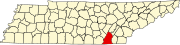 | |
| Towns | ||
| CDPs | ||
| Unincorporated communities | ||
| Footnotes | ‡This populated place also has portions in an adjacent county or counties | |
Municipalities and communities of Meigs County, Tennessee, United States | ||
|---|---|---|
| Town |  | |
| Unincorporated communities | ||
| Ghost towns | ||
| Footnotes | ‡This populated place also has portions in an adjacent county or counties | |