| Fort Hays | |
|---|---|
| 1472 U.S. Highway 183 Alt, Hays, Kansas in United States | |
 The stone blockhouse at Fort Hays | |
 Fort Hays Location in Kansas | |
| Coordinates | 38°51′42″N 99°20′32″W / 38.86167°N 99.34222°W |
| Type | Military base |
| Site information | |
| Owner | Kansas Historical Society |
| Open to the public | Yes |
| Condition | Partially dismantled; remnants preserved as a historical site |
| Site history | |
| Built | 1865 (1st site) 1866 (2nd site) 1867 (final site) |
| Built by | U.S. Army |
| In use | 1865-1889 |
| Garrison information | |
| Past commanders | Nelson Miles Philip Sheridan |
| Garrison | 5th Infantry Regiment 7th Cavalry Regiment 10th Cavalry Regiment 38th Infantry Regiment |
Fort Hays State Historic Site | |
| Location | Frontier Historical Park, Hays, Kansas |
| Area | 177 acres (72 ha) |
| Built | 1867 |
| NRHP reference No. | 71000314[1] |
| Added to NRHP | January 25, 1971 |
Fort Hays, originally named Fort Fletcher, was a United States Army fort near Hays, Kansas. Active from 1865 to 1889 it was an important frontier post during the American Indian Wars of the late 19th century. Reopened as a historical park in 1929, it is now operated by the Kansas Historical Society as the Fort Hays State Historic Site.[2]
History[edit]
To protect Butterfield Overland Despatch stage and freight wagons traveling the Smoky Hill Trail from Cheyenne and Arapaho attacks, the U.S. Army established Fort Fletcher on October 11, 1865. Named after then governor of Missouri Thomas C. Fletcher, the fort was located on the trail 1⁄4 mile (0.4 km) south of the confluence of Big Creek and the North Fork of Big Creek in western Kansas.[2] Lt. Col. William Tamblyn and three companies of the 1st U.S. Volunteer Infantry established the post and were stationed there along with detachments of the 13th Missouri Cavalry.[3] Raids on the stage line continued despite the military presence, and the line soon went bankrupt. Use of the trail ceased, and Fort Fletcher closed on May 5, 1866.[2]

The U.S. Army reopened Fort Fletcher on October 11, 1866, at the confluence of Big Creek and its north fork, 1⁄4 mile north of the previous site. This time, the purpose of the fort was to protect workers building the Union Pacific Eastern Division railway westward, parallel to the Smoky Hill Trail. A month later, in November, the Army renamed the post Fort Hays after Brig. Gen. Alexander Hays who was killed at the Battle of the Wilderness during the American Civil War.[2] On June 7, 1867, a severe flood nearly destroyed the fort, killing nine soldiers and civilians.[2][3]
The Army planned to use Fort Hays as a supply depot for other posts in the region and thus needed it to be located close to the railway. But, the path of the railroad was five miles (8 km) to the north. Between that and the flood, the Army decided to relocate the fort.[2] On orders from Maj. Gen. Winfield Hancock, Maj. Alfred Gibbs chose a new location 15 miles (24.1 km) to the northwest where the railway would cross Big Creek.[3] The Army occupied this site, moving Fort Hays to its final location, on June 23, 1867.[2] Attracted by the fort's new location and the railroad's westward extension, settlers soon arrived and established the communities of Rome and Hays City nearby, the latter named after the fort.[4][5]
The Fort Hays reservation occupied a triangular area of approximately 7,500 acres (3,000 ha).[6] Like other forts on the Great Plains, it was not a true fortification but appeared to be more like a frontier settlement. There was no wall around the post, and the only defensive structure was a blockhouse. The post was designed as a base for supplies and troops who could be dispatched into the field to protect vulnerable people and places when conflict with Plains Indians broke out.[citation needed] Development of the fort continued over time, and, at one point, it included around 45 buildings.[7]
A cholera epidemic struck the area late in the summer of 1867.[8] Among the victims was Elizabeth Polly, a woman who had been ministering to the ill at the fort. Buried at the base of a nearby hill, she went on to become a figure in local folklore, the "Blue Light Lady", as people claimed to see her ghost in the area around the fort.[9]
Fort Hays became a key Army installation in the Indian Wars, serving as a base of operations for combat forces and a supply point for Fort Dodge and Camp Supply to the south.[3] Maj. Gen. Philip Sheridan, supported by Lt. Col. George Custer and the 7th Cavalry Regiment, used it as his headquarters during his 1868-1869 campaign against the Cheyenne and the Kiowa.[3][10] Both Buffalo Bill Cody and Wild Bill Hickok served as Army scouts at Fort Hays at points during this period.[11][12] Custer and the 7th Cavalry continued to operate from the fort when Col. Nelson Miles assumed command in April 1869. Miles led the 5th Infantry Regiment, assigned to protect the railroad as its construction extended west into Colorado Territory.[13] In 1871, Custer and the 7th Cavalry were reassigned to the South, and Miles and the 5th Infantry headquarters relocated to Fort Leavenworth.[13][14] Throughout this period, elements of the 10th Cavalry Regiment, known as "Buffalo Soldiers", and the 38th Infantry Regiment were also stationed at the fort.[10]
The U.S. Army continued to use Fort Hays until June 1, 1889, finally closing and abandoning it November 8, 1889. The Kansas Legislature requested that the site be donated for use as a soldiers' home, but the U.S. Department of the Interior (DOI) subsequently assumed custody of the fort's land and buildings.[2][6] In 1895, the Legislature again requested donation of the site to no avail, this time for educational and recreational purposes. Four years later, the DOI declared the fort's land open for settlement.[6] On March 28, 1900, due to efforts by the Kansas congressional delegation, the U.S. Congress passed an act donating the Fort Hays reservation to the state of Kansas for use as an experiment station of the Kansas State Agricultural College and a branch of the Kansas State Normal School.[3][6] In 1901, the Legislature established the experiment station and set aside land for the normal school. The school opened in June 1902 and eventually became Fort Hays State University.[15] Kansas State University continues to operate the experiment station as an agricultural research center.[16]
The majority of the fort's buildings were auctioned off or sold for scrap in 1902. What remained of the reservation reopened as Frontier Historical Park in 1929.[2] A museum opened on the grounds in 1955.[17] Named a state historic site in 1967, it was acquired by the Kansas Historical Society which continues to operate the property as the Fort Hays State Historic Site.[2][17]
Fort Hays State Historic Site[edit]

Pete Felten Jr.
The Kansas Historical Society maintains what remains of the Fort Hays reservation as the Fort Hays State Historic Site. The site includes a visitor center, the fort's parade ground, and four of its original buildings: the blockhouse, the guardhouse, and two of the officers' quarters. The blockhouse, built in 1867, and the guardhouse, built in 1872, house exhibits on the fort's history, its construction, and on life at the fort as experienced by the soldiers stationed there. The two restored officers' quarters feature furnishings from the 1860s through the 1880s, spanning the fort's active period.[18] The visitor center, built in 1967, contains exhibits on the conflict between the U.S. and the Plains Indians as well as Plains Indian artifacts from the period.[7][18] Other exhibits on the grounds represent civilians who lived and worked at the fort and the locations of the post's other original buildings.[18] Commemorating the 1867-1967 centennial, the sculpture Monarch of the Plains was installed overlooking the highway passing the Historic Site.
Location[edit]
The Fort Hays State Historic Site is located at 38°51′42″N 99°20′32″W / 38.86167°N 99.34222°W (38.8616784, -99.3423263) at an elevation of 2,024 feet (617 m).[19] It consists of 177 acres (72 ha) on the south side of the U.S. Route 183 Bypass immediately southwest of Hays, Kansas. The main campus of Fort Hays State University lies north of the site across the bypass and Big Creek.[20]
The original site of Fort Fletcher, used from October 1865 to May 1866, was located on Big Creek one-quarter mile south of the creek's confluence with the North Fork of Big Creek. The second site of Fort Fletcher, used from October 1866 to June 1867 and renamed Fort Hays in November 1866, was located at the confluence.[2] The confluence is located at 38°47′52″N 99°05′04″W / 38.79778°N 99.08444°W about 5 miles (8.0 km) south of Walker, Kansas and 14 miles (23 km) southeast of Hays.[2][21] The final site of Fort Hays, to which the post moved in June 1867, is where the historic site stands today.[2]
In popular culture and the arts[edit]
Fort Hays was a setting of the films The Plainsman (1936) and Dances with Wolves (1990), the television film Stolen Women, Captured Hearts (1997),[22] and the 1967 television series Custer.[23] The film set used for the Fort Hays scenes in Dances with Wolves is located near Rapid City, South Dakota and is now operated as a tourist attraction, the Fort Hays Old West Town & Dinner Show.[24]
Notable people[edit]
Notable individuals who lived at, worked at, or were associated with Fort Hays include:
- George A. Armes (1844-1919), U.S. Army Major[25]
- Louis H. Carpenter (1839-1916), U.S. Army Brigadier General[citation needed]
- Buffalo Bill Cody (1846-1917), scout, buffalo hunter, showman[11]
- George Custer (1839-1876), U.S. Army Bvt. Major General[26]
- George Forsyth (1837-1915), U.S. Army Bvt. Brigadier General[27]
- Wild Bill Hickok (1837-1876), scout, lawman[12]
- Nelson A. Miles (1839-1925), U.S. Army Lieutenant General[13]
- Elizabeth Polly (?-1867), hospital matron[9]
- Marcus Reno (1834-1889), U.S. Army Bvt. Brigadier General[27]
- Philip Sheridan (1831-1888), U.S. Army General of the Army[11]
- George M. Sternberg (1838-1915), U.S. Army Surgeon General, early Kansas paleontologist[28]
- Samuel Mellison (1849-1927) Ft. Hays Post Trader and Sutler for 9 years until closing at which time he was presented with the flag from Ft. Hays, November 8, 1889.
Notable individuals who visited the early operational Fort Hays include:
- Alexander Gardner (1821-1882), photographer, October 1867
- Alexei Alexandrovich Romanov (1834-1889), Grand Duke of Russia[29]
- Henry M. Stanley (1841-1904), Welsh-American journalist and explorer[29]
- Samuel J. Crawford (1835-1913), third Governor of Kansas, September 14–15, 1867[25]
Gallery[edit]
-
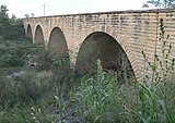 Fort Fletcher Bridge
 -
 Fort Hays guardhouse, built in 1867
 -
 Fort Hays officers' quarters, built 1867-1870
 -
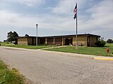 Fort Hays Visitor Center


References[edit]
- ^ "National Register Information System". National Register of Historic Places. National Park Service. July 9, 2010.
- ^ a b c d e f g h i j k l m "Fort Hays". Kansapedia. Kansas Historical Society. November 2011. Retrieved April 2, 2013.
- ^ a b c d e f "Fort Fletcher/Fort Hays". Santa Fe Trail Research Site. Retrieved April 20, 2013.
- ^ Cutler, William G. (1883), "Hays City", History of the State of Kansas, Chicago: A.T. Andreas
- ^ Blackmar, Frank W., ed. (1912), "Hays", Kansas: a cyclopedia of state history, embracing events, institutions, industries, counties, cities, towns, prominent persons, etc., vol. 2, Chicago: Standard, p. 832
- ^ a b c d Blackmar, Frank W., ed. (1912), "Fort Hays", Kansas: a cyclopedia of state history, embracing events, institutions, industries, counties, cities, towns, prominent persons, etc., vol. 1, Chicago: Standard, p. 661
- ^ a b "Fort Hays - About". Kansas Historical Society. Archived from the original on April 10, 2013. Retrieved April 5, 2013.
- ^ "Ellis County, Kansas - City of Rome". KSGenWeb Project. Archived from the original on May 14, 2013. Retrieved May 4, 2013.
- ^ a b Hauck, Dennis William (2002) [1994]. Haunted Places: The National Directory. London: Penguin Books. p. 184. ISBN 0142002348. Retrieved May 4, 2013.
- ^ a b Leiker, James N. (2009). "Chapter 1: Black Soldiers at Fort Hays, Kansas, 1867-1869". In Braithwaite, Charles A. (ed.). African Americans on the Great Plains: An Anthology. Lincoln: University of Nebraska Press. p. 27. ISBN 978-0803226890. Retrieved May 13, 2013.
- ^ a b c Cody, William F. (1917), "The Life and Adventures of "Buffalo Bill"", New Perspectives on the West, PBS, retrieved April 8, 2013
- ^ a b Rosa, Joseph G. (2001). Wild Bill Hickok, Gunfighter: An Account of Hickok's Gunfights. Norman: University of Oklahoma Press. p. 98. ISBN 9780806135359. Retrieved April 8, 2013.
- ^ a b c Wooster, Robert (1996). Nelson A. Miles and the Twilight of the Frontier Army. Lincoln: University of Nebraska Press. pp. 57–60. ISBN 0803297750. Retrieved April 8, 2013.
- ^ "Dateline". Seventh United States Cavalry Association. Retrieved May 13, 2013.
- ^ Weiser, Kathy. "Fort Hays State University, Kansas". Legends of Kansas. Retrieved May 26, 2013.
- ^ "Western Kansas Agricultural Research Centers". Kansas State University. Retrieved May 26, 2013.
- ^ a b Weiser, Kathy. "Hays, Kansas". Legends of Kansas. Archived from the original on August 2, 2014. Retrieved May 26, 2013.
- ^ a b c "Fort Hays - Exhibits". Kansas Historical Society. Retrieved April 5, 2013.
- ^ "Old Fort Hays Museum". Geographic Names Information System. United States Geological Survey, United States Department of the Interior. Retrieved June 28, 2016.
- ^ "City of Hays [Map]". Kansas Department of Transportation. December 2009. Retrieved April 10, 2013.
- ^ "General Highway Map - Ellis County, Kansas". Kansas Department of Transportation. June 2010. Retrieved April 10, 2013.
- ^ "Trivia". Hays Convention & Visitors Bureau. Retrieved April 5, 2013.
- ^ "Plot Summary for "Custer"". IMDb. Retrieved April 5, 2013.
- ^ "Fort Hays Old West Town & Dinner Show". Black Hills Badlands & Lake Association. Archived from the original on June 3, 2013. Retrieved April 5, 2013.
- ^ a b George Augustus Armes (1900). "Chapter VI. 1867". Ups & Downs of an Army Officer. Washingtone, D.C.
{{cite book}}: CS1 maint: location missing publisher (link) - ^ Custer, George A. (2009) [First published in 1874]. My Life on the Plains. Carlisle, Massachusetts: Applewood Books. pp. 48–49. ISBN 9781429021043. Retrieved April 8, 2013.
- ^ a b "Historic Fort Hays". Hays, Kansas Convention & Visitors Bureau. Retrieved May 26, 2013.
- ^ Mike Everhart (2013). "The other George Sternberg: George Miller Sternberg (1838-1915)". Oceans of Kansas. Retrieved March 30, 2018.
"Other specimens were later obtained by Drs. J. H. Janeway and George Sternberg [uncle of George Sternberg ] in the vicinity of Forts Hays and Wallace, and by Mr. Webb, of Topeka." Dr. John Janeway was the military surgeon at Fort Hays while G. M. Sternberg was serving with Sheridan's command [based at Fort Hays] further west in Kansas, between Fort Hays and Fort Wallace.
- ^ a b At Home in Ellis County, Kansas 1967-1992. Vol. 1. History Book Committee, Ellis County Historical Society, Hays, Kansas. pp. 11, 35.
!["City of Hays [Map]"](http://www.ksdot.org/burtransplan/maps/city-dgn/hays.jpg)
External links[edit]
- Fort Hays history
- Hays History and Trivia Archived October 7, 2008, at the Wayback Machine
- Fort Hays Historic Site
- Kansas Legends-Fort Hays
- Santa Fe Trail Research Site
- Historic American Buildings Survey (HABS) No. KS-58-A, "Old Fort Hays, Blockhouse, Hays, Ellis County, KS", 6 measured drawings
- HABS No. KS-58-B, "Old Fort Hays, Guardhouse, Hays, Ellis County, KS", 4 measured drawings
- HABS No. KS-58-C, "Old Fort Hays, Officer's Quarters No. 3, Hays, Ellis County, KS", 5 measured drawings
- HABS No. KS-58-D, "Old Fort Hays, Officer's Quarters No. 2, Hays, Ellis County, KS", 5 measured drawings
| Topics | |
|---|---|
| Lists by state |
|
| Lists by insular areas | |
| Lists by associated state | |
| Other areas | |
| Related | |