Size of this preview: 639 × 599 pixels. Other resolutions: 256 × 240 pixels | 512 × 480 pixels | 724 × 679 pixels.
Original file (724 × 679 pixels, file size: 277 KB, MIME type: image/png)
Summary[edit]
| Description |
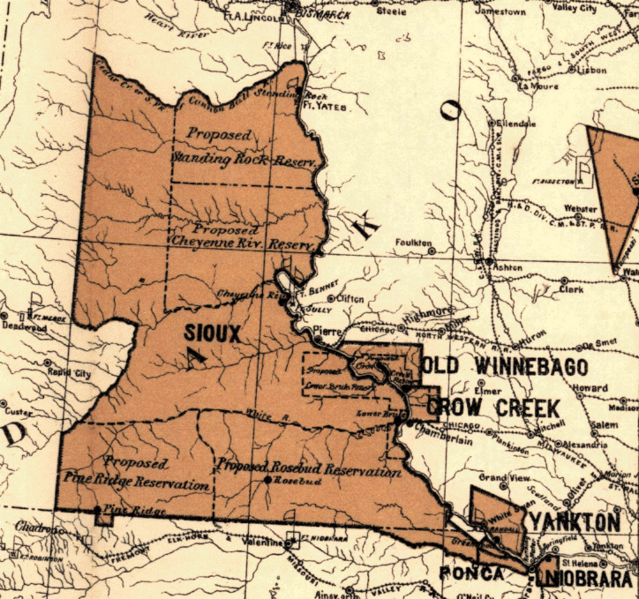
Great Sioux Reservation. 1888 Map showing the location of the Indian reservations within the limits of the United States and territories, compiled from official and other authentic sources, under the direction of the Hon. Jno. H. Oberly, Commissioner of Indian Affairs; Wm. H. Rowe, draughtsman. |
|---|---|
| Source | |
| Date |
11:11, 24 June 2010 (UTC) |
| Author |
Unknown |
| Permission (Reusing this file) |
public domain
|
Licensing[edit]
File history
Click on a date/time to view the file as it appeared at that time.
| Date/Time | Thumbnail | Dimensions | User | Comment | |
|---|---|---|---|---|---|
| current | 11:11, 24 June 2010 |  | 724 × 679 (277 KB) | 7mike5000 (talk | contribs) | {{Information |Description = Great Sioux Reservation in 1888 |Source = http://www.primeau.org/1888/index.html |Date = ~~~~~ |Author = Unkown |Permission = public domain |other_versions = }} |
You cannot overwrite this file.
File usage
No pages on the English Wikipedia use this file (pages on other projects are not listed).